
Pou dels Graells
Avenc de 40 metres de fondària a la Baronia de Rialb.
EspeleoWorld
Pou dels Graells
Avenc de 40 metres de fondària a la Baronia de Rialb.
Baronia de Rialb, La · Noguera
Length: 70 m · Depth: 40 m
Updated record
https://espeleoworld.com/en/c/pou-dels-graells
Information can change. Always verify coordinates, access, weather, and cave conditions before setting out.
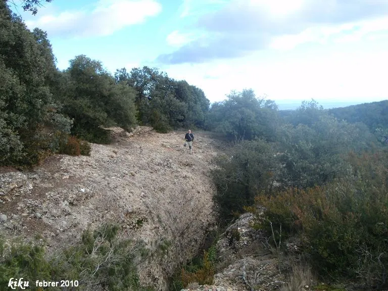
A 40-metre-deep pit in the Baronia de Rialb, with an entrance of 23x4 metres. First documented exploration in December 1961 by the GES - CMB, which gave it a depth of 45 metres; visited by C. Ribera and others in 1965.
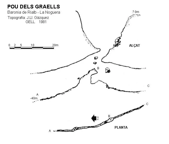
Topographic

Espeleoindex · CC BY-NC 4.0, https://creativecommons.org/licenses/by-nc/4.0/ · Image © its author.
Photos

Espeleoindex · CC BY-NC 4.0, https://creativecommons.org/licenses/by-nc/4.0/ · Image © its author.
Description
Morphology
Entrance of 23x4 metres. A shaft of about 7 metres leads to a wide floor. To the south, after a 6-metre drop, it is possible to continue first on a steep slope and then more flatly for about twenty metres, until a formation constriction makes it impassable, with the continuation of the gallery visible on the other side, somewhat wider and at a lower level.
Progression
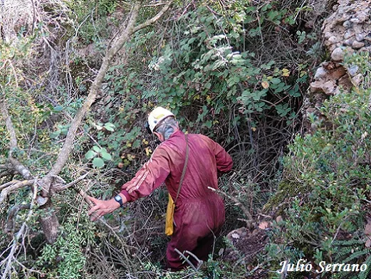
The entrance can be descended on the S side by means of a steep ramp with a lot of vegetation that leads to a small shaft at about -10 metres; it can also be descended from the E side by a line of bolts (the first is 10mm with a 17 spanner, the rest 8mm with a 13 spanner), an access that joins the previous one at the same point. A shaft of about 7 metres leads to a wide floor where, on its N side, one continues descending through a narrower fissure until reaching a large embedded block. From this point and in a northerly direction the gallery continues, narrow and high, descending until it becomes impenetrable. To the south, after a 6-metre drop, it is possible to continue first on a steep slope and then more flatly for about twenty metres, until a formation constriction makes it impassable.
History
According to unpublished documentation that we have found, it seems that the first exploration of the pit took place in December 1961 by members of the GES - CMB, giving it a depth of 45 metres. It was later visited by C. Ribera and others in 1965, which is the first report that was known.
User Comments (0)
No comments yet.
Be the first to share your experience!
Registered Explorations (0)
No explorations registered yet.
Register your visit to this cave!
Bibliography
- Escolà i Boada, Oleguer.(1970).-“Catàlogo Espeleológico del Montsec”. Espeleòleg (10-11): 453-541. ERE – CE Catalunya. Barcelona.
- Gàzquez i Pons, Josep Lluís.(1995).-“Catàleg Espeleològic de la Noguera”. Grallera (3-4):1-90. GELL – CE Lleida.
- Valles, Jordi de.(2009).-"Alt Urgell, Noguera, Pla d'Urgell, Segarra, Solsonès, Urgell". Catàleg Espeleològic de Catalunya (vol.2):175. ECG/FCE. NOTA: Cal fer esment que les dues topografies que apareixen en la fitxa d'aquest catàleg, no són pas del Pou dels Graells, si no de l'Esquerda del Graller (Àger).
- Fotos i dades actualitzades per J. Serrano i F. Rubinat l'octubre de 2017.
- Actualització de dades maig de 2018.
Nearby caves
Forat del Lladre
2.0 km · SW
Isona i Conca Dellà (Pallars Jussà)
1 topo.10 photos
Pou de la Collada
3.3 km · SW
Artesa de Segre (Noguera)
1 topo.7 photos
Pou del Curs
4.4 km · S
Artesa de Segre (Noguera)
1 topo.2 photos
Avenc de Lo Clot de Joan Pere
4.5 km · SW
Artesa de Segre (Noguera)
1 topo.3 photos
Source: Espeleoindex (espeleoindex.com), modified. CC BY-NC 4.0, https://creativecommons.org/licenses/by-nc/4.0/