
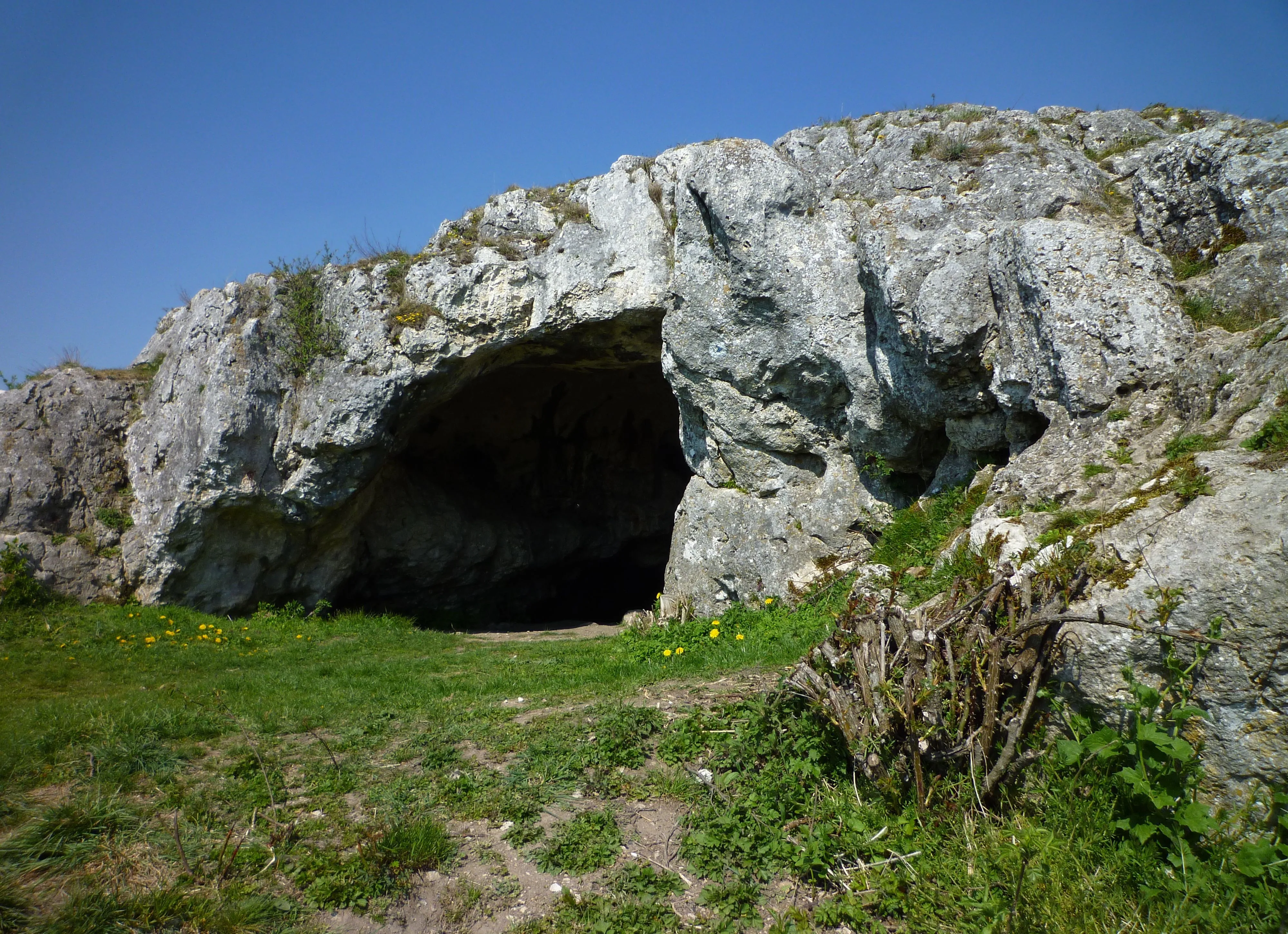
Ofnethöhlen
The Ofnethöhlen are natural karst caves near Holheim, a district of Nördlingen in the Donau-Ries district of Bavaria.
EspeleoWorld
Ofnethöhlen
The Ofnethöhlen are natural karst caves near Holheim, a district of Nördlingen in the Donau-Ries district of Bavaria.
Nördlingen
Updated record
https://espeleoworld.com/en/c/ofnethoehlen-noerdlingen
Information can change. Always verify coordinates, access, weather, and cave conditions before setting out.
The Ofnethöhlen are natural karst caves near Holheim, a district of Nördlingen in the Donau-Ries district of Bavaria.
Photos

© Franzfoto · CC BY-SA 3.0, https://creativecommons.org/licenses/by-sa/3.0/ · Wikimedia Commons · https://commons.wikimedia.org/wiki/File:N%C3%B6rdlingen_-_Ofneth%C3%B6hle_auf_dem_Riegelberg_02.jpg
Description
Morphology
The Ofnethöhlen are the remains of an underground karst system on the crater rim of the Nördlinger Ries. In the cave register Fränkische Alb (HFA) they are registered as M 7 (Große Ofnethöhle) and M 8 (Kleine Ofnethöhle). The caves, including the immediate surroundings (a total of approx. 8 hectares), are also classified as the nature reserve „Ofnethöhlen bei Holheim“.
Other details
The origin of the term „Ofnet“ is not documented.
History
Archaeological finds indicate that the caves were inhabited from the Middle Paleolithic to the Mesolithic. The Ofnethöhlen gained supraregional significance when Stone Age skull burials were discovered in the year 1908.
User Comments (0)
No comments yet.
Be the first to share your experience!
Registered Explorations (0)
No explorations registered yet.
Register your visit to this cave!
Nearby caves
Source: Geotopkataster Bayern (Bayerisches Landesamt für Umwelt) (www.umweltatlas.bayern.de), modified. CC BY 4.0, https://creativecommons.org/licenses/by/4.0/ Datenquelle: Bayerisches Landesamt für Umwelt, www.lfu.bayern.de · https://www.umweltatlas.bayern.de/mapapps/resources/reports/sb_geotope/generateBericht.pdf?additionallayerfieldvalue=779H001 · data as of 2026 · Contains information from © OpenStreetMap contributors, www.openstreetmap.org, made available under the Open Database License (ODbL 1.0, https://opendatacommons.org/licenses/odbl/1-0/), modified. · names · obtained 2026-11-13 · https://www.openstreetmap.org/node/356052506 · data as of 2026 · Source: Wikidata – cave items (Germany) (www.wikidata.org), modified. CC0 1.0, https://creativecommons.org/publicdomain/zero/1.0/ Wikidata (CC0 1.0) · names · obtained 2026-11-13 · data as of 2026 · Source: German Wikipedia – article leads (cave descriptions) (de.wikipedia.org), modified. CC BY-SA 4.0, https://creativecommons.org/licenses/by-sa/4.0/ Wikipedia contributors (de.wikipedia.org), CC BY-SA 4.0 · Text by Wikipedia contributors (Ofnethöhlen) · adapted by Espeleoworld (normalized, translated); the adaptation is licensed CC BY-SA 4.0, https://creativecommons.org/licenses/by-sa/4.0/ · description · obtained 2026-11-13 · https://de.wikipedia.org/wiki/Ofneth%C3%B6hlen · data as of 2026 · The derived data is available on request under the ODbL: [email protected]