
les Correjades
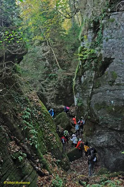
A group of large fissures in the Vall d'en Bas, on the baga de Freixeneda, with three correjades: de Baix, del Mig and de Dalt, separated by the Pla del Campament and the Prat de Dalt.
EspeleoWorld
les Correjades
A group of large fissures in the Vall d'en Bas, on the baga de Freixeneda, with three correjades: de Baix, del Mig and de Dalt, separated by the Pla del Campament and the Prat de Dalt.
Vall d'en Bas, La · Garrotxa
Length: 1835 m · Depth: 18 m
Updated record
https://espeleoworld.com/en/c/les-correjades
Information can change. Always verify coordinates, access, weather, and cave conditions before setting out.
A group of large fissures in the Vall d'en Bas, on the baga de Freixeneda, with three correjades: de Baix, del Mig and de Dalt, separated by the Pla del Campament and the Prat de Dalt.
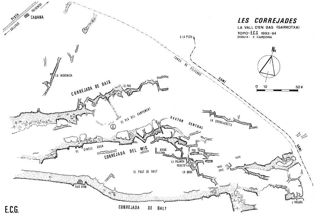
Topographic
Espeleoindex · CC BY-NC 4.0, https://creativecommons.org/licenses/by-nc/4.0/ · Image © its author.
Photos
Espeleoindex · CC BY-NC 4.0, https://creativecommons.org/licenses/by-nc/4.0/ · Image © its author.
Description
Morphology
Broadly speaking, three large fissures or groups of fissures can be distinguished, which according to their topographic situation have been named Correjada de Baix, Correjada del Mig, and Correjada de Dalt. Each of them has characteristics that differentiate it from the others.
Between the first two aforementioned correjades, there is an elongated, flat clearing in the forest, which to better situate the group was named Pla del Campament. The third correjada is separated from the second by another clearing that was named Prat de Dalt.
All the fissures together reach a length of 1835 metres, but it is very bold to give this figure as a total, since the three main fissures have no communication between them, therefore there is no evident continuity, even less so if we take into account that the longest continuous stretch does not exceed 300 metres.
Correjada de Baix: As its name indicates, it is the fissure found at a lower elevation than the others (if we do not consider some isolated fissures situated between it and the forest hut). In this fissure we can differentiate two sectors: Western Sector.- It is very open, with vegetation occupying its floor. The N lip is a cliff about 10 metres high on average, the S lip is more indefinite. Central and Eastern Sector.- It is relatively closed, although of variable depth, since its floor rises and falls many times. It has a layout with numerous changes of direction in the form of a bayonet.
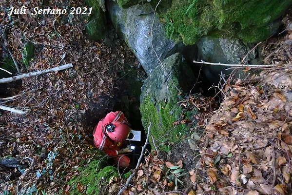
Correjada del Mig: It is the correjada where we find the most spectacular and closed stretches, and we can differentiate three sectors. Western Sector.- The most notable feature is the existence of an important cliff, el Cingle Gran, which corresponds to the S lip of the fissure, and which reaches 20 metres in height. The block corresponding to the N lip is slipped and remains as rocky masses that interpose between the fissure and the Pla del Campament, with passages that facilitate communication. Central Sector.- It is the one with the most complex configuration. It is formed by a group of fissures of different directions and depths that interconnect; some are narrow and shady, others have the occasional stretch that runs underground. We also find there a pit -12 metres deep, and the occasional shaft in the middle of the fissures. Eastern Sector.- This sector is somewhat isolated from the previous one, since there is no direct communication through fissures. It is formed by the fissures drawn at the right-hand end of the topography. Except for one, the fissures are open and asymmetrical, with one lip more prominent than the other.
Correjada de Dalt: It is a long and very well traced fissure, but very wide, and consequently open. It is very asymmetrical, since while the S lip is continuous and very well defined, although with moderate heights, the N lip is lower and often indefinite, even disappearing in a stretch in which it opens directly onto the Prat de Dalt. With these characteristics, the correjada is full of vegetation.
Hydrology
The track then crosses a torrent (10 metres upstream of this point we will find a spring).
History
Known locally since time immemorial, although no mention is found until 1973 when les Escletxes de la Freixeneda appear, without any further data, on the map of Editorial Alpina. Later, in a local monograph on the Vidranès (Ramon Vinyeta, 1986) they appear cited as les Correjades and this aroused the curiosity of Ferran Cardona who, with Josep Cuenca and Xavier Samarra, located them in the winter of 1989-90.
The Espeleo Club de Gràcia explored and surveyed them during the years 1993-94.
Toponymy: The meaning of the toponym correjades could not be ascertained, it should be said however that both in Enciclopèdia Catalana and on the ICGC map the toponym that appears at this point is Pla de les Carrejades (from carrejar = to cart). Will it be the correct one?, or perhaps an easy solution in the face of the unknown?
User Comments (0)
No comments yet.
Be the first to share your experience!
Registered Explorations (0)
No explorations registered yet.
Register your visit to this cave!
Bibliography
- Borràs, J; Miñarro, JM; Talavera, F.(1980).-”el ripollès, la garrotxa i l'alt empordà”. Catàleg Espeleològic de Catalunya (vol.4):242. Ed. Políglota. Barcelona.
- Cardona Oliván, Ferran.(1993).-”Les Correjades (la Vall d'en Bas-Garrotxa)”. Exploracions (16):51-65. (EC Gràcia). Barcelona.
- Valles, Jordi de. (2009).-”Berguedà, Cerdanya, Garrotxa, Ripollès” Catàleg Espeleològic de Catalunya (vol.3):236-238. EC Gràcia/FCE.
- Fotografies i coordenades facilitades per Alfred Montserrat (ERE-CEC).
- Més informació gràfica al blog: espeleobloc.blogspot. Apunt del 6-12-2011
Nearby caves


Source: Espeleoindex (espeleoindex.com), modified. CC BY-NC 4.0, https://creativecommons.org/licenses/by-nc/4.0/