
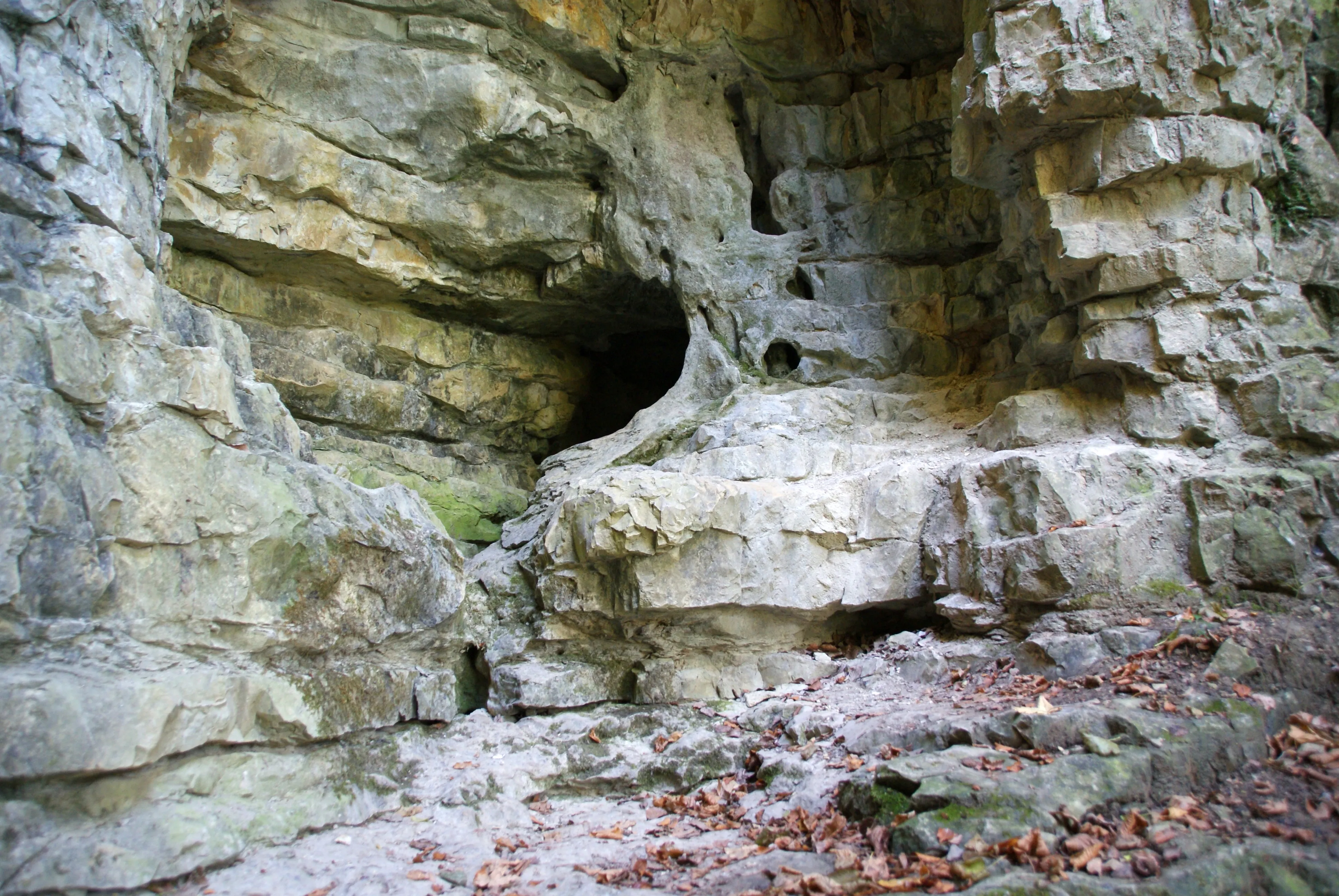
Höhle Bauerloch
The Bauerloch is a karst cave on the northern escarpment of the Swabian Alb.
EspeleoWorld
Höhle Bauerloch
The Bauerloch is a karst cave on the northern escarpment of the Swabian Alb.
Neuffen
Updated record
https://espeleoworld.com/en/c/hoehle-bauerloch-neuffen
Information can change. Always verify coordinates, access, weather, and cave conditions before setting out.
The Bauerloch is a karst cave on the northern escarpment of the Swabian Alb.
Photos

© Karle3 · CC BY-SA 4.0, https://creativecommons.org/licenses/by-sa/4.0/ · Wikimedia Commons · https://commons.wikimedia.org/wiki/File:Bauerloch-Hoehle-20161016-00527.jpg
Description
Hydrology
During heavy rain and at snowmelt, the Dürrenbach springs from the entrance of the Bauerloch, and large parts of the cave are then completely under water. In dry periods the stream emerges only at about 520 m above sea level in the lower part of the Tales.
Progression
For this reason, entering the cave is dangerous.
Other details
The Bauerloch is protected as a geotope under the number 13634/934 and, under the name Bauerlochhöhle und Magerrasen im Gewann Bauerlochberg with the protected area number 811-60462912, also as a natural monument.
User Comments (0)
No comments yet.
Be the first to share your experience!
Registered Explorations (0)
No explorations registered yet.
Register your visit to this cave!
Nearby caves
Source: Geotopkataster Baden-Württemberg (Regierungspräsidium Freiburg – LGRB) (services.lgrb-bw.de), modified. Data licence Germany – attribution – version 2.0 (dl-de/by-2-0), https://www.govdata.de/dl-de/by-2-0 Datenquelle: Regierungspräsidium Freiburg - LGRB, www.lgrb-bw.de · data as of 2026 · Contains information from © OpenStreetMap contributors, www.openstreetmap.org, made available under the Open Database License (ODbL 1.0, https://opendatacommons.org/licenses/odbl/1-0/), modified. · names · obtained 2026-11-13 · https://www.openstreetmap.org/node/759770645 · data as of 2026 · Source: Wikidata – cave items (Germany) (www.wikidata.org), modified. CC0 1.0, https://creativecommons.org/publicdomain/zero/1.0/ Wikidata (CC0 1.0) · data as of 2026 · Source: German Wikipedia – article leads (cave descriptions) (de.wikipedia.org), modified. CC BY-SA 4.0, https://creativecommons.org/licenses/by-sa/4.0/ Wikipedia contributors (de.wikipedia.org), CC BY-SA 4.0 · Text by Wikipedia contributors (Bauerloch) · adapted by Espeleoworld (normalized, translated); the adaptation is licensed CC BY-SA 4.0, https://creativecommons.org/licenses/by-sa/4.0/ · description · obtained 2026-11-13 · https://de.wikipedia.org/wiki/Bauerloch · data as of 2026 · The derived data is available on request under the ODbL: [email protected]