
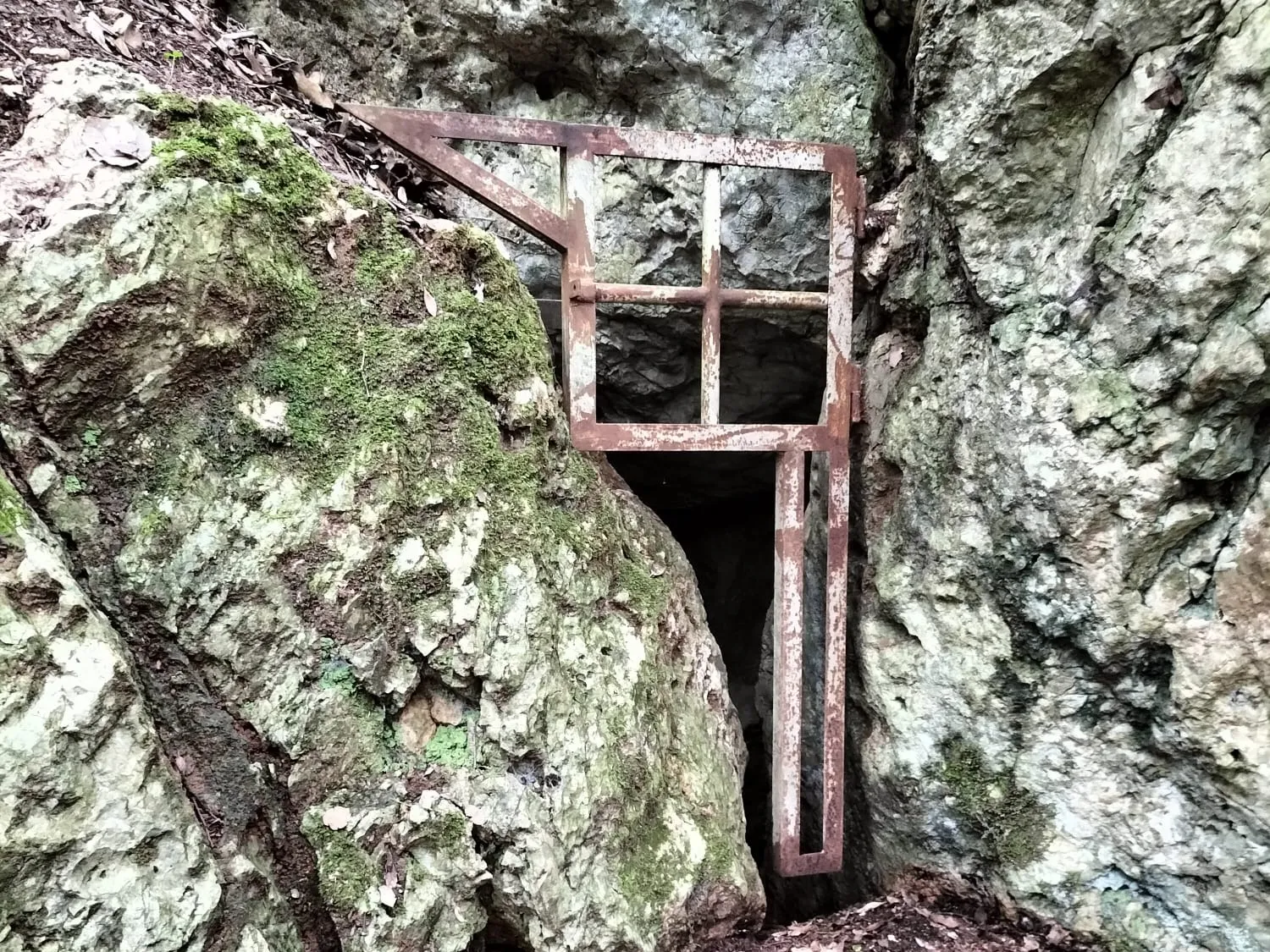
Grotta Poligonale
A cavity formed along a joint, with the floor filled in, ending in a fissure at the bottom that is currently not passable.
EspeleoWorld
Grotta Poligonale
A cavity formed along a joint, with the floor filled in, ending in a fissure at the bottom that is currently not passable.
Amelia
Length: 45 m · Depth: 30 m
Updated record
https://espeleoworld.com/en/c/grotta-poligonale-amelia-terni
Information can change. Always verify coordinates, access, weather, and cave conditions before setting out.
A cavity formed along a joint, with the floor filled in, ending in a fissure at the bottom that is currently not passable.
Photos

© Maurizio Todini · LicenseRef-FUGS-media-per-item · Federazione Umbra Gruppi Speleologici (FUGS), Catasto Speleologico dell'Umbria · https://catasto.fugs.it/index.php?mod=caves&op=view&id=1038
Description
Morphology
This is a cavity formed along a joint with the floor filled in; it ends in a fissure at the bottom that is currently not passable. Descending trend.
Progression
Easy traversability, with the recommended period being all year. Progression difficulty: climbs and narrow squeezes. Temporary rigging: a thirty-meter rope to be anchored to a tree at the entrance.
Other details
Geology: Montenero is a Mesozoic carbonate block; its "island" shape is due to its emergence in the Pleistocene sea, confirmed by the presence of borings made by lithophagous organisms at an elevation of 300 m above sea level. From: E. Squazzini in the Proceedings of the 2005 Amelia Conference.
History
Paleoethnological finds. Archaeology and paleoethnology: of interest due to the presence of bones, it was the subject of excavation campaigns by the Soprintendenza around 1998-99 and most recently in 2004-2005. In November 2005, at the conference held in Amelia "Uomini, terre e materiali: aspetti dell'antica Ameria tra paleontologia e tardoantico", a paper was presented by M.C. De Angelis-R. Sardella-E. Squazzini-G. Manzi entitled "Il sito di Montenero di Amelia, fauna e resti antropici". Protection of historical-archaeological sites: yes. Studies: paleoethnological. Cadastral chronology: it has never been registered even though its discovery dates back to the '90s. Notes on the name: so called by its discoverer Stefano Baroncini but also referred to in some scientific publications as Grotta delle Ossa.
User Comments (0)
No comments yet.
Be the first to share your experience!
Registered Explorations (0)
No explorations registered yet.
Register your visit to this cave!
Nearby caves
Source: Catasto Cavità Umbria (Federazione Umbra Gruppi Speleologici, FUGS) (catasto.fugs.it), modified. LicenseRef-FUGS-no-licence-stated Federazione Umbra Gruppi Speleologici (FUGS), Catasto Speleologico dell'Umbria · https://catasto.fugs.it/index.php?mod=caves&op=view&id=1038 · data as of 2025 · Source: Catasto Cavità Umbria (Federazione Umbra Gruppi Speleologici, FUGS) (catasto.fugs.it), modified. LicenseRef-FUGS-media-per-item Federazione Umbra Gruppi Speleologici (FUGS), Catasto Speleologico dell'Umbria · data as of 2025