
Grotta di Pizzo Corvo
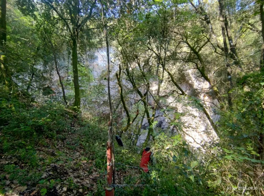
A wide collapse doline with initially vertical walls that flare out toward the bottom, formed by a thick layer of collapse boulders partly colonized by bryophytes.
EspeleoWorld
Grotta di Pizzo Corvo
A wide collapse doline with initially vertical walls that flare out toward the bottom, formed by a thick layer of collapse boulders partly colonized by bryophytes.
Narni
Length: 48 m · Depth: 48 m
Updated record
https://espeleoworld.com/en/c/grotta-di-pizzo-corvo-narni-terni
Information can change. Always verify coordinates, access, weather, and cave conditions before setting out.
A wide collapse doline with initially vertical walls that flare out toward the bottom, formed by a thick layer of collapse boulders partly colonized by bryophytes.
Topographic
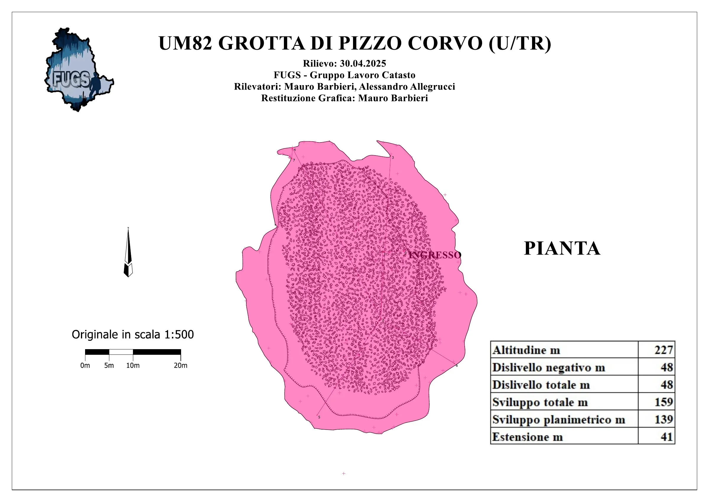

© Mauro Barbieri · CC BY-SA 4.0, https://creativecommons.org/licenses/by-sa/4.0/ · Federazione Umbra Gruppi Speleologici (FUGS), Catasto Speleologico dell'Umbria · https://catasto.fugs.it/index.php?mod=caves&op=view&id=82
Photos

© Mauro Barbieri · LicenseRef-FUGS-media-per-item · Federazione Umbra Gruppi Speleologici (FUGS), Catasto Speleologico dell'Umbria · https://catasto.fugs.it/index.php?mod=caves&op=view&id=82
Description
Morphology
Wide collapse doline that opens with initially vertical walls and then flares out toward the lowest portion. The bottom is formed by a thick layer of collapse boulders partly colonized by a dense population of bryophytes. Trend: vertical.
Geology: MAS Limestone Massiccio - Lower-Upper Jurassic (Sinemurian-Pliensbachian); massive limestones; massive.
Hydrology
Hydrology and meteorology: no circulation; ambient temperature, although the scarce internal irradiation causes a cooling of the doline.
Progression
Traversability: experts only; recommended period: dry period. Progression difficulty: pits.
Rigging: not rigged; rigged on 3 naturals (trees). Clean well of branches and soil as it discharges a lot. Recommended use of ropes or slings "choked" so as to keep the attachment high and reduce rope friction with the ground.
Other details
Hazards: dangerous access, landslides/collapses, pits that discharge, other hazards.
Pollution: low intensity, presence of solid plastic debris thrown even since time immemorial.
History
Notes on the name: it seems that the name derives from the fact that the water is rapidly absorbed, hence the term Corbo = basket.
Bio
Other hypogean fauna: presence of a live toad at the bottom on 28/04/2025.
Hypogean botany: population of bryophytes that colonizes the highest part of the debris cone at the bottom, where solar irradiation reaches.
User Comments (0)
No comments yet.
Be the first to share your experience!
Registered Explorations (0)
No explorations registered yet.
Register your visit to this cave!
Bibliography
LIPPI BONCAMBI C. (1950) Sullo stato attuale del Catasto Speleologico dell'Umbria LEMMI G. (1958) Note di aggiornamento del Catasto Speleologico dell'Umbria LEMMI G. & COLETTI G. (1961) Elenco catastale delle grotte dell'Umbria ANONIMO (1962) Attività del Gruppo Grotte dell'Istituto di Geologia dell'Università di Perugia
Nearby caves
Source: Catasto Cavità Umbria (Federazione Umbra Gruppi Speleologici, FUGS) (catasto.fugs.it), modified. LicenseRef-FUGS-no-licence-stated Federazione Umbra Gruppi Speleologici (FUGS), Catasto Speleologico dell'Umbria · https://catasto.fugs.it/index.php?mod=caves&op=view&id=82 · data as of 2025 · Source: Catasto Cavità Umbria (Federazione Umbra Gruppi Speleologici, FUGS) (catasto.fugs.it), modified. LicenseRef-FUGS-media-per-item Federazione Umbra Gruppi Speleologici (FUGS), Catasto Speleologico dell'Umbria · data as of 2025