
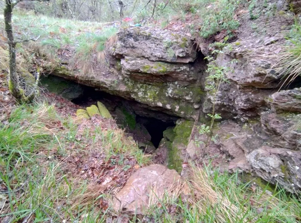
Grotta di Fontana Miella
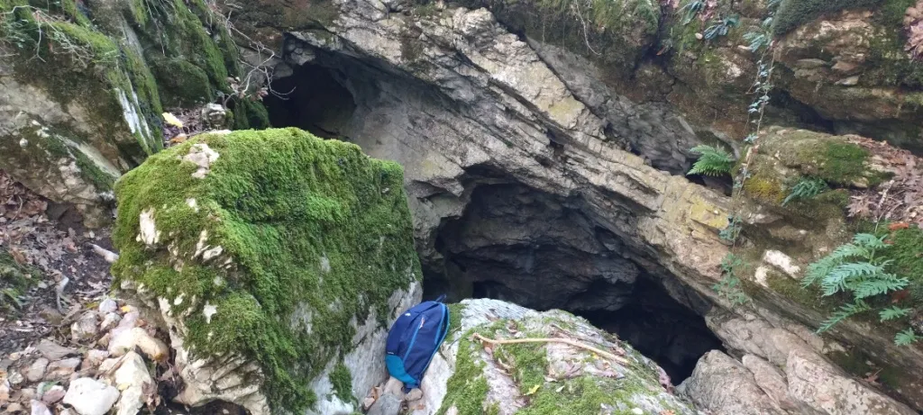
Cave that opens with a wide swallow hole about 2x2 m in a landslide gully and continues with an 18 m pit, from the bottom of which a system of fissures and wide galleries is reached.
EspeleoWorld
Grotta di Fontana Miella
Cave that opens with a wide swallow hole about 2x2 m in a landslide gully and continues with an 18 m pit, from the bottom of which a system of fissures and wide galleries is reached.
San Venanzo
Length: 77 m · Depth: 33 m
Updated record
https://espeleoworld.com/en/c/grotta-di-fontana-miella-san-venanzo-terni
Information can change. Always verify coordinates, access, weather, and cave conditions before setting out.
Cave that opens with a wide swallow hole about 2x2 m in a landslide gully and continues with an 18 m pit, from the bottom of which a system of fissures and wide galleries is reached.
Topographic
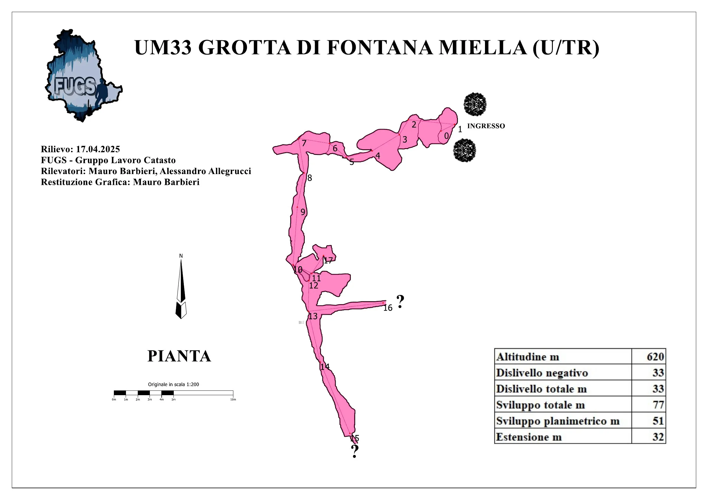
© Mauro Barbieri · CC BY-SA 4.0, https://creativecommons.org/licenses/by-sa/4.0/ · Federazione Umbra Gruppi Speleologici (FUGS), Catasto Speleologico dell'Umbria · https://catasto.fugs.it/index.php?mod=caves&op=view&id=33
Photos
© Mauro Barbieri · LicenseRef-FUGS-media-per-item · Federazione Umbra Gruppi Speleologici (FUGS), Catasto Speleologico dell'Umbria · https://catasto.fugs.it/index.php?mod=caves&op=view&id=33
Description
Morphology
Entrance: wide swallow hole inside a landslide gully, about 2x2 m in size. 18 m pit, from the bottom of which a system of fissures and wide galleries is reached. Trend: mixed.
Hydrology
Water difficulties: waterfalls.
Progression
Passability: experts only; recommended period all year round. Rigging: fixed. Hazards: dangerous access, landslides/collapses.
Other details
Geology: VAS Scaglia Variegata - Eocene Med.Sup. (Lutetian-Priabonian); marls; stratified.
History
Notes on the name: it presumably takes its name from a gully near the Fosso di Ospedaletto close to the entrance.
User Comments (0)
No comments yet.
Be the first to share your experience!
Registered Explorations (0)
No explorations registered yet.
Register your visit to this cave!
Bibliography
LEMMI G. & COLETTI G. (1961) Elenco catastale delle grotte dell'Umbria ANONIMO (1962) Attività del Gruppo Grotte dell'Istituto di Geologia dell'Università di Perugia COCCHI C. (1962) La Grotta di Fontana Miella MARTINI A. (1962) Alcune considerazioni preliminari sulla microflora delle caveme ANONIMO (1972) Il 1971 per Io Speleo Club di Orvieto
Nearby caves


Source: Catasto Cavità Umbria (Federazione Umbra Gruppi Speleologici, FUGS) (catasto.fugs.it), modified. LicenseRef-FUGS-no-licence-stated Federazione Umbra Gruppi Speleologici (FUGS), Catasto Speleologico dell'Umbria · https://catasto.fugs.it/index.php?mod=caves&op=view&id=33 · data as of 2025 · Source: Catasto Cavità Umbria (Federazione Umbra Gruppi Speleologici, FUGS) (catasto.fugs.it), modified. LicenseRef-FUGS-media-per-item Federazione Umbra Gruppi Speleologici (FUGS), Catasto Speleologico dell'Umbria · data as of 2025