
Graller d'en Remigi Moli
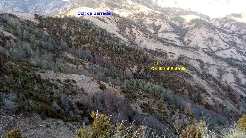
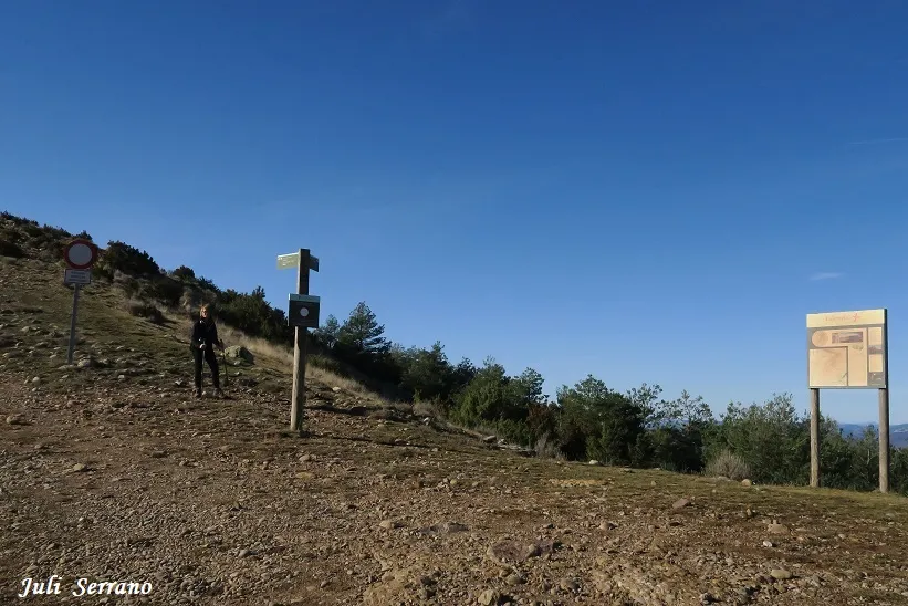
A 61-metre-deep pit in the Serra de Lleràs, Tremp. First explored by the SIE del CEA in 1972. Access from Salàs de Pallars via tracks and a footpath. A cavity with a 19-metre shaft and galleries.
EspeleoWorld
Graller d'en Remigi Moli
A 61-metre-deep pit in the Serra de Lleràs, Tremp. First explored by the SIE del CEA in 1972. Access from Salàs de Pallars via tracks and a footpath. A cavity with a 19-metre shaft and galleries.
Tremp · Pallars Jussà
Length: 95 m · Depth: 61 m
Updated record
https://espeleoworld.com/en/c/graller-d-en-remigi-moli
Information can change. Always verify coordinates, access, weather, and cave conditions before setting out.
A 61-metre-deep pit in the Serra de Lleràs, Tremp. First explored by the SIE del CEA in 1972. Access from Salàs de Pallars via tracks and a footpath. A cavity with a 19-metre shaft and galleries.
Topographic
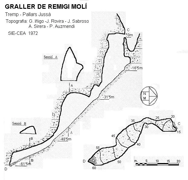
Espeleoindex · CC BY-NC 4.0, https://creativecommons.org/licenses/by-nc/4.0/ · Image © its author.
Photos
Espeleoindex · CC BY-NC 4.0, https://creativecommons.org/licenses/by-nc/4.0/ · Image © its author.
Description
Morphology
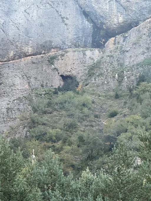
The mouth opens in the shape of a window and leads us into a wide pit of about 19 metres. About three metres below the mouth and on the left as we descend, we find a re-belay. The base of the pit is formed by a large ramp that leads to a drop. At this point the gallery narrows a little, but it immediately enters a wide and high gallery on a slope. At the end of this the accumulations of earth and guano end, and one enters a lower gallery with the floor also on a slope and full of cobbles.
Speleothems
At the end of the cavity we find some interesting transparent formations.
Progression
A small tree located about 4 metres from the mouth is used to rig. At the mouth, on the right and at head height, there is an M10 bolt with a plate. About three metres below the mouth and on the left as we descend, we find a re-belay with an M10 bolt with a plate, from which we already reach the base of the pit. It is necessary to cross the whole base to the left-hand wall, where, besides avoiding the fall of stones that come down when the wall is touched, we find another M10 bolt with a plate to rig the rope with which we will overcome the drop. At the base of this and on the left as we descend we find an M8 bolt with a plate to secure the descent down the ramp, and above all the ascent. At this point the gallery narrows a little but immediately enters a wide and high gallery on a slope, at the end of which the accumulations of earth and guano end, and one enters a lower gallery with the floor also on a slope and full of cobbles, but which no longer needs a rope. For the exploration of the cavity it is advisable to rig a 30-metre rope that reaches from the tree at the mouth to the other side of the pit before descending the drop, and a 40-metre rope rigged at this point and that reaches to the end of the ramp. This rope is only to help on the ascent; it can be a lighter rope. The cavity has been left equipped with M10 and M8 bolts with fixed plates. It is advisable not to carry a 17 mm spanner (it is a way of avoiding the temptation to take the plates).
History
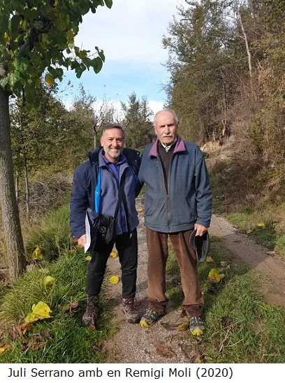
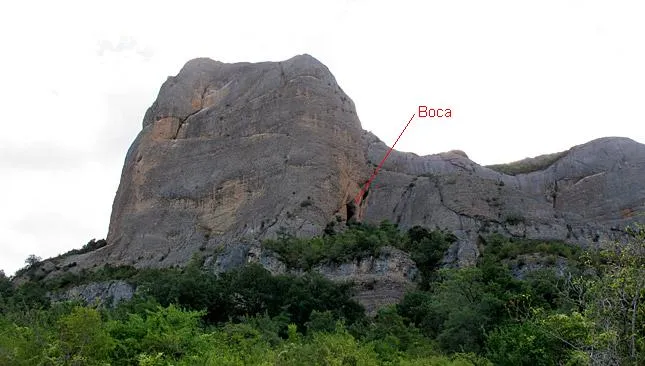
The first exploration was carried out by the SIE del CEA during Easter 1972. The name of the cavity was dedicated to en Remigi Moli, who was the person who showed them where it was. Later they learned of the existence of a cavity called “Forat del Gos de Moró” in the area, but it has never been found, and given the place where they locate it, it might perhaps be the same cavity, or not. We have no record of further explorations until the visit made in the early 80s by members of the GELL de Lleida, who visited en Remigi Moli in Castellet so that he would indicate to them where the cavity was. Since then it seems that the cavity had not been visited again. Having put the collaborating team of Espeleoíndex in contact first with en Remigi Moli in Castellet, not much result was obtained since he, after so many years, was no longer very clear about the ravine where the cavity was. Having then put ourselves in contact with Josep Mª Molgó of the GELL, who took part in the exploration of the 80s, he provided us with a panoramic photograph of the area in which the mouth of the cavity could be seen; this small detail has allowed us to find the cavity again.
User Comments (0)
No comments yet.
Be the first to share your experience!
Registered Explorations (0)
No explorations registered yet.
Register your visit to this cave!
Bibliography
- Borràs, J.; Miñarro,J.M.; Talavera, F. (1979).-”el Pallars Jussà”. Catàleg Espeleològic de Catalunya (vol.3):1-211. Ed. Políglota. Barcelona.
- Valles, Jordi de.(2008).-”Alta Ribagorça, Pallars Jussà, Pallars Sobirà, Val d'Aran”. Catàleg Espeleològic de Catalunya (vol.1):1-319. EC Gràcia / FCE.
- Victoria, J.M.;Iñigo, G;Rovira, J.(1974).-”Karstificación en los conglomerados del margen derecho de la Conca de Tremp.(Lérida). Espeleosie (16):71-120. SIE-CE Àliga. Barcelona
- Coordenades, situació, descripció i fotografies han estat facilitades per Montse Roca i Juli Serrano (SIE-CEA) i Francesc Rubinat (ERE-CEC).
- Wikiloc track per arribar a la cavitat. (https://ca.wikiloc.com/rutes-espeleologia/remigi-moli-75781935)
Nearby caves


Source: Espeleoindex (espeleoindex.com), modified. CC BY-NC 4.0, https://creativecommons.org/licenses/by-nc/4.0/