
Frühlinghauser Höhle
The Frühlinghauser Höhle is 18 m long, has additional entrances, and lies in Massenkalk.
EspeleoWorld
Frühlinghauser Höhle
The Frühlinghauser Höhle is 18 m long, has additional entrances, and lies in Massenkalk.
Balve
Length: 18 m
Updated record
https://espeleoworld.com/en/c/fruehlinghauser-hoehle-balve
Information can change. Always verify coordinates, access, weather, and cave conditions before setting out.
The Frühlinghauser Höhle is 18 m long, has additional entrances, and lies in Massenkalk.
Description
Morphology
The Frühlinghauser Höhle is 18 m long and has additional entrances. It lies in Middle Devonian reef limestone, the so-called Massenkalk.
Other details
In places, typical reef fossils are recognizable in the rock. The beech forest above the cave is protected as the natural monument "Laubwald im Stein".
User Comments (0)
No comments yet.
Be the first to share your experience!
Registered Explorations (0)
No explorations registered yet.
Register your visit to this cave!
Nearby caves
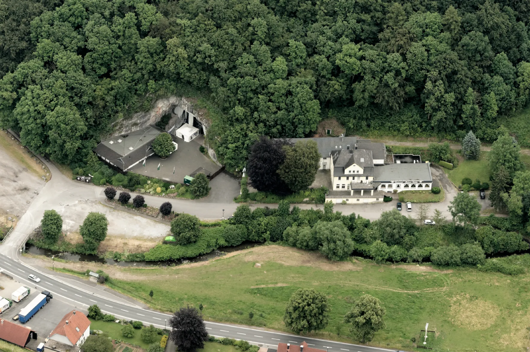
Source: Geotopkataster Nordrhein-Westfalen (Geologischer Dienst NRW) (ogc-api.nrw.de), modified. Data licence Germany – attribution – version 2.0 (dl-de/by-2-0), https://www.govdata.de/dl-de/by-2-0 Geowissenschaftliche Daten: INSP-GeotopeinNRW @ Geologischer Dienst NRW · data as of 2026 · Contains information from Grottocenter (Wikicaves), grottocenter.org, made available under the Open Database License (ODbL 1.0, https://opendatacommons.org/licenses/odbl/1-0/), modified. · length · obtained 2026-11-13 · https://grottocenter.org/ui/entrances/23702 · data as of 2026 · Source: Wikidata – cave items (Germany) (www.wikidata.org), modified. CC0 1.0, https://creativecommons.org/publicdomain/zero/1.0/ Wikidata (CC0 1.0) · data as of 2026 · Location data: © OpenStreetMap contributors, ODbL 1.0, https://opendatacommons.org/licenses/odbl/1-0/. · https://www.openstreetmap.org/node/928930058 · The derived data is available on request under the ODbL: [email protected]