
Frickenhöhle
The Frickenhöhle is a natural karst cave on the western slope of the Hoher Fricken, 3,222 m long and with an elevation difference of about 60 m.
EspeleoWorld
Frickenhöhle
The Frickenhöhle is a natural karst cave on the western slope of the Hoher Fricken, 3,222 m long and with an elevation difference of about 60 m.
Farchant
Updated record
https://espeleoworld.com/en/c/frickenhoehle-farchant
Information can change. Always verify coordinates, access, weather, and cave conditions before setting out.
The Frickenhöhle is a natural karst cave on the western slope of the Hoher Fricken, 3,222 m long and with an elevation difference of about 60 m.
Photos

© Fossane · CC BY-SA 4.0, https://creativecommons.org/licenses/by-sa/4.0/ · Wikimedia Commons · https://commons.wikimedia.org/wiki/File:Frickenh%C3%B6hle_See_Siphon.jpg
Description
Morphology
The Frickenhöhle is a natural karst cave. It is 3,222 m long and has an elevation difference of about 60 m.
Hydrology
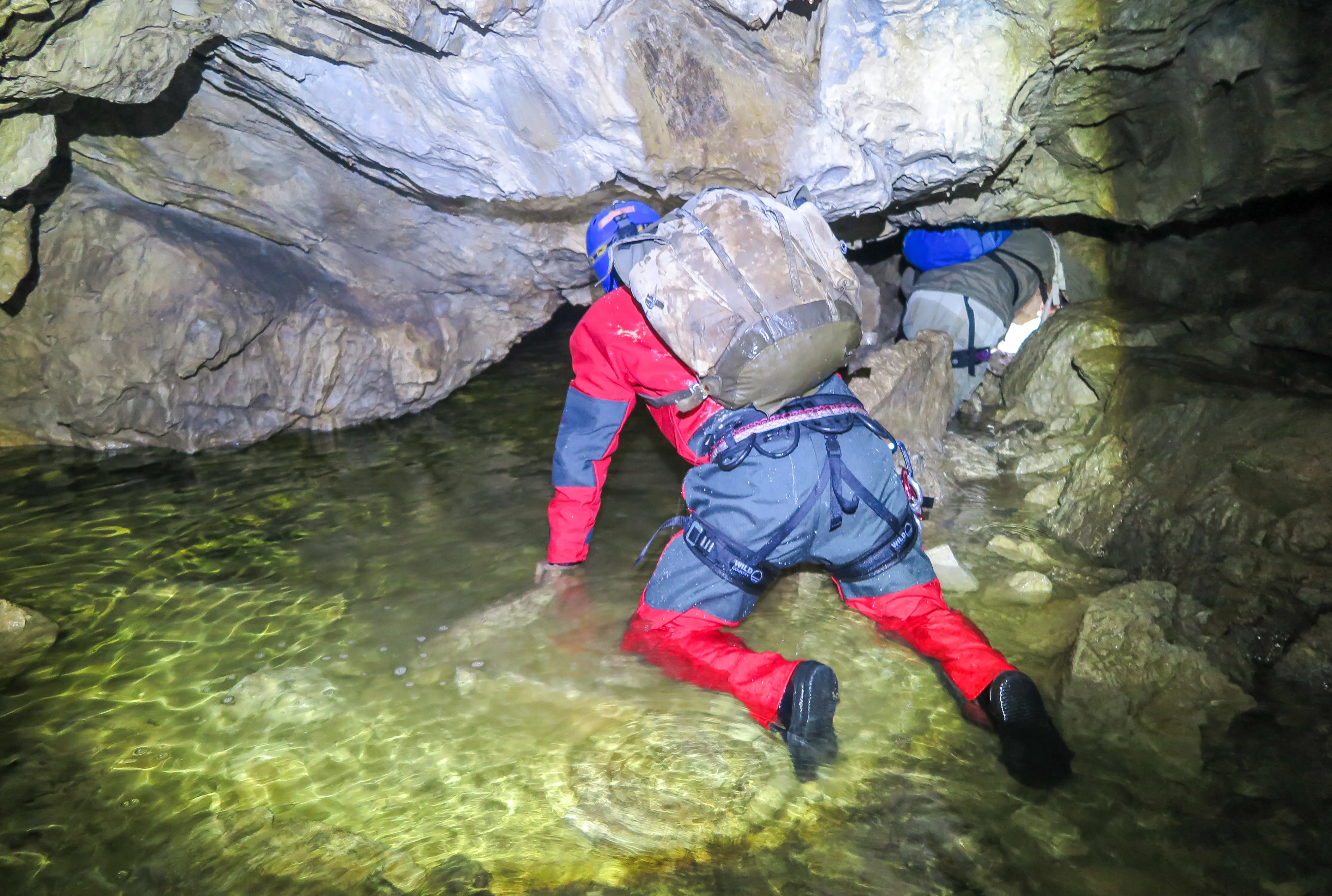
Shortly behind the entrance lies a lake that can only be dived through with a neoprene suit or climbed around with a rope. In the further section there are several sumps.
Progression
The cave can be reached as a side trip on the hiking trail from Farchant in about 1¾ hours on a steep path.
User Comments (0)
No comments yet.
Be the first to share your experience!
Registered Explorations (0)
No explorations registered yet.
Register your visit to this cave!
Nearby caves
Contains information from © OpenStreetMap contributors, www.openstreetmap.org, made available under the Open Database License (ODbL 1.0, https://opendatacommons.org/licenses/odbl/1-0/), modified. · https://www.openstreetmap.org/node/715720510 · data as of 2026 · Source: German Wikipedia – article leads (cave descriptions) (de.wikipedia.org), modified. CC BY-SA 4.0, https://creativecommons.org/licenses/by-sa/4.0/ Wikipedia contributors (de.wikipedia.org), CC BY-SA 4.0 · Text by Wikipedia contributors (Frickenhöhle) · adapted by Espeleoworld (normalized, translated); the adaptation is licensed CC BY-SA 4.0, https://creativecommons.org/licenses/by-sa/4.0/ · description · obtained 2026-11-13 · https://de.wikipedia.org/wiki/Frickenh%C3%B6hle · data as of 2026 · The derived data is available on request under the ODbL: [email protected]