
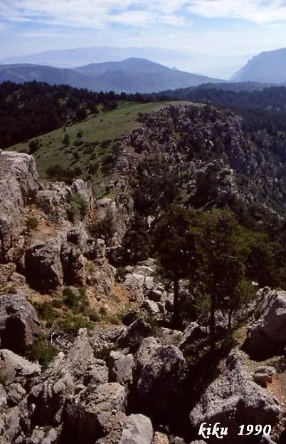
Forats de la Neu
A set of crevices 37 metres deep in Cabó, known since ancient times for preserving snow in them.
EspeleoWorld
Forats de la Neu
A set of crevices 37 metres deep in Cabó, known since ancient times for preserving snow in them.
Cabó · Alt Urgell
Length: 60 m · Depth: 37 m
Updated record
https://espeleoworld.com/en/c/forats-de-la-neu
Information can change. Always verify coordinates, access, weather, and cave conditions before setting out.
A set of crevices 37 metres deep in Cabó, known since ancient times for preserving snow in them.
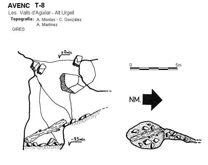
Topographic
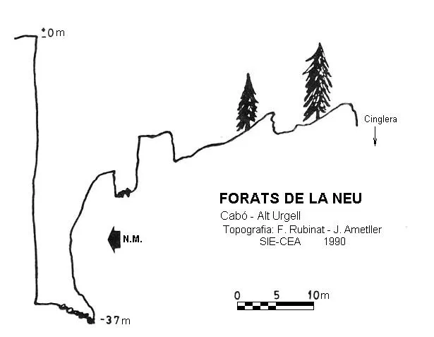
Espeleoindex · CC BY-NC 4.0, https://creativecommons.org/licenses/by-nc/4.0/ · Image © its author.
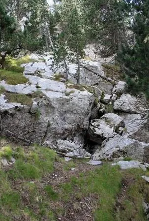
Photos
Espeleoindex · CC BY-NC 4.0, https://creativecommons.org/licenses/by-nc/4.0/ · Image © its author.
Description
Morphology
A set of crevices formed from a displacement of the materials towards the Cabó valley, leaving a series of crevices of various dimensions between the main axis of the crevice (represented on the survey) and the cliff.
History
It seems they have been known since ancient times by the local people, since snow was preserved inside them for a long time. The first speleological exploration of which we have record was carried out by the SIE del CEA in 1984, but they wrongly named it “Esquerda del Clot de Fa”, which was the name that appeared in this area on the IGC maps at a scale of 1:50,000 and the 1949 edition; this was the only cartography existing of the area in those years. It was later visited by the GIRES de Sant Esteve de Sesrovires during its campaign at Boumort, and the SIE-CE Aliga returned there again in 1990.
In reality the name Clot de Fa is erroneous, since the correct toponymy is Favà, but that lies further to the east, although currently the ICC cites it as Clot de Far at the 1:25,000 scale, while at 1:50,000 it cites it as Clot de Favà.
User Comments (0)
No comments yet.
Be the first to share your experience!
Registered Explorations (0)
No explorations registered yet.
Register your visit to this cave!
Bibliography
- Cortès Ribelles, Manuel.(2005).-La serra del Boumort i muntanyes veïnes. pp:1-380. Cossetània edicions.
- Rubinat, Francesc.(1990).-”Noves dades al massís del Boumort” EspeleoSie (31): 51-53. SIE del CE Àliga. Barcelona.
Nearby caves


Source: Espeleoindex (espeleoindex.com), modified. CC BY-NC 4.0, https://creativecommons.org/licenses/by-nc/4.0/