
Avenc del Mort
Avenc de 15 metres de fondària a Les Valls d'Aguilar
EspeleoWorld
Avenc del Mort
Avenc de 15 metres de fondària a Les Valls d'Aguilar
Valls d'Aguilar, Les · Alt Urgell
Length: 20 m · Depth: 15 m
Updated record
https://espeleoworld.com/en/c/avenc-del-mort
Information can change. Always verify coordinates, access, weather, and cave conditions before setting out.
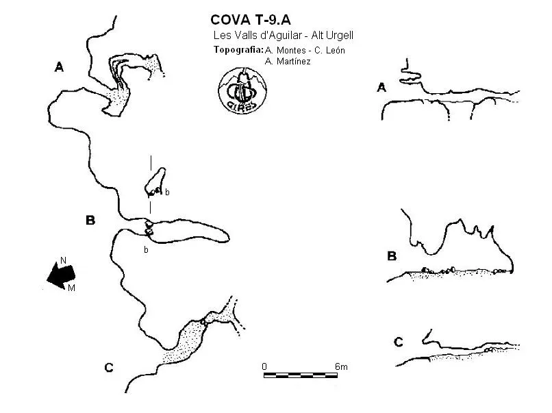
A 15-metre-deep pit in Les Valls d'Aguilar, with a 3x2-metre entrance divided by a stone slab.
Topographic
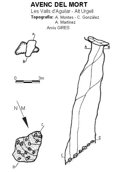
Espeleoindex · CC BY-NC 4.0, https://creativecommons.org/licenses/by-nc/4.0/ · Image © its author.
Description
Morphology
A 3x2-metre entrance with a stone slab that divides it in two. It consists of a single shaft that ends in a slope of stone, earth and branches from the exterior.
History
Explored by GIRES in various campaigns carried out in the 90s.
This cave could be the “Forat del Bosc de Taús”, but there is no certainty of this. It was given its name after a corpse was found during the exploration, possibly from the post-war period of 1936.
User Comments (0)
No comments yet.
Be the first to share your experience!
Registered Explorations (0)
No explorations registered yet.
Register your visit to this cave!
Bibliography
- GIRES (2003).-'Cavidades de la Vall d'Aguilar' Passamà (2): 18-39, GIRES, St.Esteve Sesrovires.
- de Valles Tena, Jordi. (2009).- Catàleg Espeleològic de Catalunya (Vol. 2):78-79. Espeleo Club de Gràcia i Federació Catalana d'Espeleologia Barcelona.
Nearby caves

Source: Espeleoindex (espeleoindex.com), modified. CC BY-NC 4.0, https://creativecommons.org/licenses/by-nc/4.0/