
Avenc T-4
Avenc de 21 metres de fondària a Les Valls d'Aguilar
EspeleoWorld
Avenc T-4
Avenc de 21 metres de fondària a Les Valls d'Aguilar
Valls d'Aguilar, Les · Alt Urgell
Length: 41 m · Depth: 21 m
Updated record
https://espeleoworld.com/en/c/avenc-t-4
Information can change. Always verify coordinates, access, weather, and cave conditions before setting out.
A 21-metre-deep pit in Les Valls d'Aguilar, explored by GIRES over several campaigns in the 90s.
Topographic
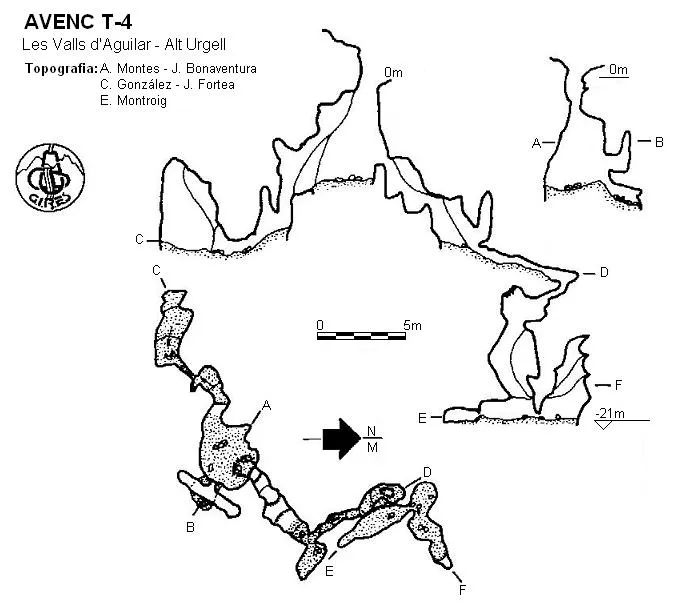
Espeleoindex · CC BY-NC 4.0, https://creativecommons.org/licenses/by-nc/4.0/ · Image © its author.
Description
Morphology
A 2x1 metre entrance leading to a 6-metre shaft; the base is a 4x4 metre chamber with two possible continuations. To the south-west there is a 2-metre step down that leads to a crawlway with a small chamber at the end. To the north-east you must descend two dry potholes and a 2.5-metre step down that place you at the start of a descending crawlway at the end of which a new shaft opens; its base is divided into two chambers where the cavity ends.
History
Explored by GIRES over several campaigns carried out in the 90s.
User Comments (0)
No comments yet.
Be the first to share your experience!
Registered Explorations (0)
No explorations registered yet.
Register your visit to this cave!
Bibliography
GIRES (2003).-"Cavidades de la Vall d'Aguilar" Passamà (2): 18-39, GIRES, St.Esteve Sesrovires.
Nearby caves
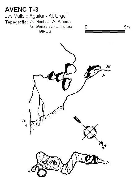

Source: Espeleoindex (espeleoindex.com), modified. CC BY-NC 4.0, https://creativecommons.org/licenses/by-nc/4.0/