

Forat del Graller
An 89-metre descent in the Vall de Boí, at the Forat del Graller, within the Parc Nacional d'Aigües Tortes i Llac de Sant Maurici.
EspeleoWorld
Forat del Graller
An 89-metre descent in the Vall de Boí, at the Forat del Graller, within the Parc Nacional d'Aigües Tortes i Llac de Sant Maurici.
Vall de Boí, La · Alta Ribagorça
Length: 211 m · Depth: 89 m
Updated record
https://espeleoworld.com/en/c/forat-del-graller
Information can change. Always verify coordinates, access, weather, and cave conditions before setting out.
An 89-metre descent in the Vall de Boí, at the Forat del Graller, within the Parc Nacional d'Aigües Tortes i Llac de Sant Maurici.
Topographic


Espeleoindex · CC BY-NC 4.0, https://creativecommons.org/licenses/by-nc/4.0/ · Image © its author.
Photos

Espeleoindex · CC BY-NC 4.0, https://creativecommons.org/licenses/by-nc/4.0/ · Image © its author.
Description
Morphology
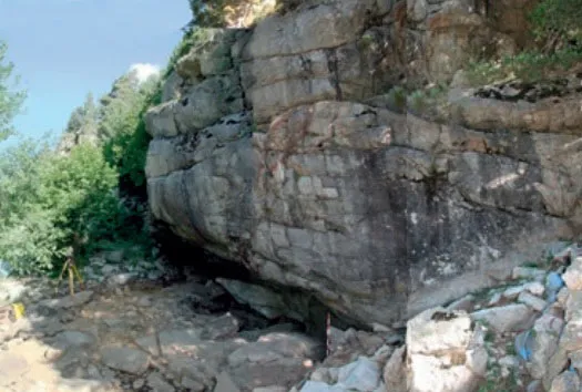
The access through the upper mouth is formed by two passable conduits and a third impassable one through which the water flows. The large mouth gives access to a gallery on a steep slope, this becoming more pronounced between -29 and -39 metres, where it is cut at the midpoint of another almost parallel gallery but of a very different appearance, which can be ascended for about 30 metres of route and 15 of drop until we are right below the blocks of the entrance gallery, a few metres from the mouth. The upper zone of that gallery, in times of abundant water, is traversed by part of the water flow that ends up being lost in a narrow passage.
Once back at -39 metres, there is the possibility of continuing along the South gallery or else along that of the diaclases, which would be the continuation of the entrance one. After 25 metres it places us at the head of a series of steps until reaching -79 metres of depth, a junction point in a chamber with the lower part of the parallel gallery, which we had left at -39 metres.
From this chamber, by means of a single conduit of modest sections, 2 metres high by 1 metre wide, this is traversed by the water in a tumultuous way. The cavity develops in some calco-schistose strata.
Hydrology
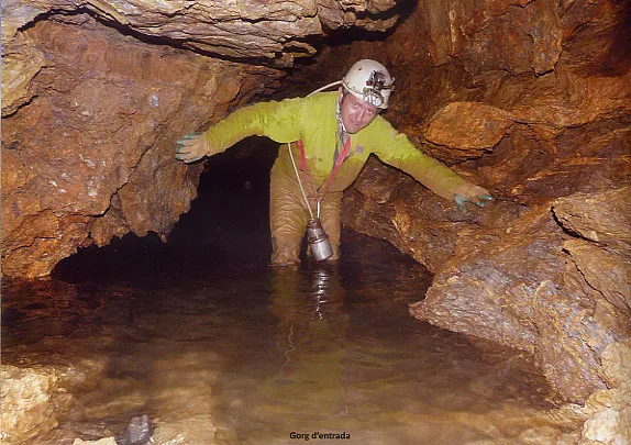
The upper zone of the gallery, in times of abundant water, is traversed by part of the water flow that ends up being lost in a narrow passage. Once at -59 metres, the place where the water current re-emerges, one must follow it through various steps, the longest of -9 metres, until reaching the junction chamber, already described, located at -79 metres. After about 80 metres of route and passing some short “rapids” one reaches the Font del Graller, where the water emerges and one returns to the outside.
Progression
Once at this previous point one descends on a steep slope to -59 metres, the place where the water current re-emerges; one must follow it through various steps, the longest of -9 metres, until reaching the junction chamber, already described, located at -79 metres. From this chamber and by means of a single conduit of modest sections, 2 metres high by 1 metre wide, this is traversed by the water in a tumultuous way. After about 80 metres of route and passing some short “rapids” one reaches the Font del Graller, where the water emerges and one returns to the outside.
Other details
As the cavity is located within the limits of the Parc Nacional d'Aigües Tortes i Llac de Sant Maurici, access is very probably restricted, since the area of the Bony del Graller is a protected space; therefore, it is advisable to find out at the Park offices before carrying out the exploration.
History
The first incursion into the cavity was not made by speleologists, but by the geologists C.E. Martí and C. Puigdefàbregas in October of the year 1964, within the work carried out by the Centre Pirenaic de Biologia in the Parc Nacional d'Aigües Tortes. Their exploration ended shortly before the chamber where the most vertical sections of the cavity end. They presented a work on the cavity in the last issue of the magazine Speleon that was published in Oviedo and they leave an unknown regarding its continuation.
After some years, this unknown was a reason for curiosity so that members of the SIE – CEA decided to go and pay a visit in mid-September 1975, verifying that, without too much difficulty, they could continue the exploration and reach the lower exit through the font del Graller. On 28 September 1975 a large group from the SIE explore all the corners of the cavity and make the survey.
From the year 1993, with the approval by the Generalitat de Catalunya of the first PRUG (Pla Rector d'Ús i Gestió) of the Parc Nacional d'Aigües Tortes i estany de Sant Maurici, access to the area of the Bony del Graller where the cavity is located is prohibited.
DOGC 1727. 29-3-1993. Decret 82/1993 de 9 de febrer. Article 11.
Àrea de protecció integral 11.1 Definició: són aquells espais del Parc Nacional de característiques excepcionals que engloben ecosistemes de rellevants valors ecològics, científics i/o paisatgístics, en els quals la seva singularitat i/o fragilitat comporta, per a la seva conservació, un ús molt limitat. 11.2 Localització: Estanys de Trescuro. Bony del Graller. Estan grafiades al plànol P.26. Zonificació d'usos i nivells de protecció. 11.3 Usos admissibles: aquests espais queden sotmesos a un règim total de protecció i només admetran, sota autorització expressa del Patronat del Parc Nacional, accions d'investigació i conservació de la natura amb finalitat exclusivament científica i de control del medi. L'accés serà exclusivament a peu i prohibit al públic en general. Amb l'autorització prèvia del director-conservador, i sota control de guies especialitzats, s'admetran visites de caire excepcional. 11.4 Usos inadmissibles: és vedada qualsevol acció i intervenció que pugui suposar una transformació o modificació del medi i comporti degradació dels ecosistemes. No s'admet cap tipus d'aprofitament, inclòs el tradicional de la pastura.
User Comments (0)
No comments yet.
Be the first to share your experience!
Registered Explorations (0)
No explorations registered yet.
Register your visit to this cave!
Bibliography
- Borràs,J.; Miñarro,J.M.; Talavera,F. (1979).-”el Pallars Jussà”. Catàleg Espeleològic de Catalunya (Vol.3):1-211. Ed Políglota. Barcelona.
- Cardona i Oliván,Ferran.(1989).-”La Serralada Pirinenca”. Grans Cavitats de Catalunya (Primer Volum):102-105. E.C. Gràcia. Barcelona.
- Marti, C.E.; Puigdefàbregas,C.(1965).-”Estudio del Parque Nacional de Aigües Tortes: Geomorfología del Forat del Graller”. Speleon (16):3-12. Universidad Oviedo.
- SIE.(1976).-“El Forat del Graller – Font del Graller”. EspeleoSie (19):29-33. SIE-CE Àliga. Barcelona.
- Valles, Jordi de (2008).-”Alta Ribagorça, Pallars Jussà, Pallars Sobirà, Val d'Aran”. Catàleg Espeleològic de Catalunya (Vol.1):1-319. ECG/FCE.
- Fotografies facilitades per Josep M. Molgó (GELL-CEL).
Nearby caves
Cova del Sardo
2.2 km · N
Vall de Boí, La (Alta Ribagorça)
2 topo.2 photos

Forat del Mont
8.7 km · W
Vall de Boí, La (Alta Ribagorça)
1 topo.3 photos
Surgència de Fontmentiró
11 km · S
Sarroca de Bellera (Pallars Jussà)
1 topo.3 photos

Cova de Gerber
12 km · NE
Alt Àneu (Pallars Sobirà)
1 topo.5 photos
Source: Espeleoindex (espeleoindex.com), modified. CC BY-NC 4.0, https://creativecommons.org/licenses/by-nc/4.0/