
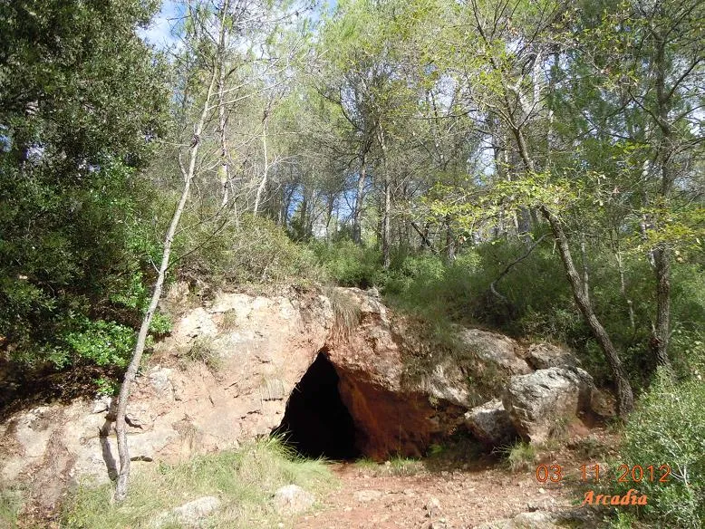
Cova del Bolet
A 225-metre-long cave in Mediona (Alt Penedès), with three entrances and an approximate elevation change of -10 metres.
EspeleoWorld
Cova del Bolet
A 225-metre-long cave in Mediona (Alt Penedès), with three entrances and an approximate elevation change of -10 metres.
Mediona · Alt Penedès
Length: 225 m · Depth: 10 m
Updated record
https://espeleoworld.com/en/c/cova-del-bolet
Information can change. Always verify coordinates, access, weather, and cave conditions before setting out.
A 225-metre-long cave in Mediona (Alt Penedès), with three entrances and an approximate elevation change of -10 metres.
Topographic
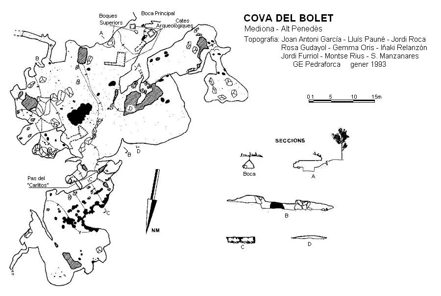
Espeleoindex · CC BY-NC 4.0, https://creativecommons.org/licenses/by-nc/4.0/ · Image © its author.
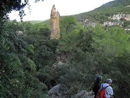
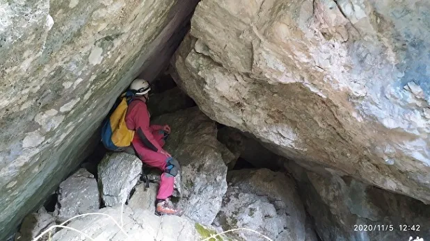
Photos
Espeleoindex · CC BY-NC 4.0, https://creativecommons.org/licenses/by-nc/4.0/ · Image © its author.
Description
Morphology
Three entrances give access to the entrance hall of the cave, two in the form of a cave and the third as a pit, since it is located in the ceiling of this hall. From the entrance hall, if we follow in an E direction, a short ramp leads us to a new hall situated at a lower level. Towards the SE of the hall we find a short gallery that ends after a few metres. On the N side of the hall and behind some flowstone, we find a small pit that leads us to a small lower level. Returning to the entrance hall, on the W side, we can access through two different points a wide conduit, although of little height, about 20 metres long; at the end of this it becomes narrower and turns towards the N, giving access to a small hall where it ends. Situated again in the entrance hall, if we follow towards the N, we follow a gallery with a low ceiling that soon turns left and then right, where we find two drops; the gently sloping floor leads us to a hall, on the right side of which we access another space from whose NE part a narrow conduit emerges that ends after a few metres. The cave has an approximate length of 225 metres and the approximate elevation change would be around -10 metres.
Speleothems
The new hall situated at a lower level has a lot of wall formation, although its state of conservation leaves much to be desired. In the low-ceiling gallery, on the left side, we find abundant concretions that are quite damaged.
History
Known since time immemorial by the people of the region and about which many legends were told. Mentioned by Font i Sagué in his Catàleg (1897), it gives brief references from other informants. Despite having intended to visit it at the end of his campaign in the Priorat, Muntanyes de Prades and Alt Penedès (summer of 1899), the tiredness of those days made him postpone the visit for later, but he never came to visit it. The first speleological exploration was carried out by M. Faura i Sans with some friends from the Mas Guinoles on 6 August 1907 (it was his second experience underground). His visit was relatively superficial, calculating some 60 metres of length and publishing a first very schematic sketch. He also made some first test digs in the entrance hall, without obtaining any result. Many years later it began to be visited by speleologists and was also the object of different archaeological campaigns that gave good results, finding remains from the Neolithic and Eneolithic. In 1934 it is visited by Francesc Español in his biospeleological research and, with the same purpose, A. Lagar visits it in 1950. In February 1973, Lagar with members of the SIRE – UEC carry out a detailed exploration and, among other results, they produce a new topography more complete than that of Faura. But now (October 2022), after more than 50 years, we have rediscovered in the archive of the ERE – CEC a very accurate topography that we calculate was made towards the end of the 1960's. It is not until 1993 that members of the GE Pedraforca (Barcelona) carry out a series of explorations throughout the Mediona area and produce what until now had been the clearest and most complete topography of the cavity.
Bio
Coleoptera
Troglocharinus españoli Zar. (F. Español, 1934)
User Comments (0)
No comments yet.
Be the first to share your experience!
Registered Explorations (0)
No explorations registered yet.
Register your visit to this cave!
Bibliography
- Aymamí, G. (1998).- “Les coves del Penedès: La seva descoberta i utilització per l'home al llarg del temps”. Del Penedès (7): 7-48. Institut d'Estudis Penedesencs. Vilafranca del Penedès
- Faura i Sans, M. (1909).- “Les coves del Bolet”. Sota Terra (I): 43-52. Club Muntanyenc. Barcelona
- Lagar, A.; Sabater, J.; Torrella, J. (1974).- “La cova del Bolet (Mediona – Barcelona)”. Senderos (174): 17-19. Unió Excursionista de Catalunya. Barcelona.
- Rafecas, Eduard (1995).- Mediona. Guia d'esports d'aventura. 76 pp. Ajuntament de Mediona.
- Topografia inèdita arxiu ERE - CEC
Nearby caves
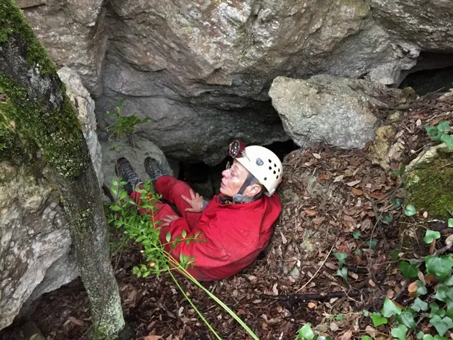
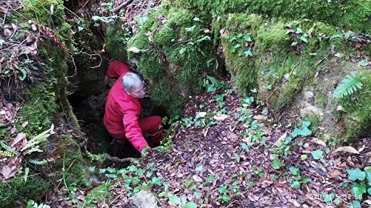


Source: Espeleoindex (espeleoindex.com), modified. CC BY-NC 4.0, https://creativecommons.org/licenses/by-nc/4.0/