
Cova de les Angúnies
Cova de 190 metres de recorregut a Sant Aniol de Finestres.
EspeleoWorld
Cova de les Angúnies
Cova de 190 metres de recorregut a Sant Aniol de Finestres.
Sant Aniol de Finestres · Garrotxa
Length: 190 m · Depth: 40 m
Updated record
https://espeleoworld.com/en/c/cova-de-les-angunies
Information can change. Always verify coordinates, access, weather, and cave conditions before setting out.
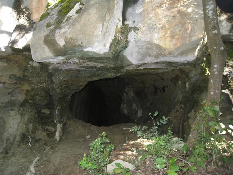
A 190-metre-long cave in Sant Aniol de Finestres.
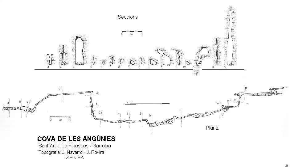
Topographic
Espeleoindex · CC BY-NC 4.0, https://creativecommons.org/licenses/by-nc/4.0/ · Image © its author.
Photos
Espeleoindex · CC BY-NC 4.0, https://creativecommons.org/licenses/by-nc/4.0/ · Image © its author.
Description
Morphology
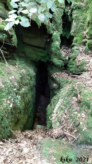
It begins in the middle of the torrent with a 3-metre drop in the open air; at the bottom, a narrow passage with a drop of about 8 metres places us in a narrow, high gallery descending until, after a few metres, it widens a little. At its end, through a narrow passage and a drop, one enters another gallery much narrower than the entrance one and with an almost perpendicular direction, but which little by little takes on that of the former again. Progress is made along the lower and middle part, since at the upper end of the joint it is extremely narrow. About 50 metres from the entrance, the gallery turns sharply to the right, continuing in this direction for about 15 metres more, before turning again and taking the general direction. In the following 30 metres of gallery there are some pools full of water and, due to the dip of the strata, the ceiling is lower and noticeably sloping. Through a new drop one enters a new gallery, covered with blocks of regular size, wider than the previous ones and with a high ceiling; it is about 12 metres long; it continues narrowing again, but without losing height, to emerge once more into a stretch wider but shorter than the previous one. About 10 metres further on one reaches the sala dels Blocs, and in its lower part the joint continues, here very high and narrow, along which it continues until reaching a drop that allows one to reach a gallery of imperceptible height; at its end, through a small pit, one reaches the last gallery, which lies directly beneath the previous one. Along this final stretch a small watercourse normally flows, the product of the various water inputs along the cavity.
History
The first exploration was carried out in October 1966 by the GIE and the GRA, both of the CE Gràcia; they did not make the survey, but they assigned it a somewhat exaggerated length of 350 metres and pending continuation. They also explored a nearby cave which they named cova d'Angel Rull, about a hundred metres long, but of which nothing more has ever been heard. Hypothetically this could be the nearby cova del Llop. On 1.2 and 3 November 1968, the SIE of the CEA explored and surveyed the cavity, although this would not be published until the appearance in 1980 of volume 4 of the catàleg Espeleològic de Catalunya.
User Comments (0)
No comments yet.
Be the first to share your experience!
Registered Explorations (0)
No explorations registered yet.
Register your visit to this cave!
Bibliography
- Borrás,J.; Miñarro,JM;Talavera,F.(1980).-”el ripollès, la garrotxa i l'alt empordà”. Catàleg Espeleològic de Catalunya (vol 4):226-229. ed. Políglota. Barcelona.
- Marigot,E.(1967).-”Espeleologia a la Garrotxa”. Circ.C.E.Gràcia (295):4-5. Barcelona.
- SIE (1970).-”Relación cronológica de las exploraciones de 1968”. EspeleoSie (6):16-30.
- Valles, Jordi de. (2009).-”Berguedà, Cerdanya, Garrotxa i Ripollès”. Catàleg Espeleològic de Catalunya (vol.3):1-381. EC Gràcia/FCE.
- Situació, Coordenades i fotografies facilitades per Juli Serrano (SIE-CEA) i Francesc Rubinat (ERE-CEC). Juny de 2021.
- RUB-Z. Wikiloc (https://ca.wikiloc.com/rutes-espeleologia/cova-de-les-angunies-cova-del-llop-76274623) Track de la ruta de la cova de les Angúnies i la cova del Llop.
Nearby caves


Source: Espeleoindex (espeleoindex.com), modified. CC BY-NC 4.0, https://creativecommons.org/licenses/by-nc/4.0/