
Cova de Cala Castell
Cova marina de 40 m. de recorregut a Palamós
EspeleoWorld
Cova de Cala Castell
Cova marina de 40 m. de recorregut a Palamós
Palamós · Baix Empordà
Length: 40 m
Updated record
https://espeleoworld.com/en/c/cova-de-cala-castell
Information can change. Always verify coordinates, access, weather, and cave conditions before setting out.
A 40 m-long sea cave in Palamós, known speleologically since 1982.
Topographic
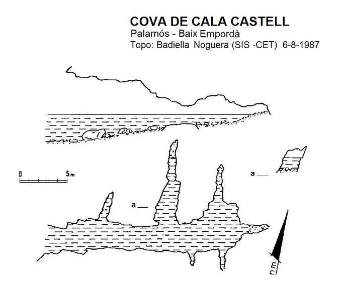
Espeleoindex · CC BY-NC 4.0, https://creativecommons.org/licenses/by-nc/4.0/ · Image © its author.
Description
Morphology
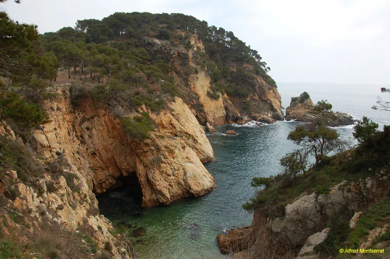
The mouth is 3 metres wide by 3 metres high and 3 metres deep below the water level. It gives way to a 20-metre gallery, whose ceiling lowers while the floor rises gently until forming a small beach at the end. A few metres from the start there is a gallery just over 3 metres long. About 6 metres further on there is a second gallery, also on the left, 9 metres long, which ends in a pebble beach. Right by the final beach, the gallery widens, forming at both ends short and very narrow galleries.
History
Although long known to the local people, the first speleological reference is provided by members of the GES – CMB, who explored and surveyed it in August 1982, naming it Cova de la Platja de Castell. Later, members of the SIS – CE Terrassa also explored and surveyed it in August 1987.
User Comments (0)
No comments yet.
Be the first to share your experience!
Registered Explorations (0)
No explorations registered yet.
Register your visit to this cave!
Bibliography
- Badiella, Enric; Badiella, Xavier; Badiella, Eduard (1992).- “Les cavitats litorals del Baix Empordà. (I) de Palamós a Aiguablava”. SIS (12): 26-51 / Arxiu del Centre Excursionista de Terrassa (75): 162-187. Terrassa.
- Espí, V. (1983).- “Nota sobre dues coves marines de la Costa Brava”. Sota Terra (4): 51. GES – Club Muntanyenc Barcelonès. Barcelona
Nearby caves


Source: Espeleoindex (espeleoindex.com), modified. CC BY-NC 4.0, https://creativecommons.org/licenses/by-nc/4.0/