
Cauva Deth Marimanha
A 140 m long cave in the Vall d'Aran, near the border with Pallars Sobirà. It includes galleries, shafts, a 6 m waterfall and a sumping lake.
EspeleoWorld
Cauva Deth Marimanha
A 140 m long cave in the Vall d'Aran, near the border with Pallars Sobirà. It includes galleries, shafts, a 6 m waterfall and a sumping lake.
Naut Aran · Val d'Aran
Length: 140 m · Depth: 35 m
Updated record
https://espeleoworld.com/en/c/cauva-deth-marimanha
Information can change. Always verify coordinates, access, weather, and cave conditions before setting out.
A 140 m long cave in the Vall d'Aran, near the border with Pallars Sobirà. It includes galleries, shafts, a 6 m waterfall and a sumping lake.
Topographic
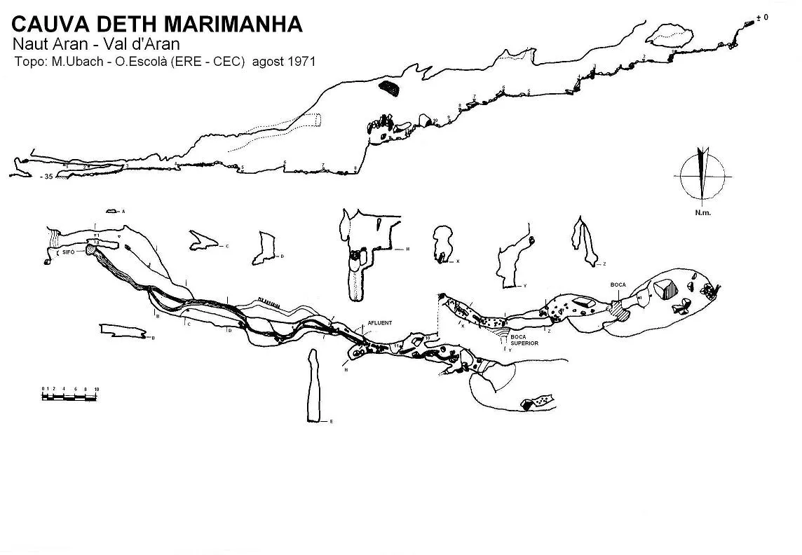
Espeleoindex · CC BY-NC 4.0, https://creativecommons.org/licenses/by-nc/4.0/ · Image © its author.
Description
Morphology
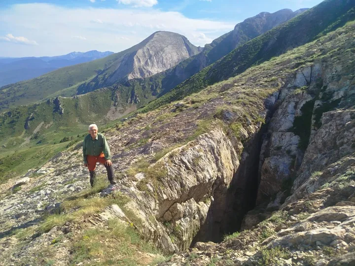
The upper mouth, at the foot of a rocky wall, is 3 x 2 metres, soon narrows and a 5 metre long crawlway is found that leads to the base of the second mouth, larger, and which is the largest of all. It has the appearance of a shaft with one of the walls very inclined, with small ledges, for which reason it offers no difficulty for access. From here on the cave acquires rather more spacious dimensions and comes to have widths of about 7 metres. The floor is occupied by some blocks of considerable size. At 12 metres from the base of mouth 2 the gallery bifurcates. On one side a hanging gallery continues, displaced slightly to the right, which joins shortly after with the lower gallery. This begins with a fairly straight ledge, by which some large blocks polished by water allow the descent and give access to a gallery with many signs of the passage of water, always with gours and narrower (from 2 to 3 metres). Some 10 metres downstream of the ledge we reach below the third mouth, of small dimensions and which does not allow access without the help of equipment. This is found 10 metres above the floor and offers dimensions of 0.7 x 0.4 metres; it opens at the top of the gallery and in a small shaft allows descending a stretch until it becomes vertical. At this point the gallery is only 1.5 or 2 metres wide but is high. The floor descends after a flat little room at the base of the upper mouth and forms some small ledges between the blocks until between points 7 and 8 a small shaft is formed that can easily be descended in opposition; at the base of this shaft, with walls polished by water, a pothole full of water is found according to the time of year. Shortly after the gallery joins with another more important one, all forming a very small little room.
The other gallery, which cooperates in forming the room, comes from a fourth important mouth, situated a few metres from the small mouth passed a few metres before. This mouth is the lowest of the upper ones and presents a notable funnel, which further down narrows through the blocks, continuing by a uniform ramp of blocks until reaching an enlargement of the gallery. To the left a short and narrow ascending gallery appears, by which a little water descends, a gallery that ends up being impracticable. Downwards we reach a room with a high ceiling, with tiny communications with the main gallery that descends from the upper mouths. Below, through a passage narrower than the rest, we pass to a room with a fairly high ceiling where the union with the main gallery takes place and, downwards, the barrier of stones is found that precedes the main waterfall of the river.
This room presents quite a few blocks on the floor, some of considerable size. At 10 metres from its start we reach a wall of blocks which can be overcome a little higher up, descending among them 5 metres and continuing by a lower gallery through which the water circulates and which is none other than the same one from above separated by the blocks. Shortly after, the little river precipitates in the form of a waterfall 6 metres high. Above this waterfall there are two phenomena that should be noted: a lateral ascending gallery that joins the main one just above the aforementioned waterfall and which remains to be explored, and a widening to the left, of 4 x 2 metres that leads to the base of a chimney through which water descends temporarily from small holes.
The waterfall presents a drop of 6 metres from the lower lip and is slightly inclined, so that the water flows down the descent wall. Once down, the single gallery resumes its course in a gentle slope, except for some steeper stretches. The ceiling, which reaches a height of about 20 metres is reduced shortly after to 7, while the river circulates along a single side of the section and the other side remains elevated forming a cornice. In this stretch a small upper gallery appears which can be accessed between points 4 and 5 of the section in an easy scramble and which goes up until it opens out about 8 metres from the lower floor, already near the waterfall. From point 4, the cross-section of the gallery becomes wider until reaching 9 metres, thanks to a lateral ledge of the S end. The water descends through a gallery with a low ceiling, with pebbles on the floor until it reaches shortly after a small sumping lake, at the point of maximum drop of the cave. To the right (S) the ledge leads to a low gallery that becomes two passages in the form of a short crawlway and that finally opens out to the exterior through the lower mouth.
Hydrology
The water normally resurges at the base of the scree of large blocks of the cave mouth, and when there is a lot below the same mouth, where the water of the aforementioned sump reappears immediately.
History
Located and partially explored by members of the ERE – CEC in June 1971, who enter through the lower mouth and are stopped at the foot of the waterfall. The upper mouths are found covered by snow, but through the lowest of these they can enter and reach the upper part of the waterfall.
In August of the same year they return, carrying out the total exploration and the survey. During their stay in the area they locate and explore other cavities of the area, but no record of them has remained.
User Comments (0)
No comments yet.
Be the first to share your experience!
Registered Explorations (0)
No explorations registered yet.
Register your visit to this cave!
Bibliography
Escolà, O. (1972).- “Cova Marimanya” Espeleòleg (16): 819-825. ERE – Centre Excursionista de Catalunya. Barcelona.
Nearby caves

Source: Espeleoindex (espeleoindex.com), modified. CC BY-NC 4.0, https://creativecommons.org/licenses/by-nc/4.0/