
Bòfia de l'Obaga d'espades
A cavity with 105 m of passage in la Nou de Berguedà, with a total elevation change of 15 m (-14/+1).
EspeleoWorld
Bòfia de l'Obaga d'espades
A cavity with 105 m of passage in la Nou de Berguedà, with a total elevation change of 15 m (-14/+1).
Nou de Berguedà, La · Berguedà
Length: 105 m · Depth: 15 m
Updated record
https://espeleoworld.com/en/c/bofia-de-l-obaga-d-espades
Information can change. Always verify coordinates, access, weather, and cave conditions before setting out.
A cavity with 105 m of passage in la Nou de Berguedà, with a total elevation change of 15 m (-14/+1).
Topographic
Espeleoindex · CC BY-NC 4.0, https://creativecommons.org/licenses/by-nc/4.0/ · Image © its author.
Photos
Espeleoindex · CC BY-NC 4.0, https://creativecommons.org/licenses/by-nc/4.0/ · Image © its author.
Description
Morphology
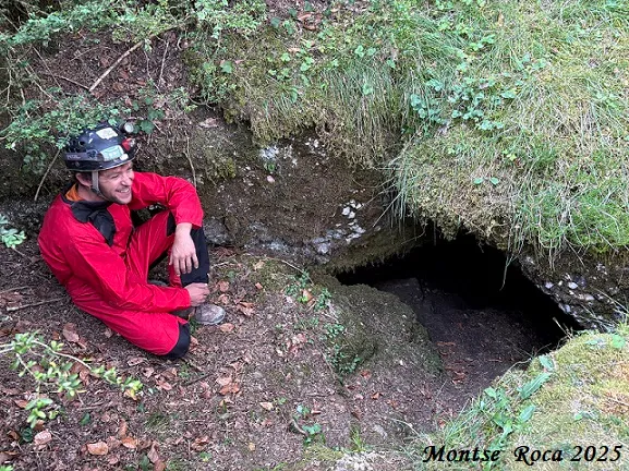
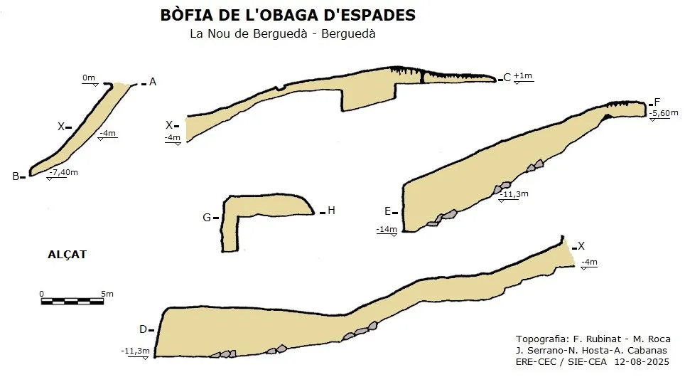
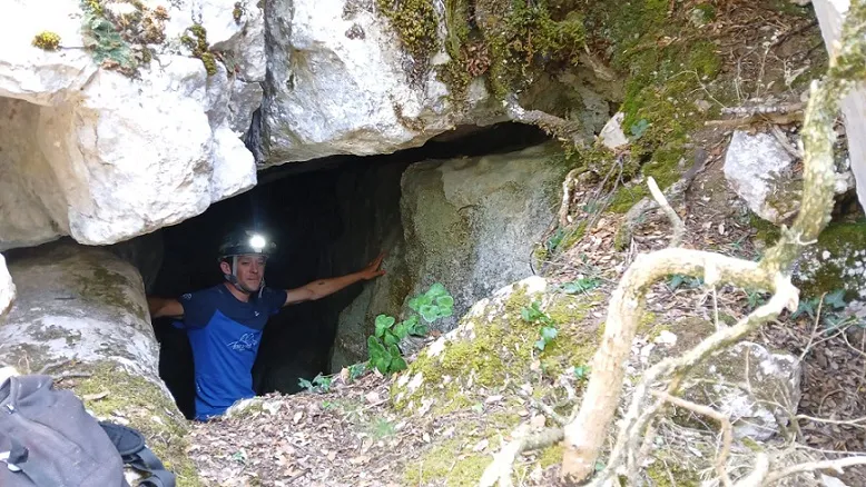
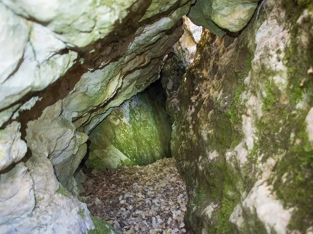
The mouth, 2 by 1 metre, gives rise to a steeply sloping ramp, which reaches -7.4 metres of elevation change where it is blocked. On the entrance ramp, 4 metres from the mouth, two continuations open up, one in a NE direction and the other in a S direction.
Following the one in a NE direction we enter a wide gallery that descends as a ramp and introduces us into a wide chamber 4 metres high; on the SE side a gallery climbs steeply until it reaches the level of -5.6 metres. On the N side the chamber descends to the lowest level of the cavity, -14 metres; from this point of the chamber, continuing in a NW direction we pass under some blocks that lead us to the end of this passage with no continuation.
Returning again to the entrance ramp, following in a S direction we follow a passage climbing steeply that soon turns in a SE direction, finding a low passage that is easily passable; the passage continues climbing gently until reaching a small chamber with a lot of formation; a few metres further on, through some very narrow passages, the crawl ends at the level of +1 metre with respect to the entrance mouth.
In this sector there is a very narrow lower passage 10 metres long that has not been drawn on the new survey.
The total elevation change of the cavity is 15 metres (-14/+1), and the total passage length is 105 metres.
Speleothems
A small chamber with a lot of formation.
Progression
No equipment is needed for the exploration.
History
Although it was certainly known since time immemorial by the people of the area (it seems medieval remains have been found), the first speleological news we have of this cave is that of the exploration carried out by members of the SIEP - Centre Excursionista Poblet (Barcelona) in 1978.
In recent years, however, it has been called Cova d'Espades, but we believe the name given by the members of the SIEP seems more correct.
User Comments (0)
No comments yet.
Be the first to share your experience!
Registered Explorations (0)
No explorations registered yet.
Register your visit to this cave!
Bibliography
Borràs, J; Miñarro, J.M; Talavera, F.(1980).-'l'Urgell, el Solsonès, la Segarra i el Berguedà'. Catàleg Espeleològic de Catalunya (vol. 5): 1-233. Ed. Políglota. Barcelona.
Tolrà, A. (1981).- 'Contribución espeleológica para el conocimiento de cavidades del Alt Berguedà'. Boletín Espeleológico SIEP (13): 3-32. SIEP-Centre Excursionista Poblet. Barcelona.
Valles, Jordi de (2009).-'Berguedà, Cerdanya, Garrotxa, Ripollès'. Catàleg Espeleològic de Catalunya (vol.3):1-381. EC Gràcia/FCE.
Coordenades, dades de situació i fotografies extretes del web: http://www.engarrista.com (de Marc Solé). Post del dia 20 de gener de 2013.
Dades, nova topografia i fotografies facilitades per Nil Hosta; Juli Serrano i Montse Roca (SIE-CEA); Francesc Rubinat i Arcadia Cabanas (ERE-CEC). Agost de 2025.
Nearby caves


Source: Espeleoindex (espeleoindex.com), modified. CC BY-NC 4.0, https://creativecommons.org/licenses/by-nc/4.0/