
Avenc de Vallbona
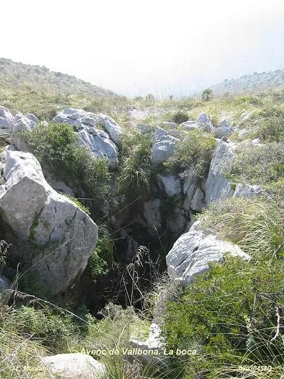
Magnificent 23 m deep pit in Garraf (Sitges), with a large 12 m by 5 m entrance and a single shaft.
EspeleoWorld
Avenc de Vallbona
Magnificent 23 m deep pit in Garraf (Sitges), with a large 12 m by 5 m entrance and a single shaft.
Sitges · Garraf
Length: 30 m · Depth: 23 m
Updated record
https://espeleoworld.com/en/c/avenc-de-vallbona
Information can change. Always verify coordinates, access, weather, and cave conditions before setting out.
Magnificent 23 m deep pit in Garraf (Sitges), with a large 12 m by 5 m entrance and a single shaft.
Topographic
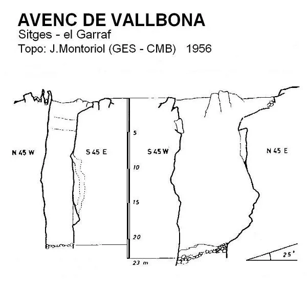
Espeleoindex · CC BY-NC 4.0, https://creativecommons.org/licenses/by-nc/4.0/ · Image © its author.
Photos
Espeleoindex · CC BY-NC 4.0, https://creativecommons.org/licenses/by-nc/4.0/ · Image © its author.
Description
Morphology
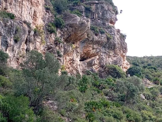
The cavity presents a large entrance of some 12 metres in length by 5 metres in width, oriented in a NE direction, which is that of the joint on which it is structured. The pit consists of a single shaft that reaches 23 metres in depth; from the –3 level, the dimensions of the shaft range between 9 and 4 metres.
It seems to be a typical cavity of rascler of extraordinary dimensions and formed from numerous infiltration points that have given rise to different embryonic cavities, later joined by longitudinal coalescence and anastomosis. One can observe an enormous development of the forms produced by erosion and corrosion.
Speleothems
Not the slightest trace of lithogenic morphology appears.
History
In their respective catalogues of Garraf, both F. Termes (1952) and J. Borràs (1974) indicate that the first exploration of the pit was carried out by Faura i Sans (without specifying the year). We have not been able to find any information about this supposed exploration. More recently, E. Aragonès, in his excellent work: “Faura, espeleòleg” (2009), also records that he has not found any data on the matter.
Curiously, in an unpublished work by J. Borràs (1978) on the occasion of the 30th anniversary of the GES, he makes an exhaustive compilation of all the cavities explored by the GES between 1948 and 1978, furnished from a clearing of the Club's activities book. Here it is recorded that the first exploration of the avenc de Vallbona was carried out by members of the GES in the month of February 1950.
User Comments (0)
No comments yet.
Be the first to share your experience!
Registered Explorations (0)
No explorations registered yet.
Register your visit to this cave!
Bibliography
- Borràs, J. (1974).- Catálogo espeleológico del macizo de Garraf. Vol. II. 166 pp. Barcelona.
- Montoriol, J.; Muntan, L. (1961).- “Resultado de nuevas investigaciones sobre el karst del Pla de les Basses (Macizo de Garraf, Barcelona)” Speleon. T.12 (1-2): 35-53. Universidad de Oviedo.
- Coordenades, fotos retolades i situació facilitades per Lluís Muntan (GES - CMB)
- Fotografies sense retolar facilitades per Jordi de Cabo, extretes del blog “espeleo y Fotografia”, post del dia 8 de març de 2015.
Nearby caves


Source: Espeleoindex (espeleoindex.com), modified. CC BY-NC 4.0, https://creativecommons.org/licenses/by-nc/4.0/