
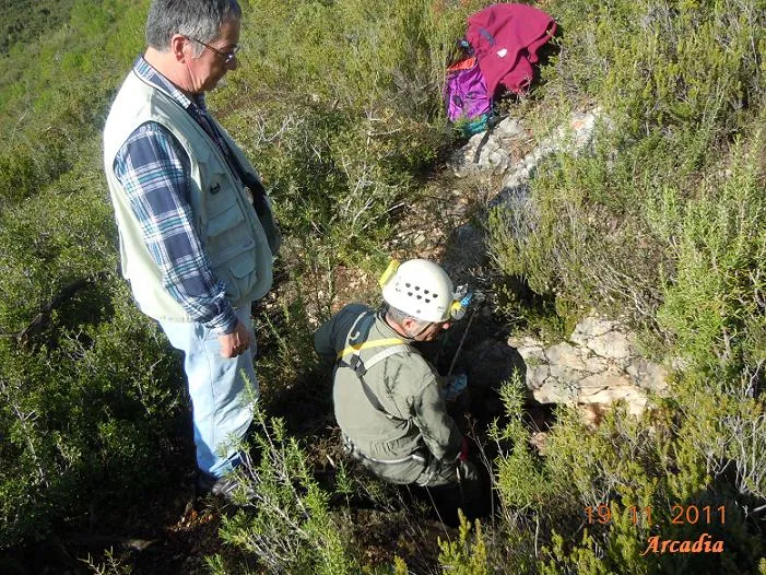
Avenc de Pallerets
Interessant avenc de 23 m. de fondària al Montmell (Baix Penedès)
EspeleoWorld
Avenc de Pallerets
Interessant avenc de 23 m. de fondària al Montmell (Baix Penedès)
Montmell, El · Baix Penedès
Length: 90 m · Depth: 23 m
Updated record
https://espeleoworld.com/en/c/avenc-de-pallerets
Information can change. Always verify coordinates, access, weather, and cave conditions before setting out.
A 23 m deep pit in the Montmell (Baix Penedès), with a square entrance, a chamber, galleries and a fissure; mentioned since 1897 and explored in 1933.
Topographic
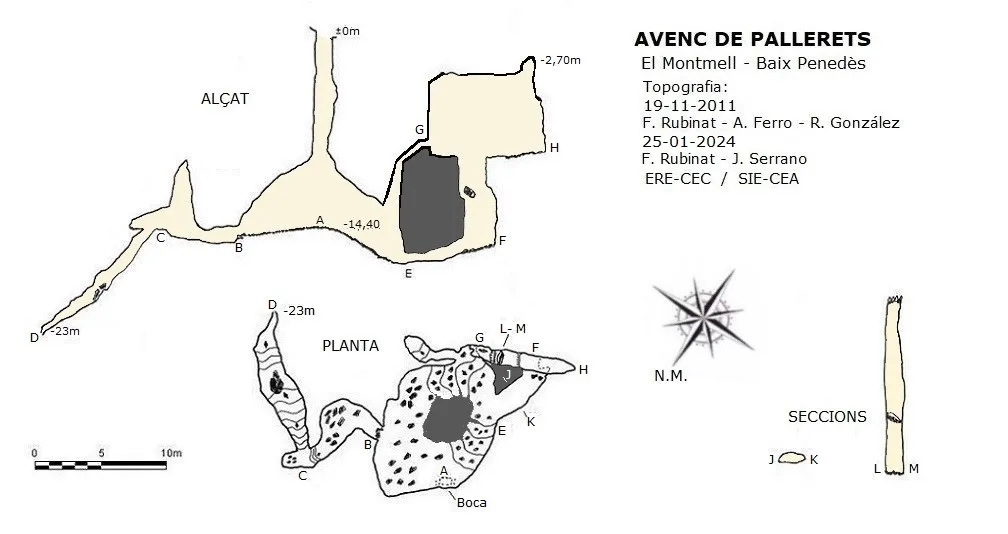

Espeleoindex · CC BY-NC 4.0, https://creativecommons.org/licenses/by-nc/4.0/ · Image © its author.
Photos

Espeleoindex · CC BY-NC 4.0, https://creativecommons.org/licenses/by-nc/4.0/ · Image © its author.
Description
Morphology
A square entrance of just over one square metre leads down a shaft 14.40 metres deep; this, 5 metres above the floor, widens, cutting into one side of a chamber of about 8x7 metres. Right in the middle of it we find a large block that forces us to go round it in order to move about the chamber.
On the E side of the chamber we find a downward passage, which leads us into a gallery that turns towards the N; at the end of this short gallery and before climbing over a step of just over one metre in height, we find a dome 5 metres high. Once on top of the step, we find a shaft that descends steeply, although no equipment is necessary, and that takes us to the deepest point of the cavity, -23 metres.
Back in the chamber, from the S side a short sloping gallery leaves and ends after a few metres.
On the W side of the chamber, and at its lowest point, we find a low-roofed gallery, less than one metre high and about 6 metres long; at the end it turns left and leads us into a fissure running NE-SW and 13 metres high. On the NE side and below a block wedged in the walls, it is possible to climb more than 6 metres, reaching an upper level that continues on both sides of the fissure; towards the SW, on the other side of the shaft formed by the fissure, it continues for 6 metres and ends, while on the NE side it ends after 2 metres, but on the right there is a very narrow passage that divides into two, both of which connect with the roof of the large chamber about 5 metres up, and the base of these ends very close to the passage that leads from the chamber to the upper part of these shafts.
Progression
When the Espeleoíndex team visited it (19 November 2011) there was no kind of rigging and they had to place various parabolts to carry out the descent.
History
Cavity first mentioned by N. Font i Sagué in his Catàlech (1897) and later recorded by Faura (1909) and Ferraté (1918) without adding any further data than the name.
It is not until 14 August 1933 that, accompanied by the tenant farmer of Can Saumell, Lluís Porta i Massana and four more companions from the Centre Excursionista de Catalunya carry out the first exploration of the pit.
Later we have news of different visits: F. Español (1934); GES-CMB (1956); SIE-CEA (1966); A. Lagar (1969); SIRE-UEC (1972) and possibly some more sporadic one of which we have no knowledge.
In fact the correct location of the pit had never been very precise, very incorrect coordinates had been given and its position on the map “El Montmell (Editorial Piolet, 2009)” is totally wrong. Thanks to the indications of our colleague Francesc Rodriguez i Portillo (Espeleo Grup Santfeliuenc) we have been able to establish an exact georeference.
Bio
Pseudoscorpions:
Troglobisium racovitzai Ellingsen (A. Lagar)
Isopods:
Catalauniscus bolivari Arcangeli (J. Abenza, 15-3-1972)
Oritoniscus lagari Vandel (A. Lagar, 23-4-1969) (J. Abenza, 30-1-1972)
Springtails:
Pseusinella tarraconensis Bonet (A. Lagar, 15-6-1969)
Beetles:
Troglocharinus espagnoli Zariquiey (subspecies ollai) (F. Español, 8-1934); J. Abenza (13-2-1972; 5-3-1972).
Bats:
Miniopterus schreibersi Kuhl (1972, well-preserved skull)
User Comments (0)
No comments yet.
Be the first to share your experience!
Registered Explorations (0)
No explorations registered yet.
Register your visit to this cave!
Bibliography
- Font i Sagué, Norbert (1897).-”Catàlech Espeleològich de Catalunya (Continuació)”. Butlletí Centre Excursionista de Catalunya (29):197-202.
- Porta i Massana, Lluís (1933).-”Recerques espeleològiques per la Serra de Montmell. L'avenc de Pallarets”. Butlletí Centre Excursionista de Catalunya (463):474-479. Barcelona
- Lagar, A. (1972).- “Cavidades de Aiguaviva – Montmell (Tarragona)” Senderos (166): 12-18. Unió Excursionista de Catalunya. Barcelona.
- Borràs, J.; Miñarro,JM.; Talavera, F. (1978).-”l'Alt Camp, la Conca de Barberà,el Baix Penedès i el Tarragonès”. Catàleg Espeleològic de Catalunya. (Vol.2):246 pp. Ed. Poliglota. Barcelona.
- Coordenades, actualització de dades, topografia i fotografies facilitades per Arcadia Cabanas; Antoni Ferro; Francesc Rubinat i Josep Manuel Miñarro. Novembre de 2011.
- Actualització de dades, topografia i fotografia, facilitades per Francesc Rubinat i Juli Serrano. Gener de 2024.
Nearby caves
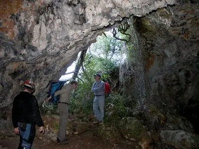
Cova de l'Olla
0.5 km · E
Montmell, El (Baix Penedès)
1 topo.4 photos
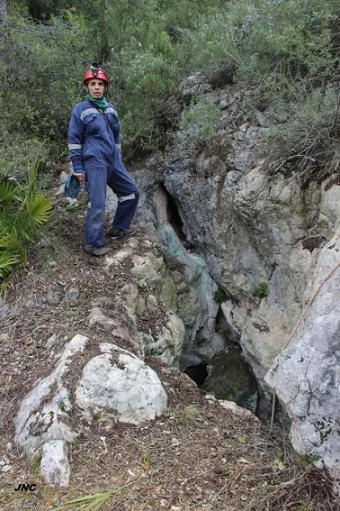
Avenc de les Ventoses
1.0 km · E
Montmell, El (Baix Penedès)
3 topo.4 photos
Cova del Fondo de la Curra
2.0 km · E
Montmell, El (Baix Penedès)
1 topo.4 photos
Avenc de Carles V
2.1 km · SW
Montmell, El (Baix Penedès)
1 topo.5 photos
Source: Espeleoindex (espeleoindex.com), modified. CC BY-NC 4.0, https://creativecommons.org/licenses/by-nc/4.0/