
Avenc de l'Espluga
Important avenc de 123 m. de fondària a la Serra de l'Obac
EspeleoWorld
Avenc de l'Espluga
Important avenc de 123 m. de fondària a la Serra de l'Obac
Mura · Bages
Length: 320 m · Depth: 123 m
Updated record
https://espeleoworld.com/en/c/avenc-de-l-espluga
Information can change. Always verify coordinates, access, weather, and cave conditions before setting out.
A 123 m deep pit in the Serra de l'Obac, with a total length of about 320 m and a history of explorations since 1953.
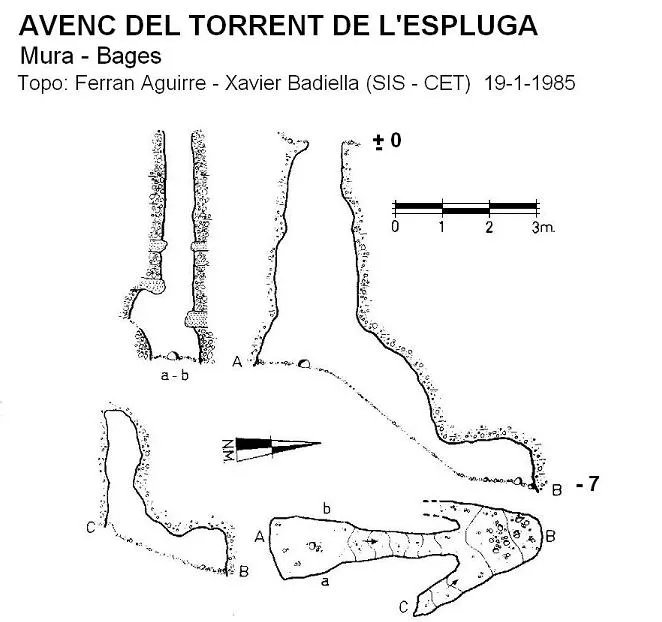
Topographic
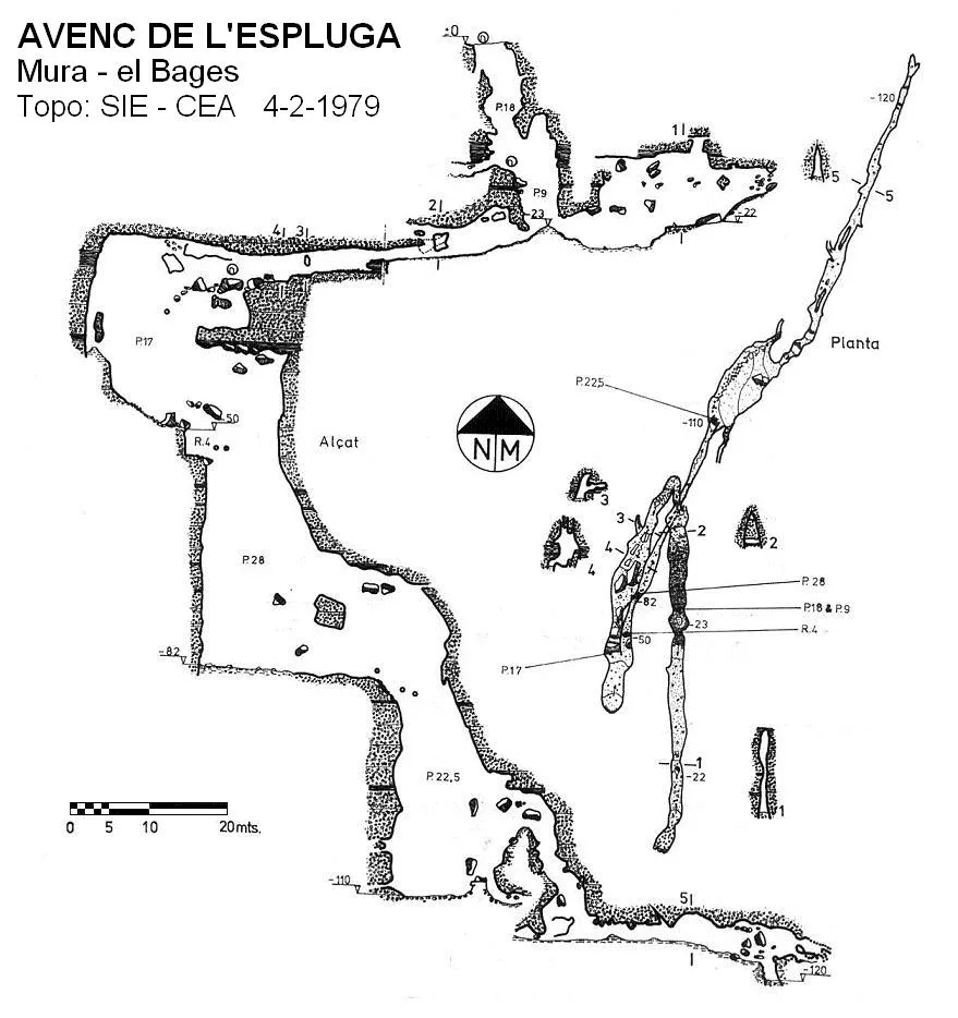
Espeleoindex · CC BY-NC 4.0, https://creativecommons.org/licenses/by-nc/4.0/ · Image © its author.
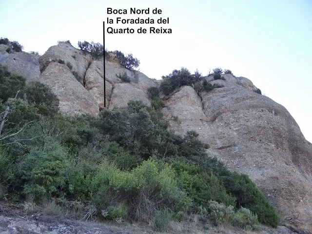
Photos
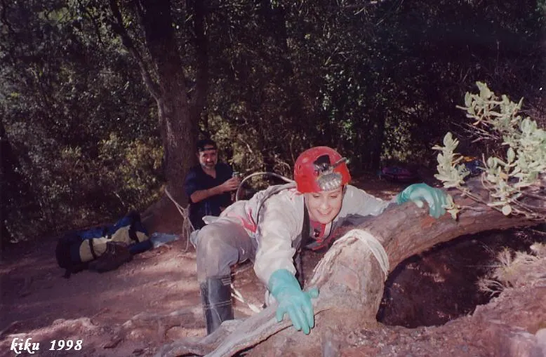
Espeleoindex · CC BY-NC 4.0, https://creativecommons.org/licenses/by-nc/4.0/ · Image © its author.
Description
Morphology
One enters the pit through a subvertical shaft of 18 metres to a platform where a new shaft of 9 metres opens. At the base of this there is a gallery that, if we follow it in a N-S direction, leads to a joint that closes at 20 metres of passage. Again at the base of the entrance shaft and in the opposite direction, we enter a meander. Following it and, after turning 180º on itself, one reaches a shaft of 17 metres where the morphology determined by the main megajoint of the cavity is already evident. At its bottom, a 4-metre drop serves to link with a new vertical, the largest in the pit, of 28 metres. At its bottom originates a horizontal gallery 18 metres long that leads us to the mouth of the last shaft, of 24 metres of drop and which is entered through a small highly inclined channel; at its base is the widest sector of the cavity. To continue the exploration one must ascend some drops and descend through an irregular shaft of 13 metres at the bottom of which originates the final gallery, about 30 metres long and at the end of which there is a small shaft of 2.5 metres, where the point of maximum depth of the pit is located. The actual horizontal passage is 200 metres, to which must be added all the vertical sections, giving a total length of about 320 metres.
Hydrology
In the meander, depending on the season, a small amount of water flows.
Progression
One enters the pit through a subvertical shaft of 18 metres to a platform where a new shaft of 9 metres opens. At the base of this there is a gallery that, if we follow it in a N-S direction, leads to a joint that closes at 20 metres of passage. Again at the base of the entrance shaft and in the opposite direction, we enter a meander. Following it and, after turning 180º on itself, one reaches a shaft of 17 metres. At its bottom, a 4-metre drop serves to link with a new vertical, the largest in the pit, of 28 metres. At its bottom originates a horizontal gallery 18 metres long that leads us to the mouth of the last shaft, of 24 metres of drop and which is entered through a small highly inclined channel. To continue the exploration one must ascend some drops and descend through an irregular shaft of 13 metres at the bottom of which originates the final gallery, about 30 metres long and at the end of which there is a small shaft of 2.5 metres, where the point of maximum depth of the pit is located.
History
The first exploration took place on 18 January 1953 by members of the Centre Excursionista de Terrassa (Clavell, Busqué, Tomàs, Llamas, Olivellas, Tugues, Martínez and Busqueta), who were occasional cavers, and they were able to descend the first shaft. They returned the following Sunday and reached the bottom of the second shaft. The third attempt did not arrive until a month later, on 22 February, reaching the bottom of the pit and it seems they made a survey. Nevertheless, it seems there were “leaks” and members of the GES-CMB (Terrassa delegation) got ahead and on 8 February of that same year, they carried out the first complete exploration and made a sketch of the pit granting it 126 metres of depth (in the topo section a tracing copy on tracing paper found in the archive of the ERE-CEC is attached, which very possibly is the sketch made by those of the GES). They also changed its name and called it Avenc del Sot del Teix, some time later it recovered its original name.
Little by little it became one of the classic cavities of the massif, although a survey made by the GES-CMB in 1967 was the first to be published, assigning it a depth of 127 metres. Later surveys (EC de Sabadell, 1976 and SIE-CEA, 1979) set the point of maximum depth at 120 metres and the most recent (EC de Gràcia, 1983) reaches 123 metres.
Our friend Lluís Muntan (GES-CMB) on 4-2-2012 sent us the following note: Indeed, on 7 and 8 February 1953 a group of members of the GES-CMB carried out the first total exploration of the Avenc de l'Espluga. We were: Josep Pallejà; Anna Mª Pallejà; Ramon Tutusaus; M. Ezequiel and Lluís Muntan, also accompanied by Rafael Pla (CE d'Alcoi). I myself made the survey, very detailed and which gave a depth of 125 metres; unfortunately, this survey, like many others of mine, was lost. The sketch found in the archive of the ERE is totally alien to us. At all times we called the cavity Avenc de l'Espluga, that of Avenc del Sot del Teix came out later. On the 8th we still had time to visit the Avenc del Llest (Lluís Muntan).
User Comments (0)
No comments yet.
Be the first to share your experience!
Registered Explorations (0)
No explorations registered yet.
Register your visit to this cave!
Bibliography
- Cardona, F. (1990).- Grans cavitats de Catalunya, vol 2. 484 pp. EC Gràcia, Barcelona.
- Castells, P. (1979).- “Revisió topogràfica de dues cavitats de la Serra de l'Obac”. EspeleoSie (23): 47-53. SIE del Centre Excursionista Àliga. Barcelona.
- Freixes, A.; Monterde,M.; Cervelló, J.Mª. (1983).- El paleocarst i el carst actual de les serres de Sant Llorenç del Munt i de l'Obac.:57 pp. ECS – Unió Excursionista de Sabadell
- Ullastre; J. (1968).- “Estudio geomorfológico y comparativo del Avenc de l'Espluga con otras cavidades del macizo Obac-Sant Llorenç (Barcelona)” Geo y Bio Karst (14-15): 31-34. Ed. J.Mª Armengou. Barcelona.
- Vives, S. (1990).- 1969-1989. 20 anys de la Secció d'Investigacions Subterrànies del Centre Excursionista de Terrassa. 77 pp. SIS del CE Terrassa.
Nearby caves
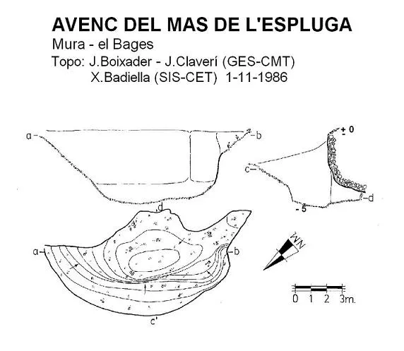


Source: Espeleoindex (espeleoindex.com), modified. CC BY-NC 4.0, https://creativecommons.org/licenses/by-nc/4.0/