
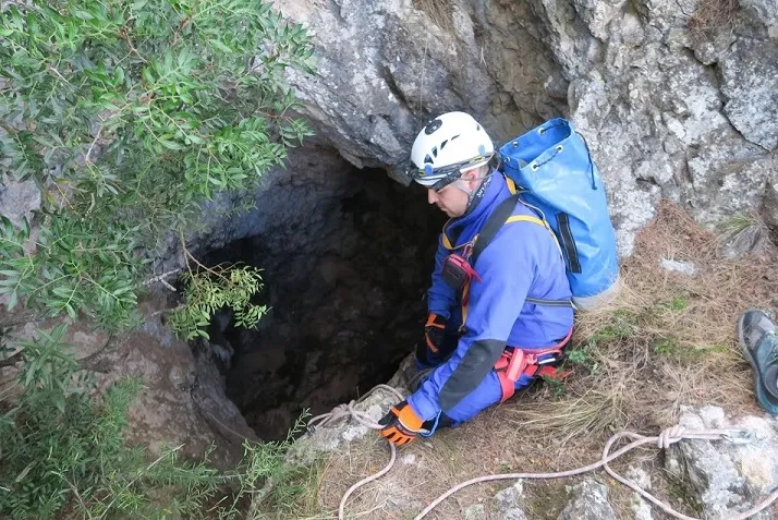
Avenc de Carxano
Avenc de 33 m. de fondària a la Serra de Pàndols (Gandesa)
EspeleoWorld
Avenc de Carxano
Avenc de 33 m. de fondària a la Serra de Pàndols (Gandesa)
Gandesa · Terra Alta
Length: 51 m · Depth: 33 m
Updated record
https://espeleoworld.com/en/c/avenc-de-carxano
Information can change. Always verify coordinates, access, weather, and cave conditions before setting out.
A 33 m deep pit in the Serra de Pàndols (Gandesa), with two entrances, an inclined ramp, a 7 m shaft and a large hall 30 by 12 m with a floor inclined 40º.
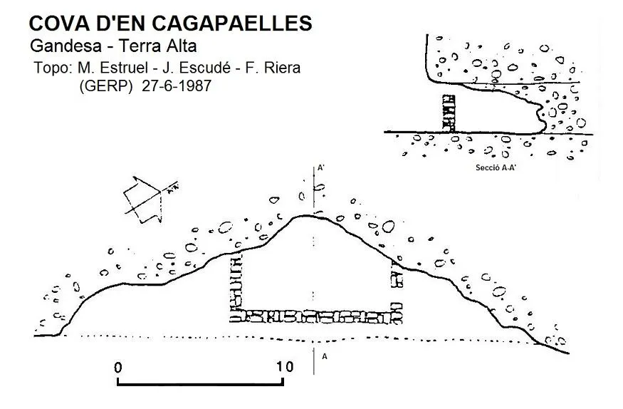
Topographic
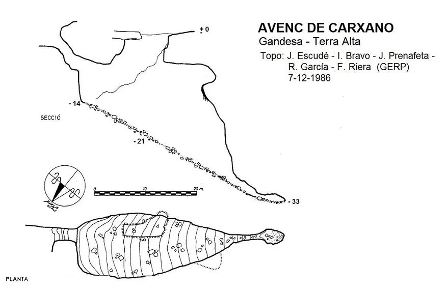
Espeleoindex · CC BY-NC 4.0, https://creativecommons.org/licenses/by-nc/4.0/ · Image © its author.
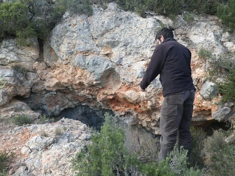
Photos
Espeleoindex · CC BY-NC 4.0, https://creativecommons.org/licenses/by-nc/4.0/ · Image © its author.
Description
Morphology
The pit has two entrances. Its bottom is the highest part of a large hall, about 30 metres long by about 12 wide and with a strongly inclined floor (40º) covered by a large scree slope. At the middle of its course one arrives beneath the vertical of the second entrance (P-20). Further on the ceiling gradually lowers and the width narrows until reaching a narrow passage with a low ceiling that in a few metres leads to the final small chamber.
Progression
Through the more easterly entrance one can descend by a rather steep ramp that ends in a small 7 metre shaft.
Other details
Toponymy: Anvenc is the word used by some inhabitants of the area when they speak of an avenc. Specifically it can be heard in Miravet and the neighbouring village of Benissanet and even more in the area of Gandesa (Terra Alta). Linguists consulted tell us that this derivation of avenc is simply an uneducated deformation of the correct name. Yes, it is said, but it is completely incorrect as a written expression.
History
Although it is a cavity known for a very long time by the people of the region, who call it Anvenc de Carxano, it does not appear in any of the old catalogues. In fact the oldest speleological exploration that we know of was carried out by members of GES – CMB in October 1956, which went completely unnoticed by speleologists. It is not until 1989 that it is published for the first time after the visit made by GE Rat-penat (Sant Just Desvern) in December 1986.
In our database we have a note (collected from some activities bulletin) that in May 1971 members of GRIS – La Salle Gràcia explored the Avenc del Mas d'en Llorenç (we have not been able to find this mas on any cartography, neither current nor old) and we think it could be the same Avenc de Carxano. We only have two data and they coincide, they are in Gandesa and are 33 metres deep. If any of the members of that trip reads these lines, we would be grateful if they could give us more information about it.
The serres de Pàndols i de Cavalls were one of the settings of the cruellest of all the battles of that ill-named civil war, the Batalla de l'Ebre. Many of the caves of these places served as refuge for the combatants and even today they are practically unknown speleologically. Teresa Rebull in her best-known song, “Paisatge de l'Ebre” explained: Avui he tornat / a la Serra de Pàndols / i a la cova he trobat / les sabates d'en Jaume. / Un forat a la sola, / una pinta de bales, / dins d'un plat enfangat / tres cascots de metralla... For many years all kinds of war materials abandoned on the mountain were found. After the war, economic needs moved many people to recover the scrap iron that had been scattered. Many intact projectiles were made to explode inside the avenc de Carxano, and then they went down the ramp and the 7 metre shaft to collect the resulting shrapnel.
User Comments (0)
No comments yet.
Be the first to share your experience!
Registered Explorations (0)
No explorations registered yet.
Register your visit to this cave!
Bibliography
- Estruel, Miquel (1990).-Ruta per conèixer la Terra Alta (Excursions – Escalada – Espeleologia). Vol. II: 119 pp. Centre Excursionista de Gandesa.
- G.E. Rat-penats (1989).- “Contribució al catàleg espeleològic de la Terra Alta”. Exploracions (13): 39-50. EC de Gràcia. Barcelona.
- Topografia inèdita 1956 de l'arxiu del GES – CMB
- Revisió de coordenades i fotografies, facilitades per Marcos Carbó "Chusa" (CE Dinàmics, la Ràpita)
Nearby caves


Source: Espeleoindex (espeleoindex.com), modified. CC BY-NC 4.0, https://creativecommons.org/licenses/by-nc/4.0/