
Cova del Mas d'en Sunyer
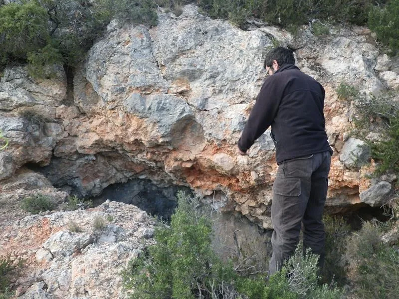
Gran balma en conglomerats a Gandesa
EspeleoWorld
Cova del Mas d'en Sunyer
Gran balma en conglomerats a Gandesa
Gandesa · Terra Alta
Length: 5 m
Updated record
https://espeleoworld.com/en/c/cova-del-mas-d-en-sunyer
Information can change. Always verify coordinates, access, weather, and cave conditions before setting out.
Large rock shelter in conglomerates at Gandesa, 32 metres wide by 5 metres deep, opened along a bedding plane.
Topographic
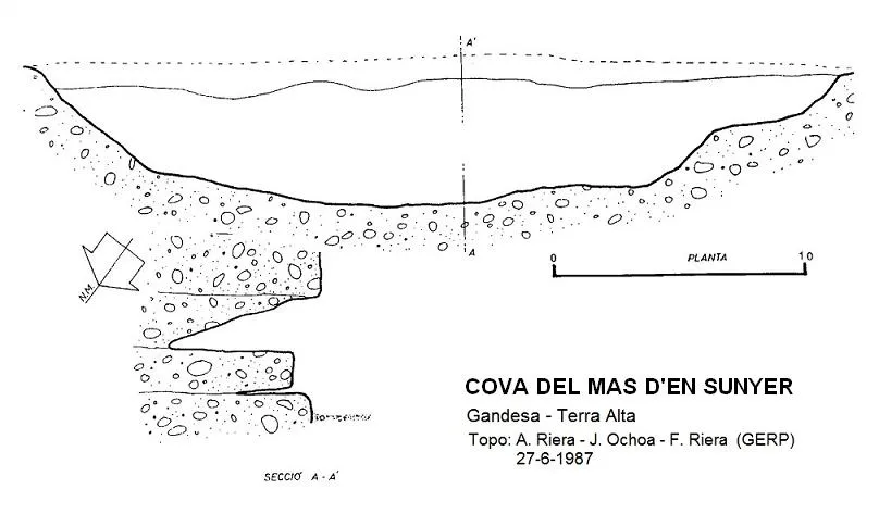
Espeleoindex · CC BY-NC 4.0, https://creativecommons.org/licenses/by-nc/4.0/ · Image © its author.
Description
Morphology
Large rock shelter 32 metres wide by only 5 metres deep. Opened along a bedding plane.
History
The only data known are those given by the members of the GERP (Sant Just Desvern) who explored and surveyed it in June 1987.
User Comments (0)
No comments yet.
Be the first to share your experience!
Registered Explorations (0)
No explorations registered yet.
Register your visit to this cave!
Bibliography
- G.E. Rat-penats (1989).- “Contribució al catàleg espeleològic de la Terra Alta”. Exploracions (13): 39-50. EC de Gràcia. Barcelona.
Nearby caves

Source: Espeleoindex (espeleoindex.com), modified. CC BY-NC 4.0, https://creativecommons.org/licenses/by-nc/4.0/