
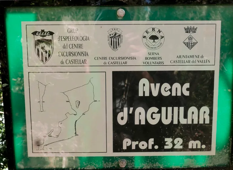
Avenc d'Aguilar
Avenc de 32 m. de fondària a Castellar del Vallès
EspeleoWorld
Avenc d'Aguilar
Avenc de 32 m. de fondària a Castellar del Vallès
Castellar del Vallès · Vallès Occidental
Length: 45 m · Depth: 32 m
Updated record
https://espeleoworld.com/en/c/avenc-d-aguilar
Information can change. Always verify coordinates, access, weather, and cave conditions before setting out.
A 32 m deep pit in Castellar del Vallès, with a 13x3 m entrance, chambers, shafts and galleries, opened along a N45O-S45E joint.
Topographic
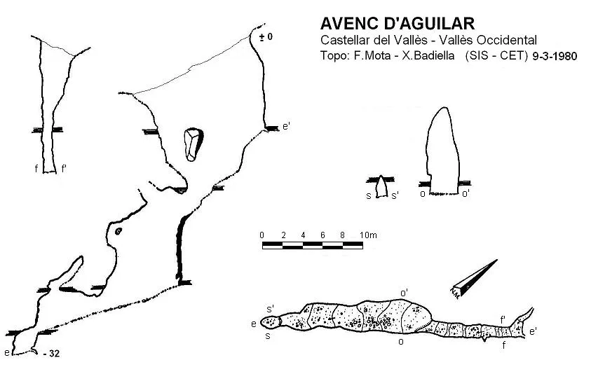

Espeleoindex · CC BY-NC 4.0, https://creativecommons.org/licenses/by-nc/4.0/ · Image © its author.
Photos

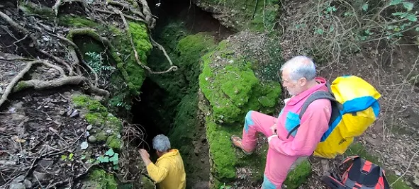
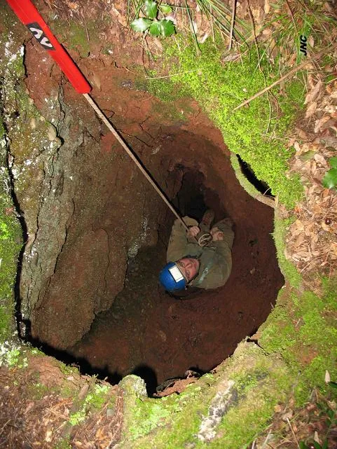
Espeleoindex · CC BY-NC 4.0, https://creativecommons.org/licenses/by-nc/4.0/ · Image © its author.
Description
Morphology
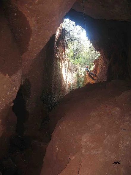
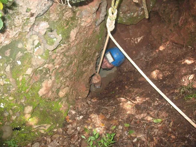
The entrance, 13x3 metres and funnel-shaped, gives way to a ramp full of moss and ivy that leads to a step beside a wedged block. From here we down-climb to the bottom of this first pit which gives onto a ledge above the chamber of what we shall call the second pit, which has 7 metres of drop. Once down this, we find ourselves at the foot of a chamber 8x3 metres, in the ceiling of which two chimneys can be seen. Continuing in an S direction, a gallery of 8 metres leads us to a 2 metre drop, the bottom of which represents the point of maximum penetration of the cavity. A few metres before reaching the final drop there is a chimney that gives onto an ascending gallery of 4 metres.
The pit is opened thanks to a N45O - S45E joint, in which the processes of erosion and corrosion are quite noticeable. It should be noted that the final part of the cavity, where a small chamber is found, has been excavated thanks to the sandstone stratum that can be seen all around it.
Speleothems
On the walls of the second pit important flowstone has formed thanks to the different water inputs that have progressively diminished until the cavity ceased to be completely active, leaving only small drips.
Other details
During 2013 we had access to a survey (unpublished until now) made by members of the GES - CMB towards the mid 1970s, during the work on the third volume of the 'Catálogo Espeleológico de la provincia de Barcelona' (which was never published) and which gives a depth noticeably less (-25m).
History
The first reference we have is that of an exploration in 1934 by Francesc Español (CMB), calling it avenc de Can Cadafalch. Despite its distance from this farmhouse, in Castellar it is known by one name and in Sant Llorenç Savall by the other.
User Comments (0)
No comments yet.
Be the first to share your experience!
Registered Explorations (0)
No explorations registered yet.
Register your visit to this cave!
Bibliography
Badiella, X.; Aguirre,F.; Muñoz,J.; Mota,F. (1981).- 'Les cavitats del vessant Est del riu Ripoll' SIS (8): 56-70 / Arxiu del Centre Excursionista de Terrassa (23): 296-310. SIS del CET. Terrassa.
Valles, Jordi de (2016).-'Bages, Barcelonès, Maresme, Vallès Occidental, Vallès Oriental'. Catàleg Espeleològic de Catalunya (vol.5):1-560. E C Gràcia / Federació Catalana d'Espeleologia.
Fotografies extretes del web: espeleodijous.cat Apunt de l'activitat realitzada el 30-4-2025
Nearby caves
Avenc del Sot de l'àliga
0.2 km · NE
Castellar del Vallès (Vallès Occidental)
1 topo.2 photos
Avenc del Biciclista
0.3 km · N
Castellar del Vallès (Vallès Occidental)
1 topo.3 photos
Avenc de les Dues Boques
0.4 km · SW
Castellar del Vallès (Vallès Occidental)
2 topo.4 photos
Avenc dels Talps
0.4 km · W
Castellar del Vallès (Vallès Occidental)
2 topo.4 photos
Source: Espeleoindex (espeleoindex.com), modified. CC BY-NC 4.0, https://creativecommons.org/licenses/by-nc/4.0/