
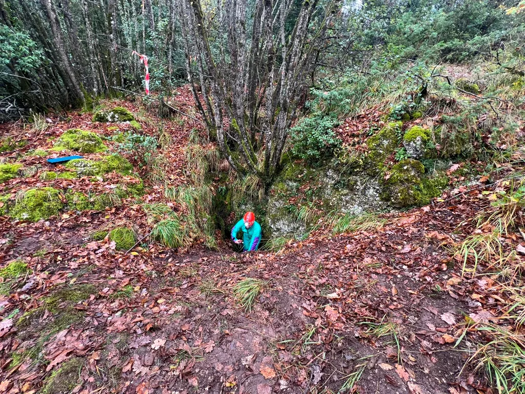
Tana di Peppazzone
Steeply sloping cavity with an earthy debris cone, descending in trend, with a narrow entrance on a 1.5 x 1.5 m slope beneath a wall.
EspeleoWorld
Tana di Peppazzone
Steeply sloping cavity with an earthy debris cone, descending in trend, with a narrow entrance on a 1.5 x 1.5 m slope beneath a wall.
Stroncone
Länge: 14 m · Tiefe: 4 m
Aktueller Datensatz
https://espeleoworld.com/de/c/tana-di-peppazzone-stroncone-terni
Informationen können sich ändern. Koordinaten, Zugang, Wetter und Höhlenbedingungen vor dem Aufbruch immer prüfen.
Steeply sloping cavity with an earthy debris cone, descending in trend, with a narrow entrance on a 1.5 x 1.5 m slope beneath a wall.
Topografie
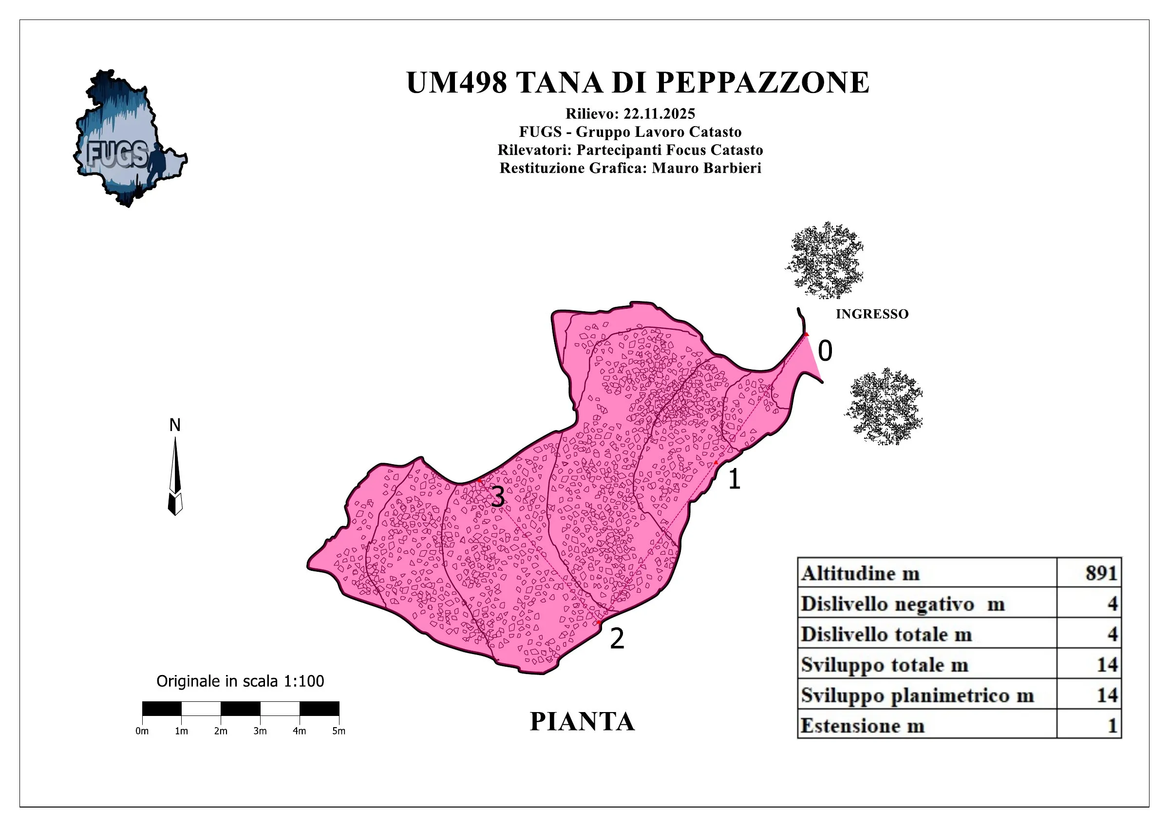
© Mauro Barbieri · CC BY-SA 4.0, https://creativecommons.org/licenses/by-sa/4.0/ · Federazione Umbra Gruppi Speleologici (FUGS), Catasto Speleologico dell'Umbria · https://catasto.fugs.it/index.php?mod=caves&op=view&id=498
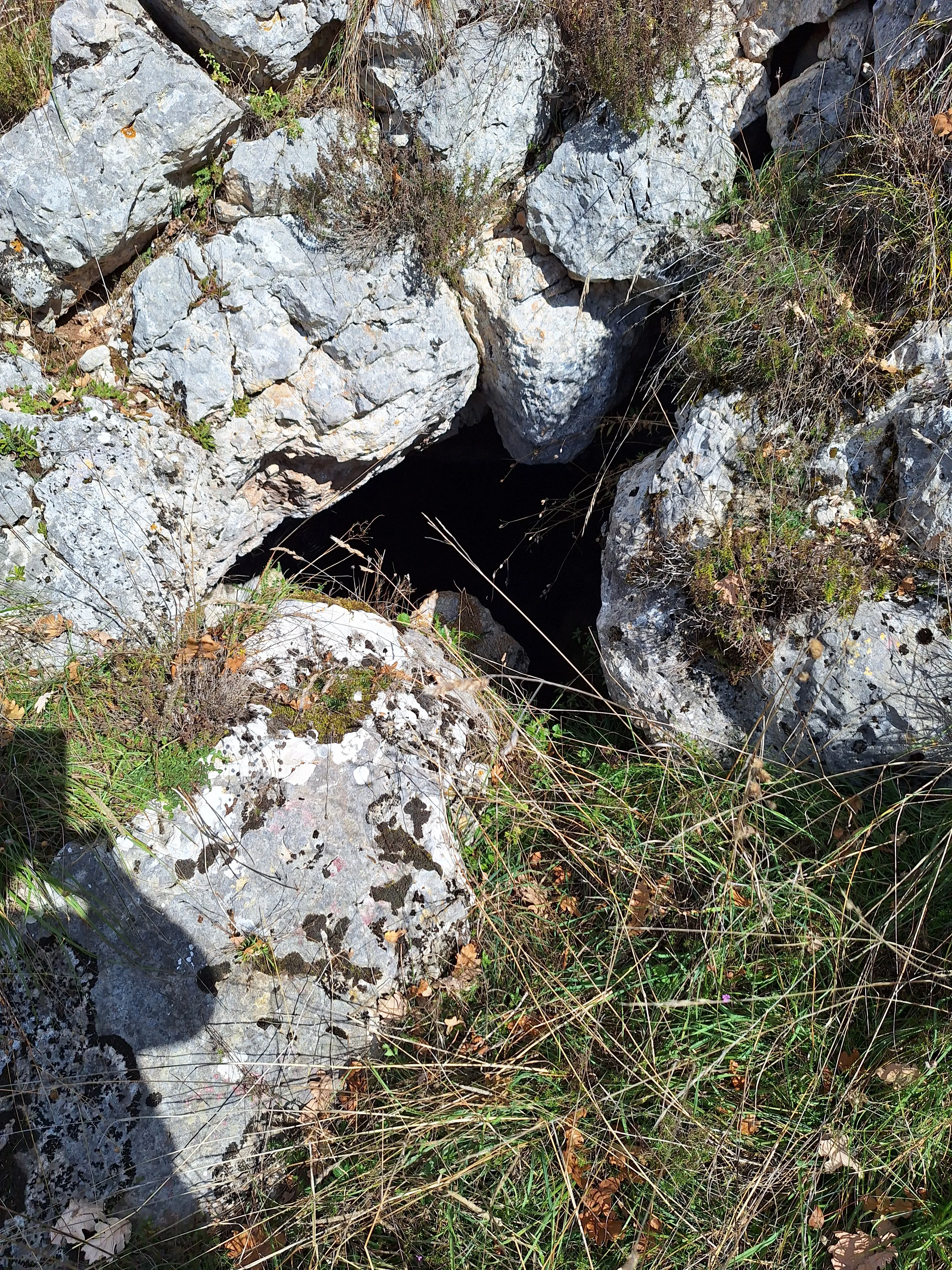
Fotos
© Mario Giacomini · LicenseRef-FUGS-media-per-item · Federazione Umbra Gruppi Speleologici (FUGS), Catasto Speleologico dell'Umbria · https://catasto.fugs.it/index.php?mod=caves&op=view&id=498
Beschreibung
Morphologie
Steeply sloping cavity with an earthy debris cone. Trend: descending. Traversability: easy; recommended period all year. Hazards: landslides/rockfalls.
Speläotheme
Leopard-skin ceiling concretions.
Hydrologie
Internal temperature 10.4 °C; humidity 86 %; no air flows; external temperature 3 °C.
Weitere Einzelheiten
Geology: CDU2 Limestones with Saccoma and Aptici - Upper Jurassic (Kimmeridgian-Tithonian); stratified micritic limestones; stratified, obliterated. Environmental and biological protections: no.
Geschichte
Notes on the name: it takes its name from a brigand who frequented the area in the period before the unification of Italy.
Bio
Chiroptera: 2 chiroptera on 22/11/2025. Other hypogean fauna: Dolichopoda on 22/11/2025. Hypogean botany: roots down to depth, mycelia, moss.
Benutzerkommentare (0)
Noch keine Kommentare.
Seien Sie der Erste, der seine Erfahrung teilt!
Registrierte Erkundungen (0)
Noch keine Erkundungen registriert.
Registrieren Sie Ihren Besuch in dieser Höhle!
Höhlen in der Nähe


Quelle: Catasto Cavità Umbria (Federazione Umbra Gruppi Speleologici, FUGS) (catasto.fugs.it), verändert. LicenseRef-FUGS-no-licence-stated Federazione Umbra Gruppi Speleologici (FUGS), Catasto Speleologico dell'Umbria · https://catasto.fugs.it/index.php?mod=caves&op=view&id=498 · Datenstand 2025 · Quelle: Catasto Cavità Umbria (Federazione Umbra Gruppi Speleologici, FUGS) (catasto.fugs.it), verändert. LicenseRef-FUGS-media-per-item Federazione Umbra Gruppi Speleologici (FUGS), Catasto Speleologico dell'Umbria · Datenstand 2025