
Graller d'Urdet
A 50-metre-deep pit near Cap d'Urdet (La Coma i la Pedra), first explored on 6 and 7 June 1964 by the ERE of the Centre Excursionista de Catalunya.
EspeleoWorld
Graller d'Urdet
A 50-metre-deep pit near Cap d'Urdet (La Coma i la Pedra), first explored on 6 and 7 June 1964 by the ERE of the Centre Excursionista de Catalunya.
Coma i la Pedra, La · Solsonès
Sviluppo: 65 m · Profondità: 50 m
Scheda aggiornata
https://espeleoworld.com/it/c/graller-d-urdet
Le informazioni possono cambiare. Verifica sempre coordinate, accesso, meteo e condizioni della cavità prima di partire.
A 50-metre-deep pit near Cap d'Urdet (La Coma i la Pedra), first explored on 6 and 7 June 1964 by the ERE of the Centre Excursionista de Catalunya.
Topografia
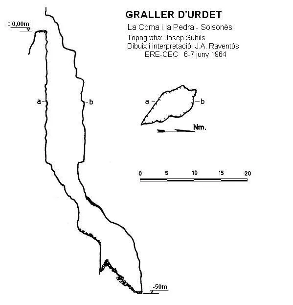
Espeleoindex · CC BY-NC 4.0, https://creativecommons.org/licenses/by-nc/4.0/ · Immagine © del suo autore.
Descrizione
Morfologia
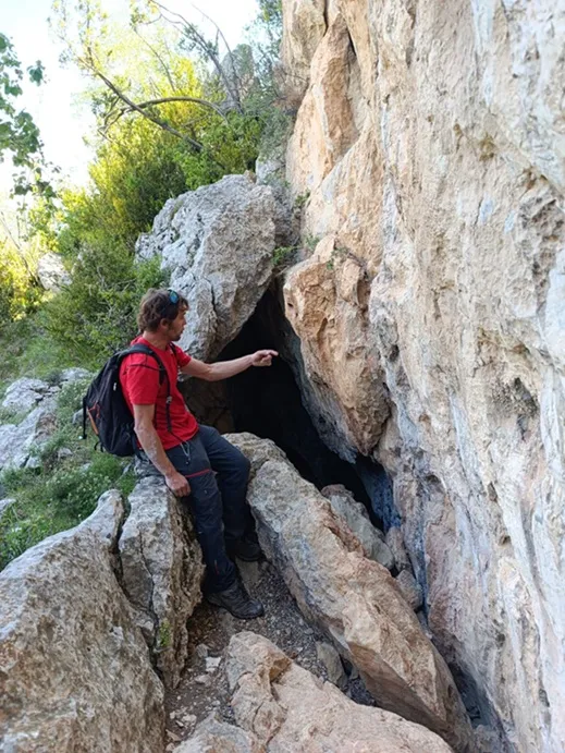
The entrance is 2.50 metres high and gives access to the upper part of a pit which at -25 metres links with a steep ramp. At the end of this there is a -5 metre pit followed by a short ramp that reaches the upper part of a chamber filled with debris, this being the deepest point of the cavity.
Storia
The first exploration was carried out on 6 and 7 June 1964 by the ERE of the Centre Excursionista de Catalunya.
Commenti degli utenti (0)
Nessun commento ancora.
Sii il primo a condividere la tua esperienza!
Esplorazioni registrate (0)
Nessuna esplorazione registrata.
Registra la tua visita a questa grotta!
Bibliografia
- Borràs, J; Miñarro, J.M.; Talavera, F.(1980).-”l'Urgell, el Solsonès, la Segarra i el Berguedà”. Catàleg Espeleològic de Catalunya (5):1-234. Ed. Políglota. Barcelona.
Grotte vicine

Fonte: Espeleoindex (espeleoindex.com), modificato. CC BY-NC 4.0, https://creativecommons.org/licenses/by-nc/4.0/