
Forat de Sant Tomàs
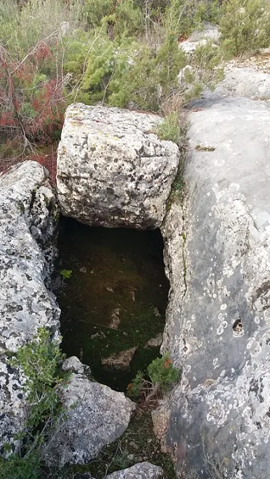
A 34-metre-deep pit in Castelló de Farfanya, explored on 21 March 1971 by the RES - CE Pirenaic.
EspeleoWorld
Forat de Sant Tomàs
A 34-metre-deep pit in Castelló de Farfanya, explored on 21 March 1971 by the RES - CE Pirenaic.
Castelló de Farfanya · Noguera
Sviluppo: 97 m · Profondità: 34 m
Scheda aggiornata
https://espeleoworld.com/it/c/forat-de-sant-tomas
Le informazioni possono cambiare. Verifica sempre coordinate, accesso, meteo e condizioni della cavità prima di partire.
A 34-metre-deep pit in Castelló de Farfanya, explored on 21 March 1971 by the RES - CE Pirenaic.
Topografia
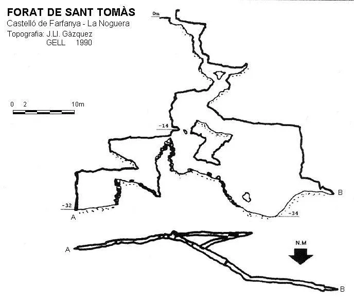
Espeleoindex · CC BY-NC 4.0, https://creativecommons.org/licenses/by-nc/4.0/ · Immagine © del suo autore.
Descrizione
Morfologia
The cavity begins with a series of ramps cut by vertical steps, one of them quite narrow, which lead to a 3-metre drop where contact is made with the main fissure of the cavity; a second drop of 6.5 metres places us at the base of the fissure. In an E direction, the cavity continues for some 25 metres until it becomes impenetrable at the point where the change of materials occurs. In a W direction, and after climbing about 6 metres, one can reach another stepped vertical of 10 metres, followed by another of 5 metres, where it ends in the form of a meander obstructed by a stalagmitic flow.
Concrezioni
The final meander is obstructed by a stalagmitic flow.
Progressione
It begins with a series of ramps cut by vertical steps, one of them quite narrow, which lead to a 3-metre drop where contact is made with the main fissure of the cavity; a second drop of 6.5 metres places us at the base of the fissure. In an E direction, the cavity continues for some 25 metres until it becomes impenetrable at the point where the change of materials occurs. In a W direction, and after climbing about 6 metres, one can reach another stepped vertical of 10 metres, followed by another of 5 metres, where it ends in the form of a meander obstructed by a stalagmitic flow.
Storia
The first exploration took place on Sunday 21 March 1971 by members of the RES - CE Pirenaic (Barcelona) based on the indications received from the local people. They had to carry out a dig to be able to get through.
Commenti degli utenti (0)
Nessun commento ancora.
Sii il primo a condividere la tua esperienza!
Esplorazioni registrate (0)
Nessuna esplorazione registrata.
Registra la tua visita a questa grotta!
Bibliografia
- Gàzquez i Pons, Josep Lluis, (1995).-”Catàleg Espeleològic de la Noguera” Grallera (3-4):1-90. GE Lleidatà. Lleida.
- Navarro; Vela.(1971).-”Cuatro primeras para el R.E.S.” Butll. Centre Exc. Pirenaic (190). Barcelona.
Grotte vicine

Fonte: Espeleoindex (espeleoindex.com), modificato. CC BY-NC 4.0, https://creativecommons.org/licenses/by-nc/4.0/