

Esquerda de les Tarteres
Significant fissure at Cambrils (Odèn, Solsonès), developed along a joint with a total vertical extent of 20 m (-13; +7).
EspeleoWorld
Esquerda de les Tarteres
Significant fissure at Cambrils (Odèn, Solsonès), developed along a joint with a total vertical extent of 20 m (-13; +7).
Odèn · Solsonès
Sviluppo: 133 m · Profondità: 20 m
Scheda aggiornata
https://espeleoworld.com/it/c/esquerda-de-les-tarteres
Le informazioni possono cambiare. Verifica sempre coordinate, accesso, meteo e condizioni della cavità prima di partire.
Significant fissure at Cambrils (Odèn, Solsonès), developed along a joint with a total vertical extent of 20 m (-13; +7).
Topografia

Espeleoindex · CC BY-NC 4.0, https://creativecommons.org/licenses/by-nc/4.0/ · Immagine © del suo autore.
Foto
Espeleoindex · CC BY-NC 4.0, https://creativecommons.org/licenses/by-nc/4.0/ · Immagine © del suo autore.
Descrizione
Morfologia
The cavity is developed along a main joint oriented N-345 that is intersected by other fractures, at different angles, of lesser importance.
The entire interior of the cavity is filled with blocks. Some on the ground, others wedged between the walls and with a rather precarious balance.
At its northern end a dry stone wall can be seen, which suggests that at this point the fissure was used to store trumfos (which is what potatoes are called in the area).
The general tendency shows a displacement of the current lower lip of the cavity, both horizontally and vertically, that is, in favour of the sliding of the scree slope that falls onto the L-401 road.
At this same end of the cavity the joint changes orientation. For about 35 metres it follows N-350, then continues, for 30 metres more, at N-190. This entire stretch must be followed on the outside since it presents widths of between 40 and 70 centimetres, following an orthogonal system of fractures that is also sensed inside the great fissure but very much in the background.
This last stretch of the joint ends at the cliff of the scree slope.
The total vertical extent of the fissuring is 20 m. (-13; +7).
Idrologia
In the SE part of the fissure a morphology similar to that shown by flood levels can be seen. They are only visible on the wall of the upper lip and could correspond to stages of ponded water after heavy rains, when the joint had a lesser development. At present all the water that precipitates drains away at depth.
Progressione
Access via any of its ends allows its interior to be traversed although in some places it is better to have some artificial aid.
Storia
Known since ancient times by the inhabitants of Cambrils, some tell us that when they were small, some 50-60 years ago, they used to play at jumping over the fissure from one side to the other. Now a very daring attitude would be required to repeat this action, since the two banks of the fissure have moved apart.
Located by Alfred Montserrat (ERE – CEC) in May 2018 during an excursion of a geological nature. On 22 June 2019 he returns with other colleagues from the ERE – CEC and they proceed to carry out the survey and other cataloguing work.
Commenti degli utenti (0)
Nessun commento ancora.
Sii il primo a condividere la tua esperienza!
Esplorazioni registrate (0)
Nessuna esplorazione registrata.
Registra la tua visita a questa grotta!
Bibliografia
- Totes les dades, topografia i fotografies han estat extretes del bloc: notesdecamp.blogspot (d'Alfred Montserrat). Apunt del 28-9-2019. Dades: A. Montserrat, A. Beguerie, T. Parès, J. Rius i X. López (ERE – CEC).
Grotte vicine


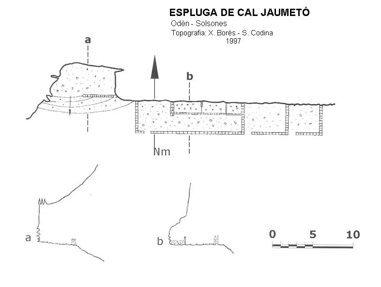


Fonte: Espeleoindex (espeleoindex.com), modificato. CC BY-NC 4.0, https://creativecommons.org/licenses/by-nc/4.0/