

Coves de Cal Sala
A set of a spring, small cracks and an upper cavity 8 m long in the Cambrils area (Solsonès).
EspeleoWorld
Coves de Cal Sala
A set of a spring, small cracks and an upper cavity 8 m long in the Cambrils area (Solsonès).
Odèn · Solsonès
Sviluppo: 8 m · Profondità: 1 m
Scheda aggiornata
https://espeleoworld.com/it/c/coves-de-cal-sala
Le informazioni possono cambiare. Verifica sempre coordinate, accesso, meteo e condizioni della cavità prima di partire.
A set of a spring, small cracks and an upper cavity 8 m long in the Cambrils area (Solsonès).
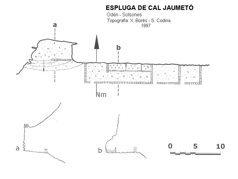
Topografia

Espeleoindex · CC BY-NC 4.0, https://creativecommons.org/licenses/by-nc/4.0/ · Immagine © del suo autore.
Foto
Espeleoindex · CC BY-NC 4.0, https://creativecommons.org/licenses/by-nc/4.0/ · Immagine © del suo autore.
Descrizione
Morfologia
The upper cave of the set is a small and narrow gallery of about 8 metres that decreases in width until it becomes impenetrable. On the right and a few metres from the entrance there is a meagre conduit that seems to connect with the trop-plein located further down.
Idrologia
This cavity seems to be the highest overflow of the Cal Sala spring. The water that gushes from the spring passes under the crop field (the sign of moisture can be seen in the aerial photo) located above the house and comes back out to the surface shortly afterwards, creating a beautiful waterfall below the farmhouse.
Storia
It is to be supposed that this whole set of small cavities has long been known to the people of the area, but the first reference we have is the one that appears in the map of Editorial Alpina (1973 edition), provided by members of the ERE – CEC who visited it some years earlier, on the last outings of the so-called Operació Solsonès.
Commenti degli utenti (0)
Nessun commento ancora.
Sii il primo a condividere la tua esperienza!
Esplorazioni registrate (0)
Nessuna esplorazione registrata.
Registra la tua visita a questa grotta!
Bibliografia
- Borràs,J; Miñarro,J.M; Talavera,F.(1980).-”l'Urgell, el Solsonès, la Segarra i el Berguedà”. Catàleg Espeleològic de Catalunya (vol. 5): 1-233. Ed. Políglota. Barcelona.
- Dades inèdites facilitades per Alfred Montserrat i Mariona Vázquez (ERE – CEC), juliol 2014
Grotte vicine




Fonte: Espeleoindex (espeleoindex.com), modificato. CC BY-NC 4.0, https://creativecommons.org/licenses/by-nc/4.0/