
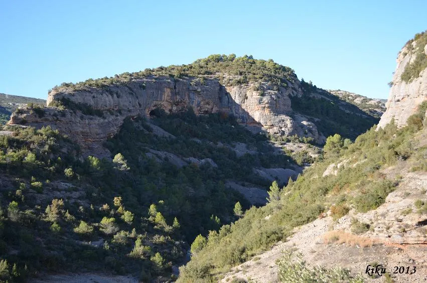
Cova dels Carrers de Lluçars
A group of rock shelters in the barranc de la Tartera, near Tòrrec (Vilanova de Meià), with several passages and remains of constructions.
EspeleoWorld
Cova dels Carrers de Lluçars
A group of rock shelters in the barranc de la Tartera, near Tòrrec (Vilanova de Meià), with several passages and remains of constructions.
Vilanova de Meià · Noguera
Sviluppo: 10 m
Scheda aggiornata
https://espeleoworld.com/it/c/cova-dels-carrers-de-llucars
Le informazioni possono cambiare. Verifica sempre coordinate, accesso, meteo e condizioni della cavità prima di partire.
A group of rock shelters in the barranc de la Tartera, near Tòrrec (Vilanova de Meià), with several passages and remains of constructions.
Topografia
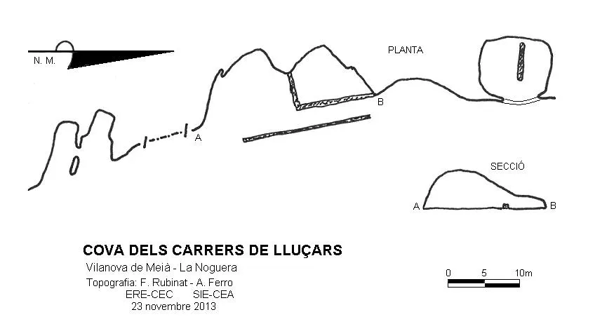
Espeleoindex · CC BY-NC 4.0, https://creativecommons.org/licenses/by-nc/4.0/ · Immagine © del suo autore.
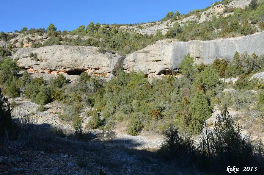
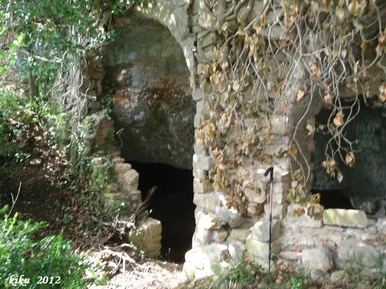
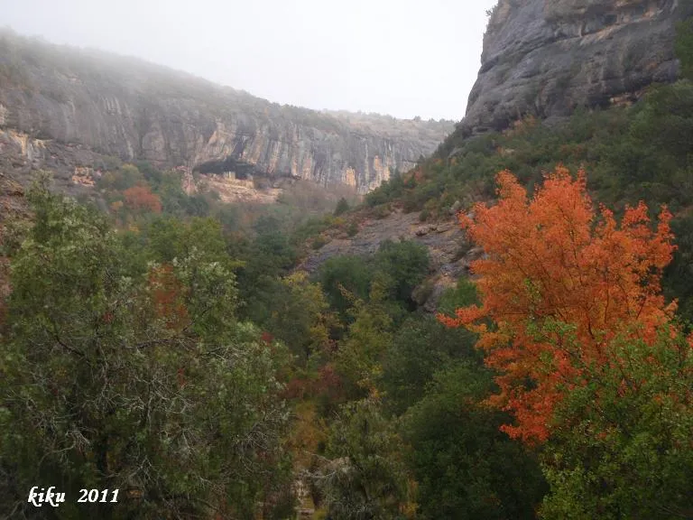
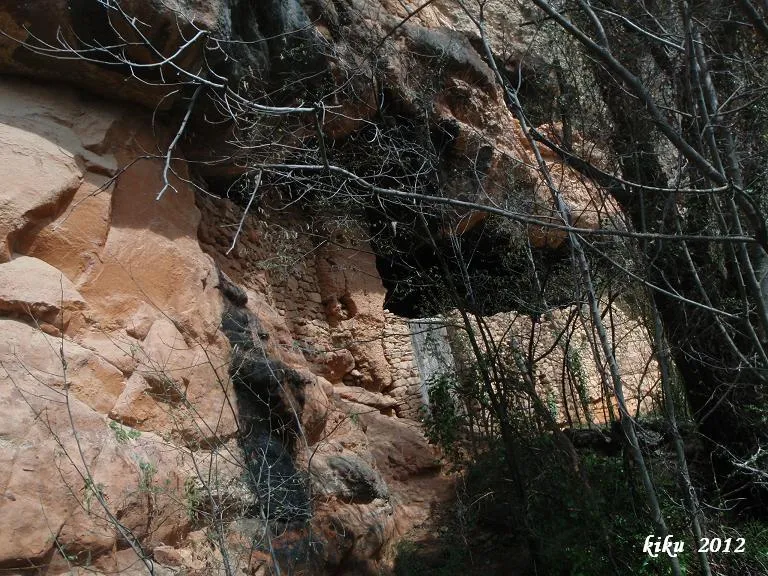
Foto
Espeleoindex · CC BY-NC 4.0, https://creativecommons.org/licenses/by-nc/4.0/ · Immagine © del suo autore.
Descrizione
Morfologia
It is a rock-shelter area with several passages; in some of them we find remains of constructions. In the central part, which is wider, there are remains (basically the foundations) of what appears to be a defensive wall. Entering the rock shelter from the S, we first find two parallel passages about 8 metres long and 1.30 metres high, joined to each other by a window. A few metres further on we find a space in the rock shelter with remains of walls about 24 metres wide and 9.46 metres deep, while the height varies from 5.51 metres to 2.28 metres. A few metres further on one can reach a higher level where we find a small passage 3.90 metres deep and 4.50 metres below this one; there we find the entrance to a dwelling about 9 metres wide by 8.43 metres deep, divided by a wall. This is the darkest passage and it is quite full of earth and excrement from the flocks of sheep that have used it. The group of rock shelters does not reach one hundred metres in width, while the deepest point is 9.46 metres.
Storia
Although known and inhabited since ancient times (contemporary with those of “La Vansa”), at a speleological level the first report we have is of the biospeleological exploration carried out by F. Español and F. de Villalta on 12 April 1936. It seems that the reason why a single name unifies the different speleological phenomena is the existence of a strong defensive wall, today almost ruined, which ran parallel to the cliff, at a distance of one to two metres, forming a kind of street in front of the dwellings.
Note biospeleologiche
Speonomus (Speonomites) Velox Jeann Español-Villalta 12-4-1936
Commenti degli utenti (0)
Nessun commento ancora.
Sii il primo a condividere la tua esperienza!
Esplorazioni registrate (0)
Nessuna esplorazione registrata.
Registra la tua visita a questa grotta!
Bibliografia
- Cortés i Ribelles, Manuel.(1984).- El Montsec i Muntanyes Veïnes. Centre Excursionista de Lleida.
- Escolà i Boada, Oleguer (1970).- “Catálogo Espeleológico del Montsec”. Espeleòleg (11-12):453-541. ERE del CEC. Barcelona.
- Gàzquez i Pons, Josep Lluís (1995).-”Catàleg Espeleològic de la Noguera”. Grallera (3-4):1-90.GELL-CE Lleida.
- Vega, Josep de la. (1981).-”Aplec de documents arqueològics de les coves del Montsec i llur projecció a les comarques i serres properes”. Mediterrània (12): 1-359.
- Valles, Jordi de.(2009).-”Alt Urgell, Noguera, Pla d'Urgell, Segarra, Solsonès, Urgell”. Catàleg Espeleològic de Catalunya (2):1-384. EC Gràcia – FCE.
Grotte vicine


Fonte: Espeleoindex (espeleoindex.com), modificato. CC BY-NC 4.0, https://creativecommons.org/licenses/by-nc/4.0/