
Cova de la Sardina
Submarine cave on the coast of l'Estartit, with a freshwater outlet, known in the past by fishermen and by divers since the 1990's.
EspeleoWorld
Cova de la Sardina
Submarine cave on the coast of l'Estartit, with a freshwater outlet, known in the past by fishermen and by divers since the 1990's.
Torroella de Montgrí · Baix Empordà
Sviluppo: 100 m · Profondità: 15 m
Scheda aggiornata
https://espeleoworld.com/it/c/cova-de-la-sardina
Le informazioni possono cambiare. Verifica sempre coordinate, accesso, meteo e condizioni della cavità prima di partire.
Submarine cave on the coast of l'Estartit, with a freshwater outlet, known in the past by fishermen and by divers since the 1990's.
Topografia
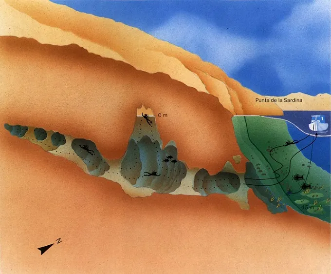

Espeleoindex · CC BY-NC 4.0, https://creativecommons.org/licenses/by-nc/4.0/ · Immagine © del suo autore.
Descrizione
Morfologia
A fissure that is visible on the surface indicates the location of the cave. The entrance has the shape of a chimney, which narrows rapidly to 3 metres, which is the average width of the cave from this point. The tunnel is not round in shape, it is rather a kind of fissure formed by two layers that gradually diminish. The right wall is flat and smooth, while the left one is very rugged and full of sharp and cutting points. Behind the air chamber the tunnel widens and diminishes at the same time (approximately 2 m). As one advances the depth decreases and the cave ends at only 1 m below the surface of the sea.
Concrezioni
On the left wall one can see holes where visibility is very good, and where many sharp stalagmites are found.
Idrologia
Immediately after entering the chamber, freshwater is found. Mixing fresh and salt water, two liquids of different density, can give a feeling of dizziness and blurred vision. Even so, it is less obvious for the second consecutive diver, and the third hardly notices it. This phenomenon depends on the amount of freshwater that enters the tunnel. This means that it is much more visible after the rainy seasons, while in very dry periods it is almost imperceptible. The visibility here at the freshwater interface increases considerably, so it is enough to turn on the lamps for one to be able to see almost to the end of it.
Progressione
From here one must dive 15 m where we will find the main mouth of the cavity. In the first metres we must take special care when swimming with fins, since there is a lot of sediment. There is no need to worry about this side, since the cave is wide enough; however, we should keep to its right side. Advancing further through the tunnel, we find that each time there is less sediment. If we look up after approximately some 40 m, we will see bubbles on the surface while arriving at an air chamber. This is very small and, as always, it is not recommended to breathe the local air, since it may be bad. Opposite there are some 40 m to the end of the tunnel.
Altri dettagli
No topography is available.
Storia
It seems that the fissure visible from sea level was known since ancient times by the fishermen of the area. We calculate that it was around the 1990's that the submarine cave became known to divers who frequent their activities along the entire coast of the Montgrí.
Commenti degli utenti (0)
Nessun commento ancora.
Sii il primo a condividere la tua esperienza!
Esplorazioni registrate (0)
Nessuna esplorazione registrata.
Registra la tua visita a questa grotta!
Bibliografia
- Valles, Jordi de (2010).- Catàleg Espeleològic de Catalunya. Vol. 4: 397 pp. Espeleo Club de Gràcia / Federació Catalana d'Espeleologia. Barcelona.
- Altres dades i dibuix-croquis extretes de la pàgina web: http://www.rambousek.cz/estartit/lokalita13.htm
Grotte vicine

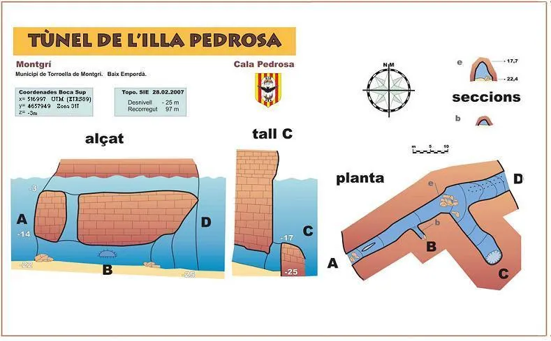
Cova del Francès
0.2 km · NO
Torroella de Montgrí (Baix Empordà)
2 topo.
Cova d'en Sala
0.3 km · NO
Torroella de Montgrí (Baix Empordà)
1 topo.
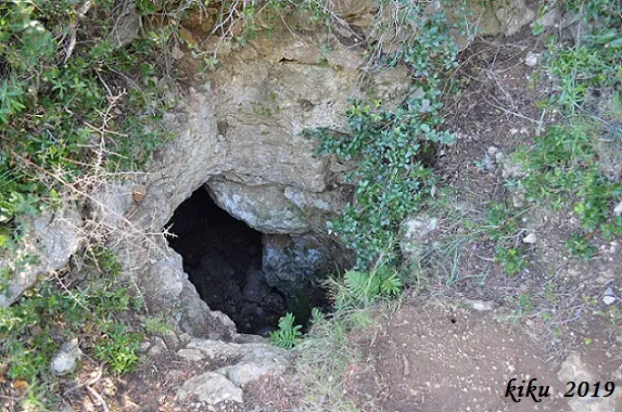
Cau de l'Avi Company
0.6 km · SO
Torroella de Montgrí (Baix Empordà)
1 topo.5 foto

Pou dels Horts de la Pedrosa
0.7 km · NO
Torroella de Montgrí (Baix Empordà)
1 topo.2 foto
Fonte: Espeleoindex (espeleoindex.com), modificato. CC BY-NC 4.0, https://creativecommons.org/licenses/by-nc/4.0/