
Cova Llonga
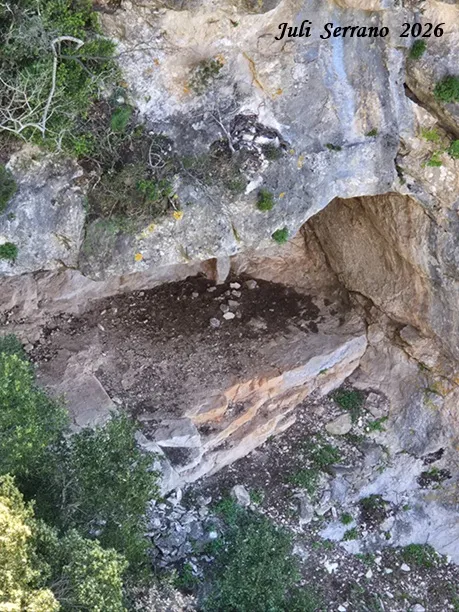
Large rock shelter on the cingle de Cova Llonga, in the Mussara (Vilaplana), 10 metres wide by 9 metres deep.
EspeleoWorld
Cova Llonga
Large rock shelter on the cingle de Cova Llonga, in the Mussara (Vilaplana), 10 metres wide by 9 metres deep.
Vilaplana · Baix Camp
Sviluppo: 9 m · Profondità: 2 m
Scheda aggiornata
https://espeleoworld.com/it/c/cova-de-can-nadal
Le informazioni possono cambiare. Verifica sempre coordinate, accesso, meteo e condizioni della cavità prima di partire.
Large rock shelter on the cingle de Cova Llonga, in the Mussara (Vilaplana), 10 metres wide by 9 metres deep.
Topografia

Espeleoindex · CC BY-NC 4.0, https://creativecommons.org/licenses/by-nc/4.0/ · Immagine © del suo autore.
Foto
Espeleoindex · CC BY-NC 4.0, https://creativecommons.org/licenses/by-nc/4.0/ · Immagine © del suo autore.
Descrizione
Morfologia
It is a rock shelter 10 metres wide by 9 metres deep; the floor rises slightly at the inner part.
Storia
Known since long ago, as the whole of the cova dels Patacons and the rock shelter was known as Cova Llonga.
During the civil war the brothers Joan, David and Miquel Pàmies, known as els Patacons, took refuge in the cave. Years later relatives and descendants of these reclaimed the historical memory of those and the part corresponding to the foradada became known as cova dels Patacons; the fact of having equipped a spectacular via ferrata with this name that passes between the two caves has also contributed to this.
Commenti degli utenti (0)
Nessun commento ancora.
Sii il primo a condividere la tua esperienza!
Esplorazioni registrate (0)
Nessuna esplorazione registrata.
Registra la tua visita a questa grotta!
Bibliografia
Amigó Anglès, Ramon.(1963).-Els topònims del terme municipal i del poble de la Mussara.pp123. Instituto de Estudios Tarraconenses 'Ramon Berenguer IV'.
Totes les dades, coordenades, topografia i fotografies han estat aportades per Montse Roca, Juli Serrano i Francesc Rubinat. Maig de 2026.
Grotte vicine


Fonte: Espeleoindex (espeleoindex.com), modificato. CC BY-NC 4.0, https://creativecommons.org/licenses/by-nc/4.0/