
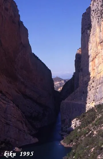
Cova Colomera
Cave with 475 metres of passage and 78 m of vertical extent in the Montrebei gorge, Sant Esteve de la Sarga.
EspeleoWorld
Cova Colomera
Cave with 475 metres of passage and 78 m of vertical extent in the Montrebei gorge, Sant Esteve de la Sarga.
Sant Esteve de la Sarga · Pallars Jussà
Sviluppo: 475 m · Profondità: 78 m
Scheda aggiornata
https://espeleoworld.com/it/c/cova-colomera
Le informazioni possono cambiare. Verifica sempre coordinate, accesso, meteo e condizioni della cavità prima di partire.
Cave with 475 metres of passage and 78 m of vertical extent in the Montrebei gorge, Sant Esteve de la Sarga.
Topografia
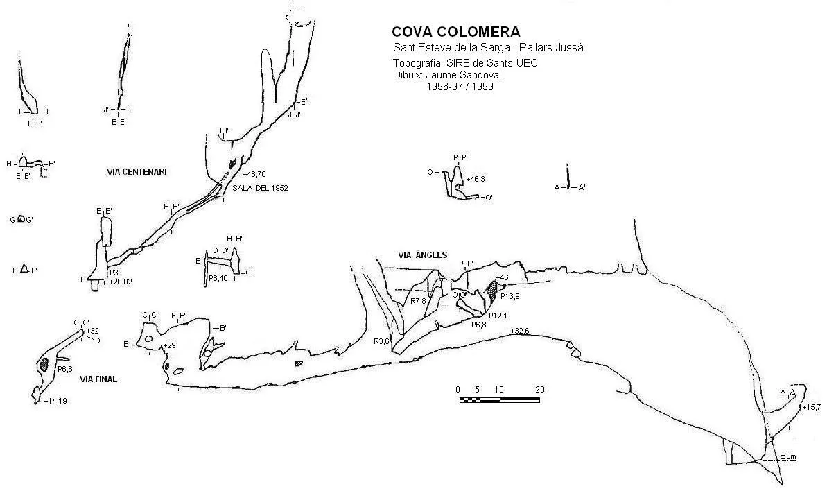
Espeleoindex · CC BY-NC 4.0, https://creativecommons.org/licenses/by-nc/4.0/ · Immagine © del suo autore.
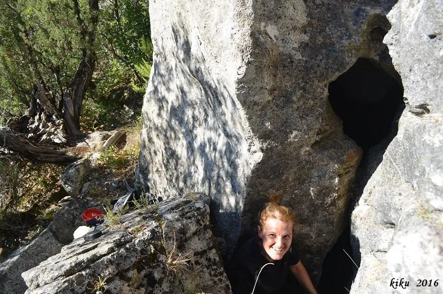
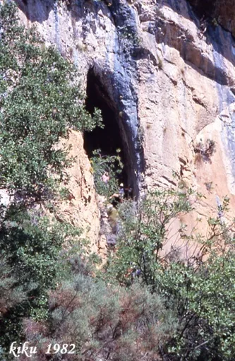
Foto
Espeleoindex · CC BY-NC 4.0, https://creativecommons.org/licenses/by-nc/4.0/ · Immagine © del suo autore.
Descrizione
Morfologia
In order to give a more accurate description, the cavity has been divided into four parts: La Galeria Principal; Via Final; Via Àngels; Via Centenari.
La Galeria Principal: The mouth has a large entrance cut diagonally, some 35 metres wide and some 48 metres high. On the right of the portal an ascending fissure begins, parallel to the cliff, very narrow, 15 metres long and with a positive vertical extent of 15.74 metres. The climb begins up a steep slope full of guano, coming from the colony of jackdaws that lives in the upper fissures of the cave. On the left a short gallery will be found that emerges onto the cliff; the climb is finished up to the upper level at +32.66 metres, the true entrance hall of the cave; from here two windows of the Via Àngels can already be seen. The gallery begins to be slightly descending, besides being partially occupied by blocks and isolated stalagmitic formations; we pass below the lower link of the Via Àngels with an average gallery width of 12 to 20 metres up to the end, and heights that range from 2 to 20 metres; the ceiling is conditioned by the dip of the strata. After 159 metres from the entrance and at +20 metres of vertical extent, the start of the Final and Centenari routes will be found. On the left a small ascending branch of 11 metres is found, which emerges again into the Galeria Principal.
Via Final: Access is gained from the end of the Galeria Principal; an 8-metre step will be climbed and a small chamber with formations at the entrance will be reached; on the right an ascending duct will be found through which the highest point of this branch will be reached at +32.36 metres. Ahead a shaft of -6.40 metres is found that ends in a tiny little room. A little before reaching the highest point, a torta ramp will have been passed on the left that ends in a shaft of -6.80 metres and through a narrow fissure we will descend to the point of maximum vertical extent of +14.19 metres.
Via Àngels: A small 10-metre shaft-slide will be climbed that places us at the beginning of an ascending gallery, a 3.64-metre step will be overcome and along a fossil gallery we will go to the other accesses to the Galeria Principal, a shaft of 13.90 metres and another of 12.10 metres. The third access is found in a sub-level below the gallery and is a shaft of 6.80 metres. In this route lithogenic formations in a fossil state are found. The maximum vertical extent is +46.35 metres.
Via Centenari: The route begins with a 3-metre step, a small ramp, normally slippery, will be climbed and a small little room with formations and small branches will be reached; a somewhat narrow passage will be climbed and we gain access to an ascending gallery of 2.50x2 metres, very slippery, until reaching the foot of two squeezes. We take the lower one and after dragging ourselves for some 8 metres, we reach the sala 1952; from here the shaft-pitches that will be found must be ascended, P.8.20 metres and P.7.70 metres, until reaching the level +57 metres. From here we will enter the fissure found ahead and will ascend amid formations until reaching a column situated at +73.17 metres; the spindle narrows but has considerable height; we climb on one side to the first spindle up to +76.50 metres where it becomes totally closed. On the other side with the aid of the concretions and in opposition we climb up to +78 metres, a place where two small impenetrable passages make this point the maximum vertical extent of the cavity.
Concrezioni
The gallery is partially occupied by blocks and isolated stalagmitic formations. In the Via Final there is a small chamber with formations at the entrance. In the Via Àngels lithogenic formations in a fossil state are found. In the Via Centenari there is a small little room with formations and small branches, and amid formations a column situated at +73.17 metres is reached.
Progressione
From the parking area the waymarked path must be followed that runs parallel to the river in a S direction, until reaching the metal suspension bridge that crosses the barranc Fondo. It must be borne in mind that if the reservoir is full, this path is flooded by the water; in that case the path on the left must be taken at the parking area, which climbs to a small col where on the right there are the ruins of a building, and from there descend along a path with a steep gradient to the suspension bridge. From the bridge the path will be followed that soon penetrates into the Montrebei gorge; almost on reaching the end, turn off to the left along a chute with a steep gradient that leads to the cave. At present the access has been equipped with chains and iron steps.
There is an alternative access to the previous ones that starts from the village of Corçà; it is necessary to go as far as la Pertusa and follow the path that crosses the barranc de la Pardina and climbs to the Mas de Carlets; from there in a N direction, the Montrebei gorge will be entered until turning off to the right along the chute that leads to the cave. This last itinerary involves walking for approximately two and a half hours, while the access from the N side of the gorge takes about 45 minutes.
Storia
In 1924 the path of the pas de Montrebei is inaugurated, it is a path excavated in the rock on the Catalan side of the gorge; this work was carried out by the mancomunitat de Catalunya. In April of that same year Dr. Ricardo Zariquiey visits the cova Colomera for biospeleological purposes.
In 1966 members of the GES-CMB explore the cavity and E. Boixadera publishes the first known survey.
In 1977 the waters of the Canelles reservoir reach their maximum capacity for the first time, the path being left under the waters. In 1984 the new path built by the ENHER company is inaugurated, with the same characteristics as the previous one but at a higher level.
Between the years 1996-1997 and later in 1999 J. Sandoval (SIRE-Sants / UEC), explore the upper galleries of the cave.
In 2002 the accesses both to the path and to the cave access are improved, installing handrails, chains and steps along the whole route.
At present archaeological studies are being carried out there.
Commenti degli utenti (0)
Nessun commento ancora.
Sii il primo a condividere la tua esperienza!
Esplorazioni registrate (0)
Nessuna esplorazione registrata.
Registra la tua visita a questa grotta!
Bibliografia
- Boixadera, E.(1966).-”Un reconocimiento a la Cova Colomera”. Bol. Puig Castellar (3):50-52.
- Campos, Joan; Sandoval, Jaume.(2001).-”Cova Colomera”. Excursionisme (295):10. UE Catalunya.
- Cortés i Ribelles, Manuel.(1984).- El Montsec i Muntanyes Veïnes. Centre Excursionista de Lleida.
- Escolà i Boada, Oleguer (1970).- “Catálogo Espeleológico del Montsec”. Espeleòleg (11-12):453-541. ERE del CEC. Barcelona.
- Faura i Sans, M.(1911).-”Excursiones espeleológicas realizadas durante el año 1910 en la región catalana”. Bol. Real Soc. Esp. historia natural (11):354-376.
- Gàzquez i Pons, Josep Lluís (1995).-”Catàleg Espeleològic de la Noguera”. Grallera (3-4):1-90.GELL-CE Lleida.
- Oms,Xavier; Bargalló, Amèlia; López-García, Juan Manuel; Morales, Juan Ignacio; Pedro, Mireia; Solé, Àlex.(2009).-”L'arqueologia prehistòrica a la serralada del Montsec des del segle XIX fins a l'actual projecte de recerca.” Revista d'arqueologia de ponent (19):29-50. Universitat de Lleida.
- Sandoval, Jaume.(1998).-”Cova Colomera”. Excursionisme (268):178-182. UE Catalunya.
- SIE (1983).-”La Cova Colomera (Pallars Jussà)”. EspeleoSie (25):32-35. SIE-CE Àliga. Barcelona.
- Vega, J. de la (1981).-”Aplec de documents arqueològics de les coves del Montsec i llur projecció a les comarques i serres properes”. Mediterrània (12): 1-359.
- Diverses fotografies extretes del blog: Espeleobloc (post del 26-12-2011)
Grotte vicine




Fonte: Espeleoindex (espeleoindex.com), modificato. CC BY-NC 4.0, https://creativecommons.org/licenses/by-nc/4.0/