
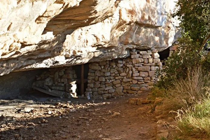
Bauma d'en Roma
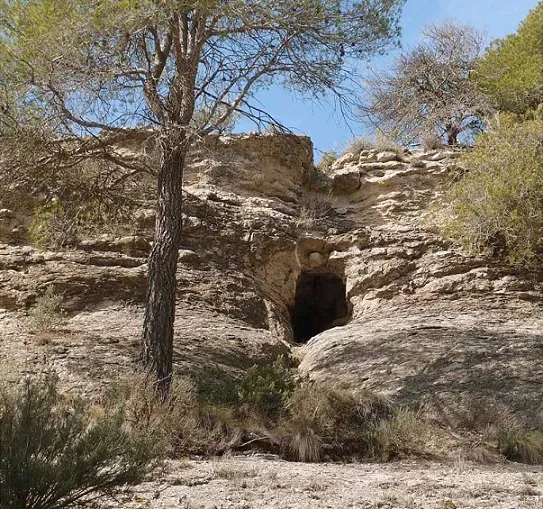
Formerly inhabited rock shelter in Castellcir (Moianès), beneath the pla de la Bruga, on the municipal boundary between Sant Martí de Centelles and Castellcir.
EspeleoWorld
Bauma d'en Roma
Formerly inhabited rock shelter in Castellcir (Moianès), beneath the pla de la Bruga, on the municipal boundary between Sant Martí de Centelles and Castellcir.
Castellcir · Moianès
Sviluppo: 12 m
Scheda aggiornata
https://espeleoworld.com/it/c/bauma-d-en-roma
Le informazioni possono cambiare. Verifica sempre coordinate, accesso, meteo e condizioni della cavità prima di partire.
Formerly inhabited rock shelter in Castellcir (Moianès), beneath the pla de la Bruga, on the municipal boundary between Sant Martí de Centelles and Castellcir.
Topografia
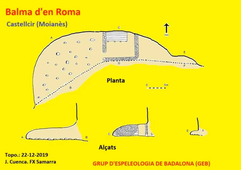
Espeleoindex · CC BY-NC 4.0, https://creativecommons.org/licenses/by-nc/4.0/ · Immagine © del suo autore.
Foto
Espeleoindex · CC BY-NC 4.0, https://creativecommons.org/licenses/by-nc/4.0/ · Immagine © del suo autore.
Descrizione
Morfologia
The rock shelter has dimensions of 41 m in length by 12 m in depth and a height of 3 m. The built part presents an enclosed space 8 m long by 5.6 m deep.
Progressione
Take the C-17 motorway to the Hostalets de Balenyà exit, continue along the C-141-3b road towards Centelles; before reaching Km 18 turn right onto the paved track that leads to Puigsagordi, continue until reaching the coll de Prims, then the coll de Seuva Negra; here turn off onto a path to the left that leads to some houses, where the track ends. Here leave the car and continue along a footpath that crosses some flats, approaching the cliff; continue along a narrow path that descends the cliff and leads to the rock shelter.
Storia
Known since remote times. Formerly it was called Espluga Baladora; the first reference is from the year 1175 and it seems it served as a refuge for bandits. The documentation from 1692 taken from the communion book of the church of Sant Martí says that, in la roca foradada of the castle of Castellcir live en Valentí Roma and Magdalena, his wife; with this documentation it is shown that it was not a rock shelter of sporadic occupation but rather an authentic farmhouse.
Commenti degli utenti (0)
Nessun commento ancora.
Sii il primo a condividere la tua esperienza!
Esplorazioni registrate (0)
Nessuna esplorazione registrata.
Registra la tua visita a questa grotta!
Bibliografia
- Totes les dades, topografia i fotografies han estat extretes del web: geb.cat (del Grup d'Espeleologia de Badalona). Apunt del 28-1-2020. Dades: Josep Cuenca i Xavier Samarra (GEB) amb documentació treta del web: excursionismecientific.wordpress (de Francesc Roma) i del llibre del mateix autor: Patrimoni existencial de Castellcir, Castellterçol i Sant Martí de Centelles.
Grotte vicine



Fonte: Espeleoindex (espeleoindex.com), modificato. CC BY-NC 4.0, https://creativecommons.org/licenses/by-nc/4.0/