
Avenc dels Caçadors
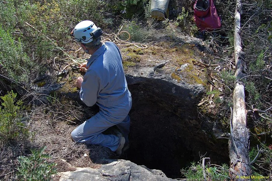
Small pit 11 metres deep at the bottom of the Lledoner (Ordal), first explored by the SIE of the Centre Excursionista Àliga in 1969.
EspeleoWorld
Avenc dels Caçadors
Small pit 11 metres deep at the bottom of the Lledoner (Ordal), first explored by the SIE of the Centre Excursionista Àliga in 1969.
Olesa de Bonesvalls · Alt Penedès
Sviluppo: 24 m · Profondità: 11 m
Scheda aggiornata
https://espeleoworld.com/it/c/avenc-dels-cacadors-olesa-de-bonesvalls
Le informazioni possono cambiare. Verifica sempre coordinate, accesso, meteo e condizioni della cavità prima di partire.
Small pit 11 metres deep at the bottom of the Lledoner (Ordal), first explored by the SIE of the Centre Excursionista Àliga in 1969.
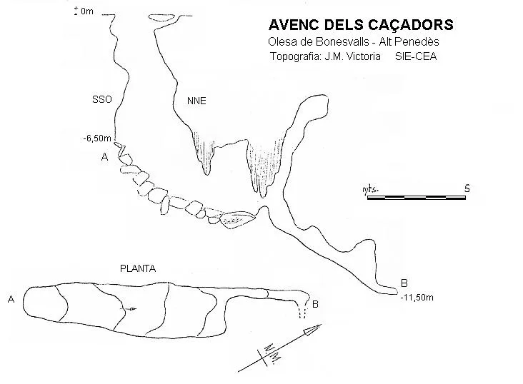
Topografia

Espeleoindex · CC BY-NC 4.0, https://creativecommons.org/licenses/by-nc/4.0/ · Immagine © del suo autore.
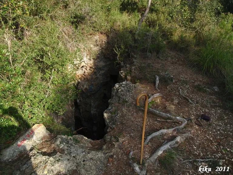
Foto

Espeleoindex · CC BY-NC 4.0, https://creativecommons.org/licenses/by-nc/4.0/ · Immagine © del suo autore.
Descrizione
Morfologia
Entrance 2x1.50 metres. 1 metres from the entrance we find an impenetrable hole that connects with the entrance pit. The pit, 6.50 metres deep, gives access to a gallery 11 metres long, with a width of 1.50 to 2.20 metres; this gallery has a steep slope, descending a height difference of 3.50 metres. The highest point of the cavity is at -11.50 metres depth.
Concrezioni
At the NNE end of the ramp a flowstone develops.
Progressione
Below the flowstone it is possible to progress through a narrow residual passage to the highest point of the cavity at -11.50 metres depth.
Storia
The first exploration was carried out by the SIE of the Centre Excursionista Àliga in 1969.
Commenti degli utenti (0)
Nessun commento ancora.
Sii il primo a condividere la tua esperienza!
Esplorazioni registrate (0)
Nessuna esplorazione registrata.
Registra la tua visita a questa grotta!
Bibliografia
- Rubinat, F. (1988).- “Catàleg espeleològic del massís de Garraf. Unitat septentrional Sector 12” EspeleoSie (30): 13-65. SIE-CEA. Barcelona.
- Victoria López, J.M.(1970).-”L'Avenc dels Caçadors”. EspeleoSie (5):11-13. SIE-CE Àliga. Barcelona.
- Localització i coordenades facilitades per Martí Romero i Rectoret (ERE – Centre Excursionista de Catalunya)
- Fotografies facilitades per Alfred Montserrat (ERE - Centre Excursionista de Catalunya)
Grotte vicine
Avenc Font I Sagué
0.3 km · NO
Olesa de Bonesvalls (Alt Penedès)
2 topo.14 foto
Avenc dels Topògrafs
0.3 km · NO
Olesa de Bonesvalls (Alt Penedès)
2 topo.11 foto
Avenc de la Ullera
0.5 km · N
Olesa de Bonesvalls (Alt Penedès)
2 topo.6 foto

Avenc de la Verdor
0.5 km · NE
Vallirana (Baix Llobregat)
3 topo.2 foto
Fonte: Espeleoindex (espeleoindex.com), modificato. CC BY-NC 4.0, https://creativecommons.org/licenses/by-nc/4.0/