

Avenc de Roca d'abella
A 41 m deep pit in Farena, in the Muntanyes de Prades, with an upper shaft-shaped opening and an entrance overlooking the ravine. Plan length of 103 m.
EspeleoWorld
Avenc de Roca d'abella
A 41 m deep pit in Farena, in the Muntanyes de Prades, with an upper shaft-shaped opening and an entrance overlooking the ravine. Plan length of 103 m.
Mont-ral · Alt Camp
Sviluppo: 125 m · Profondità: 41 m
Scheda aggiornata
https://espeleoworld.com/it/c/avenc-de-roca-d-abella
Le informazioni possono cambiare. Verifica sempre coordinate, accesso, meteo e condizioni della cavità prima di partire.
A 41 m deep pit in Farena, in the Muntanyes de Prades, with an upper shaft-shaped opening and an entrance overlooking the ravine. Plan length of 103 m.
Topografia

Espeleoindex · CC BY-NC 4.0, https://creativecommons.org/licenses/by-nc/4.0/ · Immagine © del suo autore.
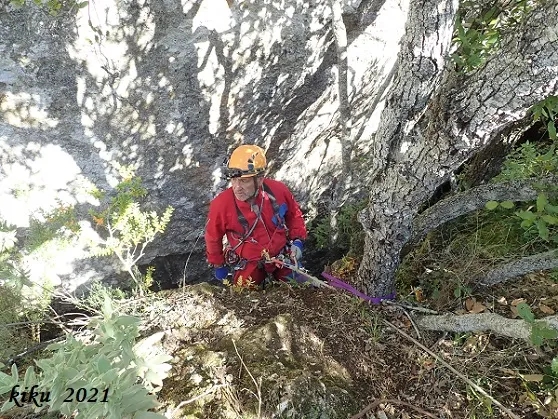
Foto
Espeleoindex · CC BY-NC 4.0, https://creativecommons.org/licenses/by-nc/4.0/ · Immagine © del suo autore.
Descrizione
Morfologia
The opening, in the form of a pit, presents a first aerial shaft of about 6 metres, although almost at its start a little-explored side gallery emerges which does not appear on the survey. Once at the base of the first shaft the chamber presents dimensions of 5x2.5 metres, the continuation being found through a crawl between blocks towards a small chamber parallel to the previous one of 3x2 metres, where we see the light entering between the blocks of the ceiling, this being the second entrance indicated on the elevation of the survey.
From this small chamber and through a small corridor we find a step of about 3 metres between blocks, which places us at two superimposed small chambers of little height, which must have served as a dwelling for ancestors, since blackened smoke marks are visible on the ceiling. At the end opposite the entrance, once this step has been descended, we find a vertical shaft of 3 metres that leads to the most characteristic gallery of the cavity, although we can avoid rigging the shaft by dragging ourselves under the blocks at the back of the chamber and once past we find ourselves on large blocks situated in the main gallery of the cavity forming a 45º slope, with a gallery that gains height between blocks until reaching a vertical drop of 13 metres with a plan of 17x2 metres with a considerable height (of 10 to 12 metres). Almost at the very end of it, on the right-hand side, there is a narrow passage between blocks that allows us to pass to a couple of lower small chambers, until reaching the last vertical shaft of 6 metres in the form of a 1 metre wide joint that leaves us at the bottom of the cavity, where there is always a film of water on the walls and some wall formations. The lower galleries of the cavity achieve a morphology with greater personality than the chaotic upper blocky parts.
As our friend Joan Pallisé tells us, it should be noted that on one of the latest visits to the cavity, a little more than 10 metres above the opening, another hole was located through which a strong air current comes out and through which a shaft and a couple of steps have been descended to a very narrow point that they have not been able to pass so far, but which could connect with the lower chamber of the pit.
On the only known survey (elevation) it is recorded that the plan length is 103 metres, to which we would have to add the vertical sections.
Concrezioni
At the bottom of the cavity there are some wall formations.
Idrologia
At the bottom of the cavity there is always a film of water on the walls.
Progressione
The opening, in the form of a pit, presents a first aerial shaft of about 6 metres. Once at the base of the first shaft the chamber presents dimensions of 5x2.5 metres, the continuation being found through a crawl between blocks towards a small chamber parallel to the previous one of 3x2 metres. From this small chamber and through a small corridor we find a step of about 3 metres between blocks, which places us at two superimposed small chambers of little height. At the end opposite the entrance, once this step has been descended, we find a vertical shaft of 3 metres that leads to the most characteristic gallery of the cavity, although we can avoid rigging the shaft by dragging ourselves under the blocks at the back of the chamber and once past we find ourselves on large blocks situated in the main gallery of the cavity forming a 45º slope, with a gallery that gains height between blocks until reaching a vertical drop of 13 metres with a plan of 17x2 metres with a considerable height (of 10 to 12 metres). Almost at the very end of it, on the right-hand side, there is a narrow passage between blocks that allows us to pass to a couple of lower small chambers, until reaching the last vertical shaft of 6 metres in the form of a 1 metre wide joint that leaves us at the bottom of the cavity.
Storia
The first reference to the cavity is in the 1927 catalogue of cavities of the Brugent river made by J. Iglésies, who considered that the name came from a cliff nearby (Roca Bellera) because of some hives that were at one time formed there. Other experts in toponymy such as R. Amigó point out the antiquity of the word Abellera as if it were a rock full of holes that made one think of a honeycomb. Iglésies with other companions explored it and makes a description with enough detail when considering it as very important, locating prehistoric pottery there.
We have no news until 1950 or 1951 when Salvador Vilaseca, who already mentions that the priest of Farena had visited it, carries out an excavation extracting prehistoric remains (pottery and human bones) that seem to correspond to an indeterminate period between the Neolithic and the Bronze Age.
More or less at that same time, in September 1951, Dr. Francesc Español together with other companions visit it in the course of their work collecting cave fauna.
It is not until the mid-1960s that it is located again by members of the incipient GIEM (Montblanc) but they do not explore it until many years later. On one of these visits they are accompanied by friends of the SIS – CE Terrassa, who in May 1978 carry out the first and only known survey (only an elevation without plan).
In recent years it has been visited again several times, especially in search of fauna. Our friend Pallisé tells us that they have made the plan, pending being drawn up neatly.
Note biospeleologiche
Coleoptera
- Antrocharidius orcinus Jeann (collected by Español in 1951)
Commenti degli utenti (0)
Nessun commento ancora.
Sii il primo a condividere la tua esperienza!
Esplorazioni registrate (0)
Nessuna esplorazione registrata.
Registra la tua visita a questa grotta!
Bibliografia
- Borràs, J.; Miñarro,JM.; Talavera, F. (1978).- Catàleg Espeleològic de Catalunya. Vol. 2 (l'Alt Camp, la Conca de Barberà,el Baix Penedès i el Tarragonès):246 pp. Ed. Poliglota. Barcelona.
- Español, F. (1952).- “Coleópteros cavernícolas del macizo de la Mussara”. Speleon III(4): 199-203. Universidad de Oviedo.
- Iglésies, J. (1927).- “Catalogació de coves i avencs de la vall del riu Brugent”. Revista del Centre de Lectura de Reus (173): 212-226. Reus
- Actualització de dades, coordenades i fotografies facilitades per Joan Pallisé (Montblanc)
- Topografia original facilitada per Salvador Vives (SIS - CET)
Grotte vicine


Fonte: Espeleoindex (espeleoindex.com), modificato. CC BY-NC 4.0, https://creativecommons.org/licenses/by-nc/4.0/