

Wolfertschwendener Steige
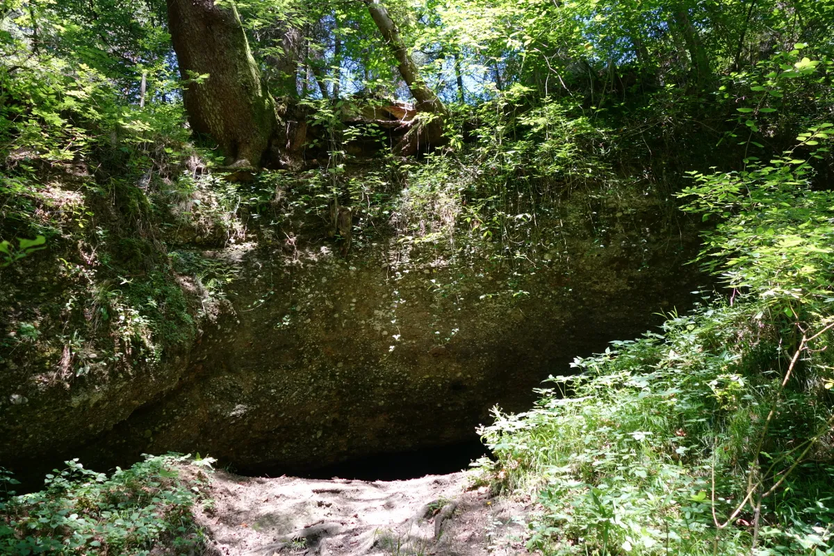
A 30-metre-long geotope exposure created by gravel extraction, with conglomerated gravels and geological organ pipes.
EspeleoWorld
Wolfertschwendener Steige
A 30-metre-long geotope exposure created by gravel extraction, with conglomerated gravels and geological organ pipes.
Wolfertschwenden
Longueur: 30 m
Fiche actualisée
https://espeleoworld.com/fr/c/wolfertschwendener-steige-wolfertschwenden
Les informations peuvent changer. Vérifiez toujours les coordonnées, l'accès, la météo et l'état de la cavité avant de partir.
A 30-metre-long geotope exposure created by gravel extraction, with conglomerated gravels and geological organ pipes.
Photos
© Mogadir · CC BY-SA 3.0, https://creativecommons.org/licenses/by-sa/3.0/ · Wikimedia Commons · https://commons.wikimedia.org/wiki/File:Wolfertschwender_Steige_09.JPG
Description
Morphologie
The exposure extends over a length of 30 metres, a width of 10 metres and a height of 8 metres, covering an area of 300 square metres. On the quarry walls it shows conglomerated gravels and partly weakly developed geological organ pipes. The gravel of the geotope contains almost exclusively limestone and dolomite pebbles, which are poorly rounded. The cover gravel dates from the Early Pleistocene.
Autres détails
The Wolfertschwendener Steige is a registered geotope with the number 778A002. The exposure was created by gravel extraction. The unprotected geotope, which was affected by remediation work on the district road in the early 2010s, is classified as geoscientifically significant and is only rarely present in the region.
Commentaires des utilisateurs (0)
Aucun commentaire pour le moment.
Soyez le premier à partager votre expérience !
Explorations enregistrées (0)
Aucune exploration enregistrée pour le moment.
Enregistrez votre visite dans cette cavité !
Grottes à proximité

Source : Wikidata – cave items (Germany) (www.wikidata.org), avec modifications. CC0 1.0, https://creativecommons.org/publicdomain/zero/1.0/ Wikidata (CC0 1.0) · données de 2026 · Source : German Wikipedia – article leads (cave descriptions) (de.wikipedia.org), avec modifications. CC BY-SA 4.0, https://creativecommons.org/licenses/by-sa/4.0/ Wikipedia contributors (de.wikipedia.org), CC BY-SA 4.0 · Texte de Wikipedia contributors (Wolfertschwendener Steige) · adapté par Espeleoworld (normalisé, traduit) ; l'adaptation est sous licence CC BY-SA 4.0, https://creativecommons.org/licenses/by-sa/4.0/ · description · obtenu le 2026-11-13 · https://de.wikipedia.org/wiki/Wolfertschwendener_Steige · données de 2026