
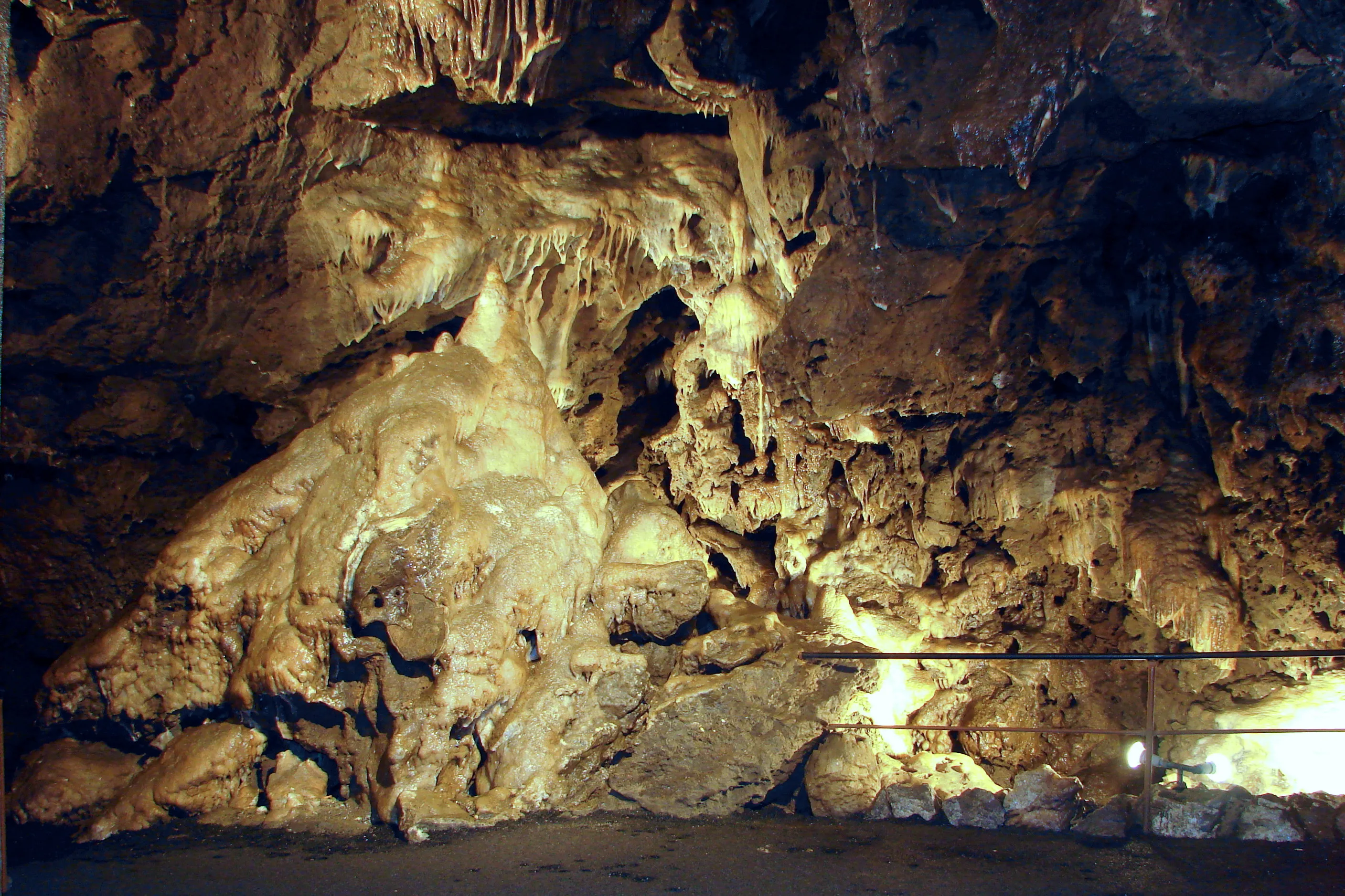
Tropfsteinhöhle Kittelsthal
The Kittelsthaler Tropfsteinhöhle in the Thuringian Forest is accessible via a former mine and has a total length of 726 meters.
EspeleoWorld
Tropfsteinhöhle Kittelsthal
The Kittelsthaler Tropfsteinhöhle in the Thuringian Forest is accessible via a former mine and has a total length of 726 meters.
Ruhla
Fiche actualisée
https://espeleoworld.com/fr/c/tropfsteinhoehle-kittelsthal-ruhla
Les informations peuvent changer. Vérifiez toujours les coordonnées, l'accès, la météo et l'état de la cavité avant de partir.
The Kittelsthaler Tropfsteinhöhle in the Thuringian Forest is accessible via a former mine and has a total length of 726 meters.
Photos

© Peter Jäger · CC BY-SA 3.0, https://creativecommons.org/licenses/by-sa/3.0/ · Wikimedia Commons · https://commons.wikimedia.org/wiki/File:Kittelsthaler_Tropfsteinh%C3%B6hle_2.jpg
Description
Morphologie
The total length of the cave is 726 meters; on guided tours, it is walked along a length of 158 meters. The cave lies 48 meters deeper and is reached via 228 steps.
Progression
The cave is accessible via a former mine. One reaches the cave, which lies 48 meters deeper, via 228 steps; on guided tours, it is walked along a length of 158 meters.
Histoire
The first natural cavities were discovered in 1888. In 1894 it was developed into a show cave and opened in 1896. Between 1968 and 1992, no guided tours took place in the cave.
Commentaires des utilisateurs (0)
Aucun commentaire pour le moment.
Soyez le premier à partager votre expérience !
Explorations enregistrées (0)
Aucune exploration enregistrée pour le moment.
Enregistrez votre visite dans cette cavité !
Grottes à proximité
Contient des informations de © OpenStreetMap contributors, www.openstreetmap.org, mises à disposition sous la licence Open Database License (ODbL 1.0, https://opendatacommons.org/licenses/odbl/1-0/), avec modifications. · https://www.openstreetmap.org/node/497548360 · données de 2026 · Source : Wikidata – cave items (Germany) (www.wikidata.org), avec modifications. CC0 1.0, https://creativecommons.org/publicdomain/zero/1.0/ Wikidata (CC0 1.0) · noms · obtenu le 2026-11-13 · données de 2026 · Source : German Wikipedia – article leads (cave descriptions) (de.wikipedia.org), avec modifications. CC BY-SA 4.0, https://creativecommons.org/licenses/by-sa/4.0/ Wikipedia contributors (de.wikipedia.org), CC BY-SA 4.0 · Texte de Wikipedia contributors (Kittelsthaler Tropfsteinhöhle) · adapté par Espeleoworld (normalisé, traduit) ; l'adaptation est sous licence CC BY-SA 4.0, https://creativecommons.org/licenses/by-sa/4.0/ · description · obtenu le 2026-11-13 · https://de.wikipedia.org/wiki/Kittelsthaler_Tropfsteinh%C3%B6hle · données de 2026 · Les données dérivées sont disponibles sur demande sous l'ODbL : [email protected]