
Schillerhöhle
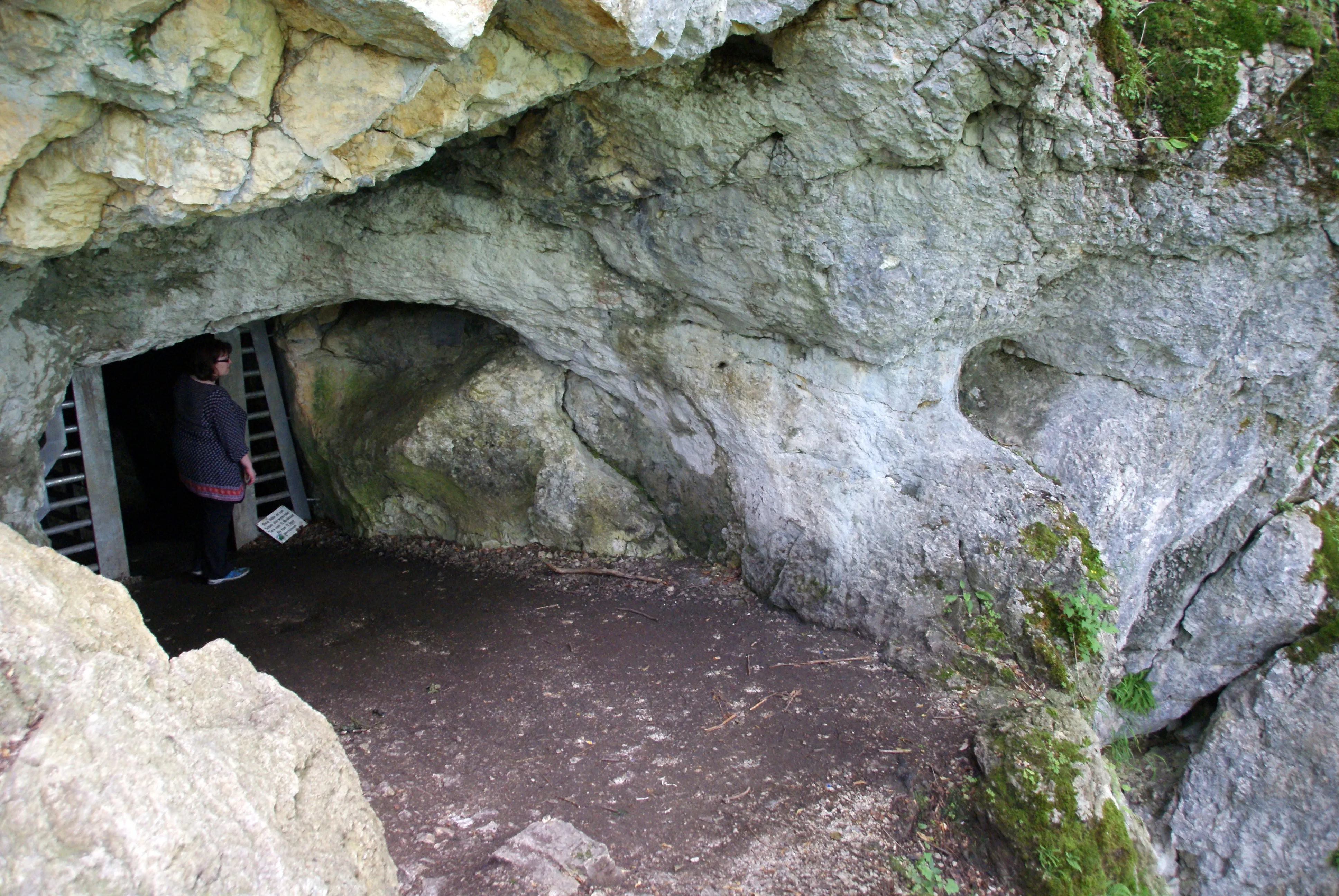
The Schillerhöhle, also known as Schillingsloch, is a cave near the Bad Urach district of Wittlingen on the Swabian Alb.
EspeleoWorld
Schillerhöhle
The Schillerhöhle, also known as Schillingsloch, is a cave near the Bad Urach district of Wittlingen on the Swabian Alb.
Bad Urach
Longueur: 245 m · Profondeur: 30 m
Fiche actualisée
https://espeleoworld.com/fr/c/schillerhoehle-bad-urach
Les informations peuvent changer. Vérifiez toujours les coordonnées, l'accès, la météo et l'état de la cavité avant de partir.
The Schillerhöhle, also known as Schillingsloch, is a cave near the Bad Urach district of Wittlingen on the Swabian Alb.
Photos

© Karle3 · CC BY-SA 4.0, https://creativecommons.org/licenses/by-sa/4.0/ · Wikimedia Commons · https://commons.wikimedia.org/wiki/File:Schillerhoehle-20160704c.jpg
Description
Morphologie
A natural bridge stood in front of the cave entrance, which collapsed in May 2009. As a result, access was closed for a few months.
Autres détails
The cave is part of the UNESCO Geopark Swabian Alb. During the bat protection period, the cave is closed.
Histoire
The Schillerhöhle is named after Friedrich Schiller or after a Herr von Schilling who had an accident there during a bear hunt in 1341. In 1833, the Urach chief forester Friedrich von Mandelsloh carried out excavations in the cave and found bones of brown bear and lynx as well as a well-preserved human skull. He did not look for traces of settlement.
The cave was described under the fictional name Tulkahöhle in the book Rulaman by David Friedrich Weinland, where it is said to have been the Wohnhöhle (dwelling cave) of a tribe of Stone Age people. An actual settlement of the cave in the Stone Age has not yet been proven.
Bio
During the excavations in 1833, the Urach chief forester Friedrich von Mandelsloh found bones of brown bear and lynx.
Commentaires des utilisateurs (0)
Aucun commentaire pour le moment.
Soyez le premier à partager votre expérience !
Explorations enregistrées (0)
Aucune exploration enregistrée pour le moment.
Enregistrez votre visite dans cette cavité !
Grottes à proximité
Source : Geotopkataster Baden-Württemberg (Regierungspräsidium Freiburg – LGRB) (services.lgrb-bw.de), avec modifications. Data licence Germany – attribution – version 2.0 (dl-de/by-2-0), https://www.govdata.de/dl-de/by-2-0 Datenquelle: Regierungspräsidium Freiburg - LGRB, www.lgrb-bw.de · données de 2026 · Contient des informations de Grottocenter (Wikicaves), grottocenter.org, mises à disposition sous la licence Open Database License (ODbL 1.0, https://opendatacommons.org/licenses/odbl/1-0/), avec modifications. · profondeur, longueur · obtenu le 2026-11-13 · https://grottocenter.org/ui/entrances/25132 · données de 2026 · Source : Wikidata – cave items (Germany) (www.wikidata.org), avec modifications. CC0 1.0, https://creativecommons.org/publicdomain/zero/1.0/ Wikidata (CC0 1.0) · noms · obtenu le 2026-11-13 · données de 2026 · Source : German Wikipedia – article leads (cave descriptions) (de.wikipedia.org), avec modifications. CC BY-SA 4.0, https://creativecommons.org/licenses/by-sa/4.0/ Wikipedia contributors (de.wikipedia.org), CC BY-SA 4.0 · Texte de Wikipedia contributors (Schillerhöhle) · adapté par Espeleoworld (normalisé, traduit) ; l'adaptation est sous licence CC BY-SA 4.0, https://creativecommons.org/licenses/by-sa/4.0/ · description · obtenu le 2026-11-13 · https://de.wikipedia.org/wiki/Schillerh%C3%B6hle · données de 2026 · Les données dérivées sont disponibles sur demande sous l'ODbL : [email protected]