
Räuber Daneil Höhle
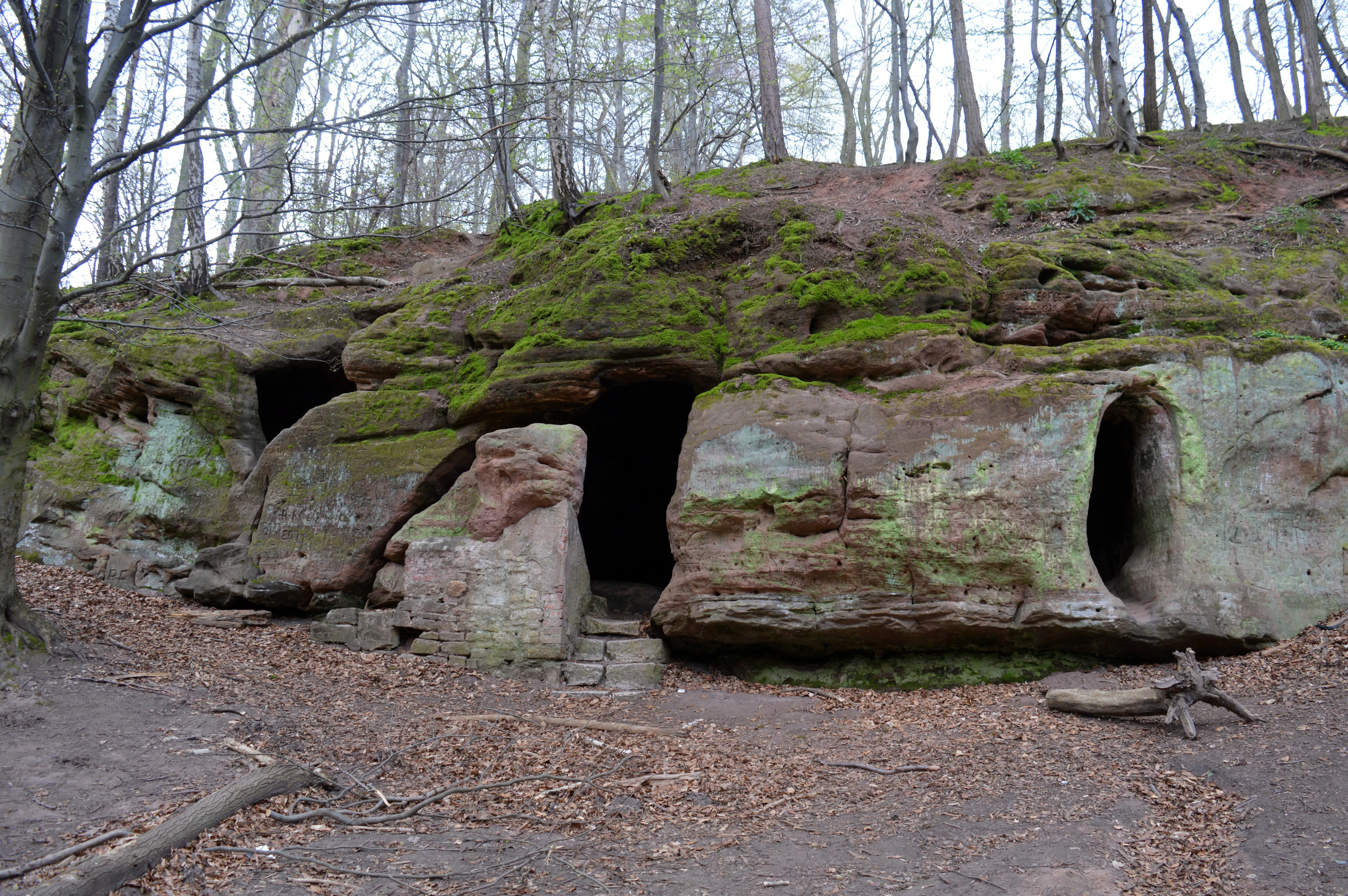
The Daneilshöhle, also called Räuberhöhle, consists of three interconnected, protected cavities in a rock face of the Middle Buntsandstein.
EspeleoWorld
Räuber Daneil Höhle
The Daneilshöhle, also called Räuberhöhle, consists of three interconnected, protected cavities in a rock face of the Middle Buntsandstein.
Huy
Fiche actualisée
https://espeleoworld.com/fr/c/raeuber-daneil-hoehle-huy
Les informations peuvent changer. Vérifiez toujours les coordonnées, l'accès, la météo et l'état de la cavité avant de partir.
The Daneilshöhle, also called Räuberhöhle, consists of three interconnected, protected cavities in a rock face of the Middle Buntsandstein.
Photos

© Ragnar1904 · CC BY-SA 4.0, https://creativecommons.org/licenses/by-sa/4.0/ · Wikimedia Commons · https://commons.wikimedia.org/wiki/File:Landschaftsschutzgebiet_Huy_-_Daneilsh%C3%B6hle_(2).JPG
Description
Morphologie
In a rock face of the Middle Buntsandstein, the Daneilshöhle forms three interconnected cavities that are protected. Holes for barrier beams and vertical walls indicate that the Daneilshöhle was enlarged by human hand.
Autres détails
The cavities evidently originated through washing out in the Tertiary or in the Ice Age, that is, they are of geological origin.
Histoire
It is said to have served in the Middle Ages as a hermit's cell and in the early modern period possibly also as a shelter for highwaymen and robbers. In the criminal trial against Simon Bingelhelm of Halberstadt, who was called Tausendteufel and who was executed in June 1600 for murder and other deeds, it is named as the scene of the crime.
Commentaires des utilisateurs (0)
Aucun commentaire pour le moment.
Soyez le premier à partager votre expérience !
Explorations enregistrées (0)
Aucune exploration enregistrée pour le moment.
Enregistrez votre visite dans cette cavité !
Grottes à proximité
Contient des informations de © OpenStreetMap contributors, www.openstreetmap.org, mises à disposition sous la licence Open Database License (ODbL 1.0, https://opendatacommons.org/licenses/odbl/1-0/), avec modifications. · https://www.openstreetmap.org/node/457859732 · données de 2026 · Source : Wikidata – cave items (Germany) (www.wikidata.org), avec modifications. CC0 1.0, https://creativecommons.org/publicdomain/zero/1.0/ Wikidata (CC0 1.0) · noms · obtenu le 2026-11-13 · données de 2026 · Source : German Wikipedia – article leads (cave descriptions) (de.wikipedia.org), avec modifications. CC BY-SA 4.0, https://creativecommons.org/licenses/by-sa/4.0/ Wikipedia contributors (de.wikipedia.org), CC BY-SA 4.0 · Texte de Wikipedia contributors (Daneilshöhle) · adapté par Espeleoworld (normalisé, traduit) ; l'adaptation est sous licence CC BY-SA 4.0, https://creativecommons.org/licenses/by-sa/4.0/ · description · obtenu le 2026-11-13 · https://de.wikipedia.org/wiki/Daneilsh%C3%B6hle · données de 2026 · Les données dérivées sont disponibles sur demande sous l'ODbL : [email protected]