
Ofnethöhlen
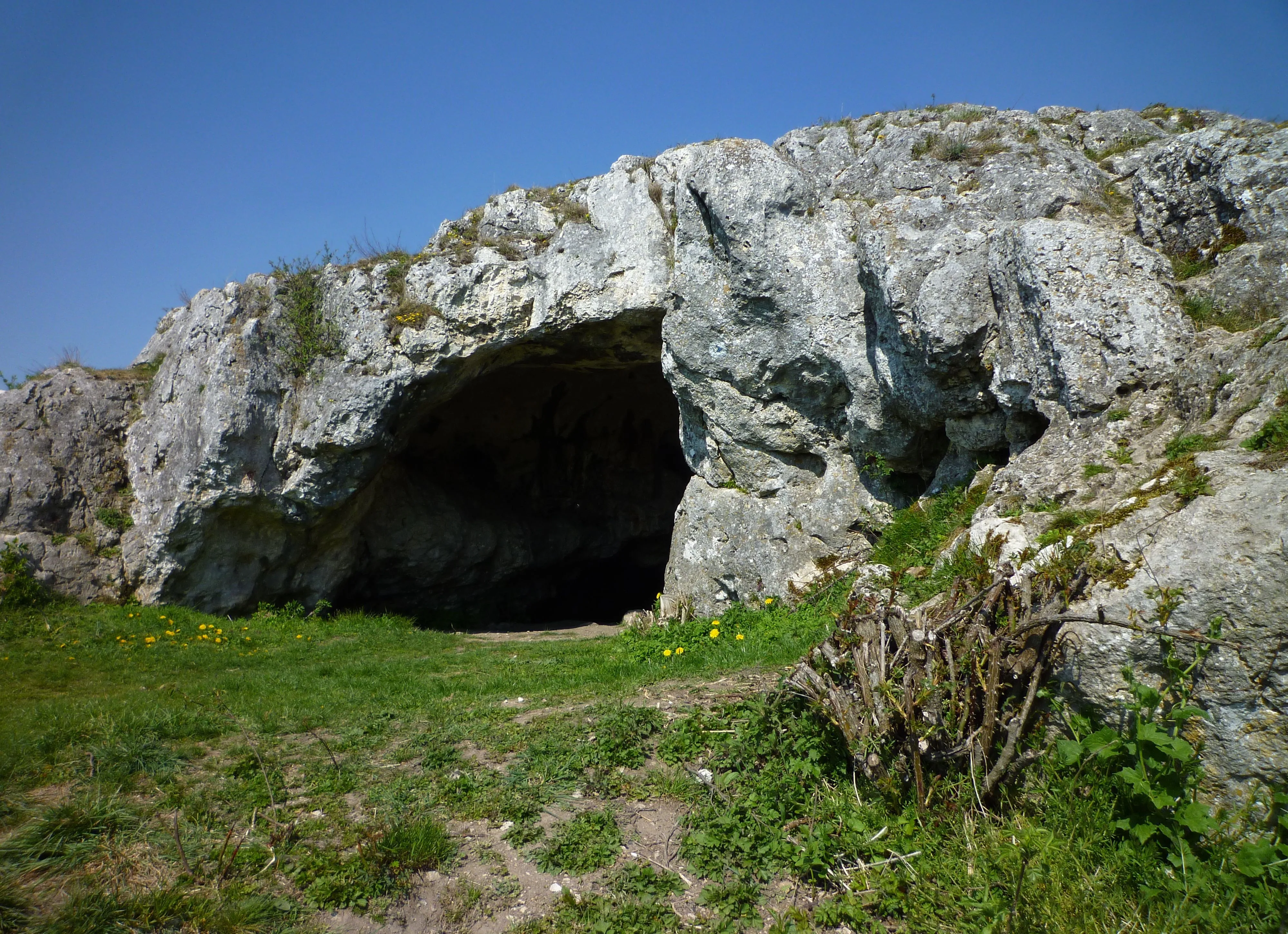
The Ofnethöhlen are natural karst caves near Holheim, a district of Nördlingen in the Donau-Ries district of Bavaria.
EspeleoWorld
Ofnethöhlen
The Ofnethöhlen are natural karst caves near Holheim, a district of Nördlingen in the Donau-Ries district of Bavaria.
Nördlingen
Fiche actualisée
https://espeleoworld.com/fr/c/ofnethoehlen-noerdlingen
Les informations peuvent changer. Vérifiez toujours les coordonnées, l'accès, la météo et l'état de la cavité avant de partir.
The Ofnethöhlen are natural karst caves near Holheim, a district of Nördlingen in the Donau-Ries district of Bavaria.
Photos

© Franzfoto · CC BY-SA 3.0, https://creativecommons.org/licenses/by-sa/3.0/ · Wikimedia Commons · https://commons.wikimedia.org/wiki/File:N%C3%B6rdlingen_-_Ofneth%C3%B6hle_auf_dem_Riegelberg_02.jpg
Description
Morphologie
The Ofnethöhlen are the remains of an underground karst system on the crater rim of the Nördlinger Ries. In the cave register Fränkische Alb (HFA) they are registered as M 7 (Große Ofnethöhle) and M 8 (Kleine Ofnethöhle). The caves, including the immediate surroundings (a total of approx. 8 hectares), are also classified as the nature reserve „Ofnethöhlen bei Holheim“.
Autres détails
The origin of the term „Ofnet“ is not documented.
Histoire
Archaeological finds indicate that the caves were inhabited from the Middle Paleolithic to the Mesolithic. The Ofnethöhlen gained supraregional significance when Stone Age skull burials were discovered in the year 1908.
Commentaires des utilisateurs (0)
Aucun commentaire pour le moment.
Soyez le premier à partager votre expérience !
Explorations enregistrées (0)
Aucune exploration enregistrée pour le moment.
Enregistrez votre visite dans cette cavité !
Grottes à proximité
Source : Geotopkataster Bayern (Bayerisches Landesamt für Umwelt) (www.umweltatlas.bayern.de), avec modifications. CC BY 4.0, https://creativecommons.org/licenses/by/4.0/ Datenquelle: Bayerisches Landesamt für Umwelt, www.lfu.bayern.de · https://www.umweltatlas.bayern.de/mapapps/resources/reports/sb_geotope/generateBericht.pdf?additionallayerfieldvalue=779H001 · données de 2026 · Contient des informations de © OpenStreetMap contributors, www.openstreetmap.org, mises à disposition sous la licence Open Database License (ODbL 1.0, https://opendatacommons.org/licenses/odbl/1-0/), avec modifications. · noms · obtenu le 2026-11-13 · https://www.openstreetmap.org/node/356052506 · données de 2026 · Source : Wikidata – cave items (Germany) (www.wikidata.org), avec modifications. CC0 1.0, https://creativecommons.org/publicdomain/zero/1.0/ Wikidata (CC0 1.0) · noms · obtenu le 2026-11-13 · données de 2026 · Source : German Wikipedia – article leads (cave descriptions) (de.wikipedia.org), avec modifications. CC BY-SA 4.0, https://creativecommons.org/licenses/by-sa/4.0/ Wikipedia contributors (de.wikipedia.org), CC BY-SA 4.0 · Texte de Wikipedia contributors (Ofnethöhlen) · adapté par Espeleoworld (normalisé, traduit) ; l'adaptation est sous licence CC BY-SA 4.0, https://creativecommons.org/licenses/by-sa/4.0/ · description · obtenu le 2026-11-13 · https://de.wikipedia.org/wiki/Ofneth%C3%B6hlen · données de 2026 · Les données dérivées sont disponibles sur demande sous l'ODbL : [email protected]