
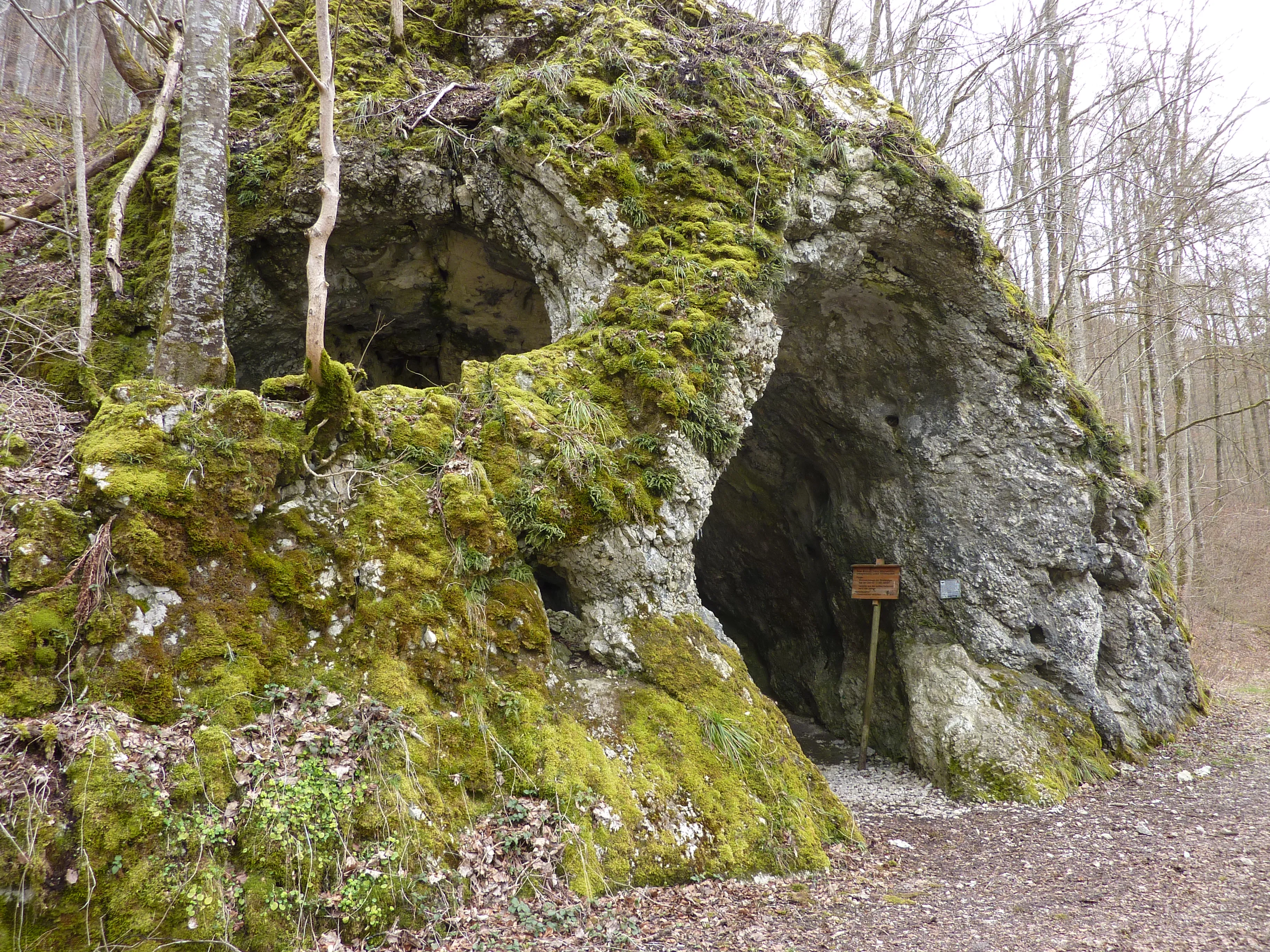
Maurushöhle
The Rote-Brunnen-Höhle is a Höhlensystem (cave system) consisting of three passages with an explored length of 376 metres, whose longest passage is walled up after ten metres to protect the bats.
EspeleoWorld
Maurushöhle
The Rote-Brunnen-Höhle is a Höhlensystem (cave system) consisting of three passages with an explored length of 376 metres, whose longest passage is walled up after ten metres to protect the bats.
Leibertingen
Profondeur: 376 m
Fiche actualisée
https://espeleoworld.com/fr/c/maurushoehle-leibertingen
Les informations peuvent changer. Vérifiez toujours les coordonnées, l'accès, la météo et l'état de la cavité avant de partir.
The Rote-Brunnen-Höhle is a Höhlensystem (cave system) consisting of three passages with an explored length of 376 metres, whose longest passage is walled up after ten metres to protect the bats.
Photos
© Manuel Heinemann · CC BY-SA 3.0, https://creativecommons.org/licenses/by-sa/3.0/ · Wikimedia Commons · https://commons.wikimedia.org/wiki/File:Rote-Brunnen-H%C3%B6hle.jpg
Description
Morphologie
The Höhlensystem (cave system) consists of three passages. The longest passage is walled up after ten metres to protect the bats and thereafter has only a passage for the bats. The cave has an explored length of 376 metres.
Spéléothèmes
The middle of the passages ends in a dripstone cave.
Hydrologie
The cave's namesake is the Rote Brunnen, a spring that rises from the hillside scree below the cave about two metres above the water level of the Danube. The spring has a mean discharge of 50 litres per second (minimum 25, maximum 675 l/s). At high discharge, water also emerges from the cave.
Autres détails
The cave is protected as a natural monument and designated as a geotope. In winter it may not be entered to protect the bats.
Histoire
Finds indicate early use by Stone Age hunters. In the 1960s it was planned to use the spring for water supply. The plans were abandoned after marking experiments established that water sinking in the Wildensteiner Tal east of the castle flows very rapidly to the Rote Brunnen.
Commentaires des utilisateurs (0)
Aucun commentaire pour le moment.
Soyez le premier à partager votre expérience !
Explorations enregistrées (0)
Aucune exploration enregistrée pour le moment.
Enregistrez votre visite dans cette cavité !
Grottes à proximité


Source : Geotopkataster Baden-Württemberg (Regierungspräsidium Freiburg – LGRB) (services.lgrb-bw.de), avec modifications. Data licence Germany – attribution – version 2.0 (dl-de/by-2-0), https://www.govdata.de/dl-de/by-2-0 Datenquelle: Regierungspräsidium Freiburg - LGRB, www.lgrb-bw.de · données de 2026 · Contient des informations de © OpenStreetMap contributors, www.openstreetmap.org, mises à disposition sous la licence Open Database License (ODbL 1.0, https://opendatacommons.org/licenses/odbl/1-0/), avec modifications. · profondeur, noms · obtenu le 2026-11-13 · https://www.openstreetmap.org/node/294924180 · données de 2026 · Source : Wikidata – cave items (Germany) (www.wikidata.org), avec modifications. CC0 1.0, https://creativecommons.org/publicdomain/zero/1.0/ Wikidata (CC0 1.0) · données de 2026 · Source : German Wikipedia – article leads (cave descriptions) (de.wikipedia.org), avec modifications. CC BY-SA 4.0, https://creativecommons.org/licenses/by-sa/4.0/ Wikipedia contributors (de.wikipedia.org), CC BY-SA 4.0 · Texte de Wikipedia contributors (Rote-Brunnen-Höhle) · adapté par Espeleoworld (normalisé, traduit) ; l'adaptation est sous licence CC BY-SA 4.0, https://creativecommons.org/licenses/by-sa/4.0/ · description · obtenu le 2026-11-13 · https://de.wikipedia.org/wiki/Rote-Brunnen-H%C3%B6hle · données de 2026 · Les données dérivées sont disponibles sur demande sous l'ODbL : [email protected]