

Kolbinger Höhle
The Kolbinger Höhle is a natural 330-metre-long dripstone cave near Kolbingen and the only show cave on the southwestern Swabian Alb.
EspeleoWorld
Kolbinger Höhle
The Kolbinger Höhle is a natural 330-metre-long dripstone cave near Kolbingen and the only show cave on the southwestern Swabian Alb.
Fridingen an der Donau
Longueur: 330 m
Fiche actualisée
https://espeleoworld.com/fr/c/kolbinger-hoehle-fridingen-an-der-donau
Les informations peuvent changer. Vérifiez toujours les coordonnées, l'accès, la météo et l'état de la cavité avant de partir.
The Kolbinger Höhle is a natural 330-metre-long dripstone cave near Kolbingen and the only show cave on the southwestern Swabian Alb.
Photos
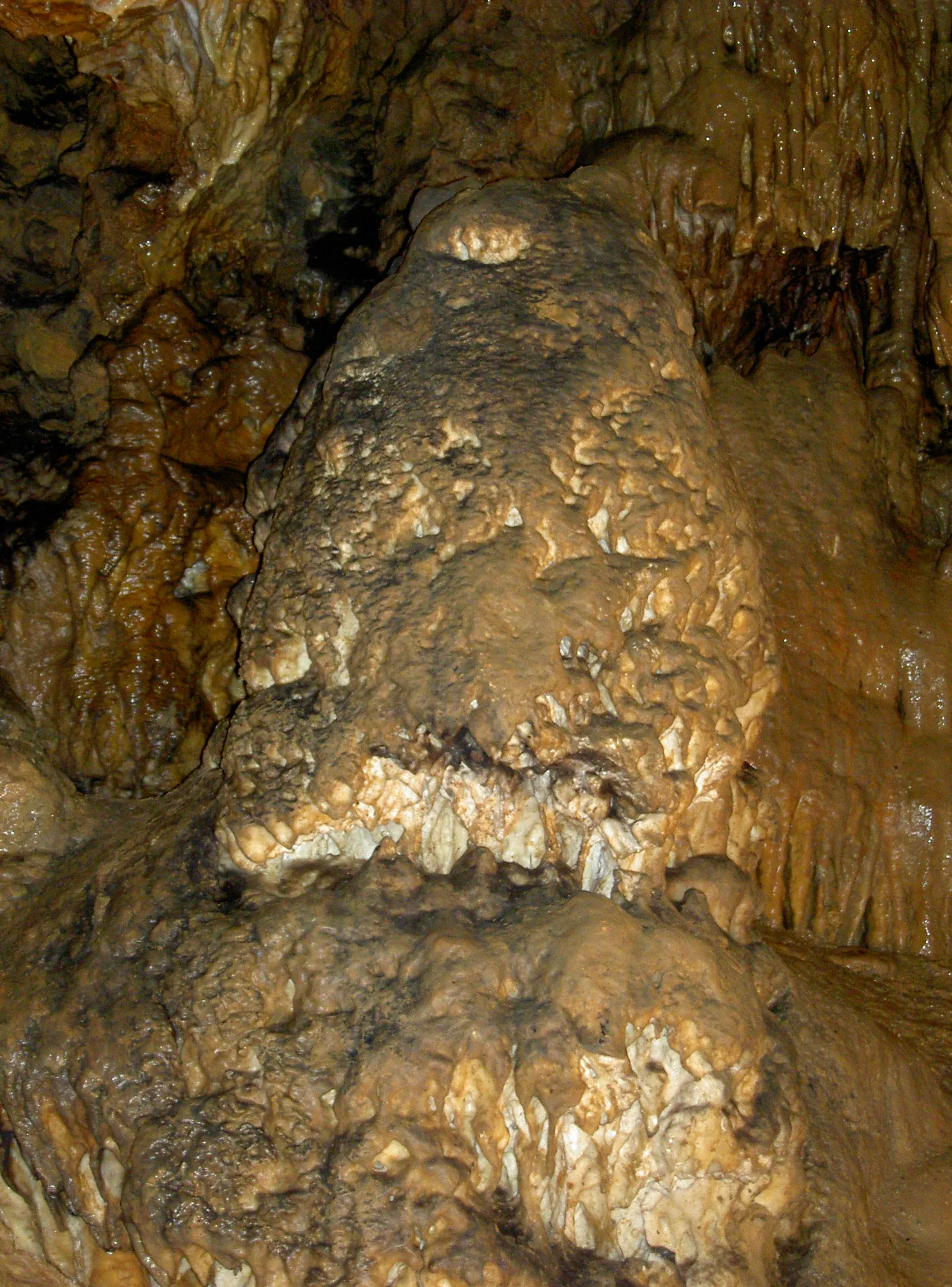
© Olga Ernst · CC BY-SA 4.0, https://creativecommons.org/licenses/by-sa/4.0/ · Wikimedia Commons · https://commons.wikimedia.org/wiki/File:Kolbinger_H%C3%B6hle,_Naturdenkmal.jpg
Description
Morphologie
The Kolbinger Höhle is a natural 330-metre-long dripstone cave. It lies in the mass limestone of the Malm of the Swabian Alb. The front part of the cave is the dome-like Stefanshöhle.
Spéléothèmes
The rear part of the cave is beautifully decorated with sinter.
Autres détails
The Kolbinger Höhle is the only show cave on the southwestern Swabian Alb. Above the cave entrance and the rock gate, a catered shelter hut of the Swabian Alb Association offers visitors the opportunity to rest. Since July 2016, the Kolbinger Höhle has been one of 26 information points of the UNESCO Swabian Alb Geopark.
Histoire
The dome-like Stefanshöhle had long been known but was first mentioned in 1879 in the Oberamtsbeschreibung of Tuttlingen. In 1913, the beautifully sintered rear part was discovered by some young men from Kolbingen. Initial tourist efforts followed: the cave was lit with candles and carbide lamps, and visits went quite well until the outbreak of the First World War. Between the two World Wars, things became quieter around the cave. After the Second World War, the stairs and bridges were renovated and electric lighting was installed. In 1950, a large cave festival was celebrated. After defects appeared in the cave, it had to be closed in 1958. Once the problems had been resolved, the cave could be reopened to visitors in 1968.
Commentaires des utilisateurs (0)
Aucun commentaire pour le moment.
Soyez le premier à partager votre expérience !
Explorations enregistrées (0)
Aucune exploration enregistrée pour le moment.
Enregistrez votre visite dans cette cavité !
Grottes à proximité


Source : Geotopkataster Baden-Württemberg (Regierungspräsidium Freiburg – LGRB) (services.lgrb-bw.de), avec modifications. Data licence Germany – attribution – version 2.0 (dl-de/by-2-0), https://www.govdata.de/dl-de/by-2-0 Datenquelle: Regierungspräsidium Freiburg - LGRB, www.lgrb-bw.de · données de 2026 · Contient des informations de Grottocenter (Wikicaves), grottocenter.org, mises à disposition sous la licence Open Database License (ODbL 1.0, https://opendatacommons.org/licenses/odbl/1-0/), avec modifications. · longueur · obtenu le 2026-11-13 · https://grottocenter.org/ui/entrances/23599 · données de 2026 · Source : Grottocenter (Association Wikicaves), worldwide collaborative cave database (grottocenter.org), avec modifications. CC BY-SA 3.0, https://creativecommons.org/licenses/by-sa/3.0/ Grottocenter (Wikicaves) · Texte de ABC · adapté par Espeleoworld (normalisé, traduit) ; l'adaptation est sous licence CC BY-SA 3.0, https://creativecommons.org/licenses/by-sa/3.0/ · historique · obtenu le 2026-11-13 · https://grottocenter.org/ui/entrances/23599 · données de 2026 · Contient des informations de © OpenStreetMap contributors, www.openstreetmap.org, mises à disposition sous la licence Open Database License (ODbL 1.0, https://opendatacommons.org/licenses/odbl/1-0/), avec modifications. · https://www.openstreetmap.org/node/1894767505 · données de 2026 · Source : Wikidata – cave items (Germany) (www.wikidata.org), avec modifications. CC0 1.0, https://creativecommons.org/publicdomain/zero/1.0/ Wikidata (CC0 1.0) · noms · obtenu le 2026-11-13 · données de 2026 · Source : German Wikipedia – article leads (cave descriptions) (de.wikipedia.org), avec modifications. CC BY-SA 4.0, https://creativecommons.org/licenses/by-sa/4.0/ Wikipedia contributors (de.wikipedia.org), CC BY-SA 4.0 · Texte de Wikipedia contributors (Kolbinger Höhle) · adapté par Espeleoworld (normalisé, traduit) ; l'adaptation est sous licence CC BY-SA 4.0, https://creativecommons.org/licenses/by-sa/4.0/ · description · obtenu le 2026-11-13 · https://de.wikipedia.org/wiki/Kolbinger_H%C3%B6hle · données de 2026 · Les données dérivées sont disponibles sur demande sous l'ODbL : [email protected]