
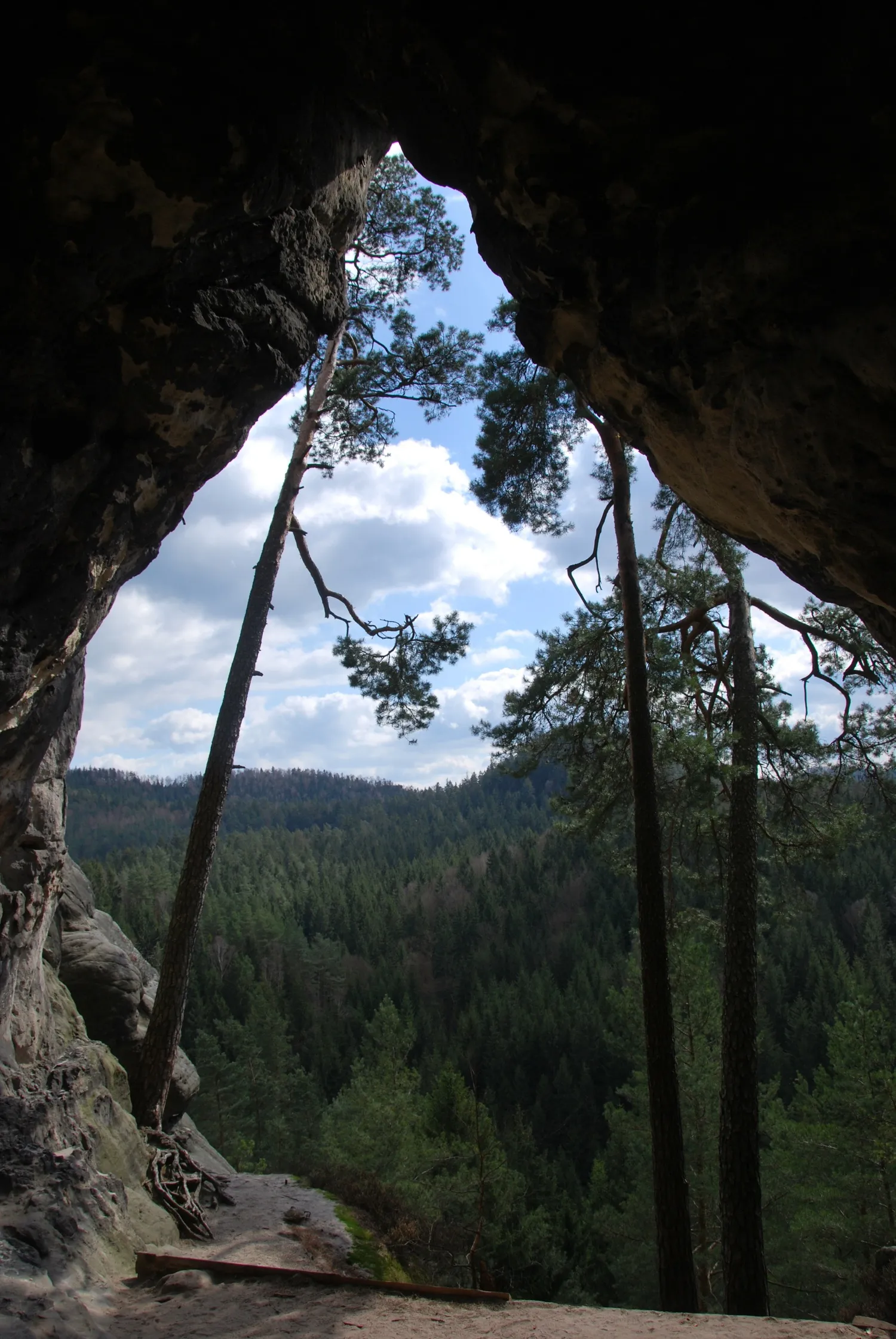
Kleinsteinhöhle
The Kleinsteinhöhle is a rock gate about 10 metres high, 10 to 12 metres wide and 5 to 7 metres deep, split in two and open at the top, on the south side of the Kleinstein.
EspeleoWorld
Kleinsteinhöhle
The Kleinsteinhöhle is a rock gate about 10 metres high, 10 to 12 metres wide and 5 to 7 metres deep, split in two and open at the top, on the south side of the Kleinstein.
Sebnitz
Fiche actualisée
https://espeleoworld.com/fr/c/kleinsteinhoehle-sebnitz
Les informations peuvent changer. Vérifiez toujours les coordonnées, l'accès, la météo et l'état de la cavité avant de partir.
The Kleinsteinhöhle is a rock gate about 10 metres high, 10 to 12 metres wide and 5 to 7 metres deep, split in two and open at the top, on the south side of the Kleinstein.
Photos

Bürger-falk · Public Domain Mark 1.0, https://creativecommons.org/publicdomain/mark/1.0/ · Wikimedia Commons · https://commons.wikimedia.org/wiki/File:Kleinsteinhoehle.jpg
Description
Morphologie
After the Kuhstall, the Kleinsteinhöhle is the second-largest rock gate in the Sächsische Schweiz. The rock gate is about 10 metres high, about 10 to 12 metres wide and 5 to 7 metres deep. The rock arch is split in two and open at the top.
Autres détails
The rock surrounding the cave is a climbing rock known as the „Kleinsteinwand“. It is one of the most important climbing rocks in the Hintere Sächsische Schweiz. There are currently over 90 climbing routes with difficulties up to grade 10 (Saxon difficulty scale).
Histoire
The rock gate was portrayed in an etching by the painter Ludwig Richter in 1820. To the left of the entrance to the rock gate, on a rock face, is the carved year „1586“; this is the second-oldest rock inscription in the Sächsische Schweiz.
Commentaires des utilisateurs (0)
Aucun commentaire pour le moment.
Soyez le premier à partager votre expérience !
Explorations enregistrées (0)
Aucune exploration enregistrée pour le moment.
Enregistrez votre visite dans cette cavité !
Grottes à proximité
Contient des informations de © OpenStreetMap contributors, www.openstreetmap.org, mises à disposition sous la licence Open Database License (ODbL 1.0, https://opendatacommons.org/licenses/odbl/1-0/), avec modifications. · https://www.openstreetmap.org/node/495421555 · données de 2026 · Source : Wikidata – cave items (Germany) (www.wikidata.org), avec modifications. CC0 1.0, https://creativecommons.org/publicdomain/zero/1.0/ Wikidata (CC0 1.0) · noms · obtenu le 2026-11-13 · données de 2026 · Source : German Wikipedia – article leads (cave descriptions) (de.wikipedia.org), avec modifications. CC BY-SA 4.0, https://creativecommons.org/licenses/by-sa/4.0/ Wikipedia contributors (de.wikipedia.org), CC BY-SA 4.0 · Texte de Wikipedia contributors (Kleinsteinhöhle) · adapté par Espeleoworld (normalisé, traduit) ; l'adaptation est sous licence CC BY-SA 4.0, https://creativecommons.org/licenses/by-sa/4.0/ · description · obtenu le 2026-11-13 · https://de.wikipedia.org/wiki/Kleinsteinh%C3%B6hle · données de 2026 · Les données dérivées sont disponibles sur demande sous l'ODbL : [email protected]