
Irpfelhöhle
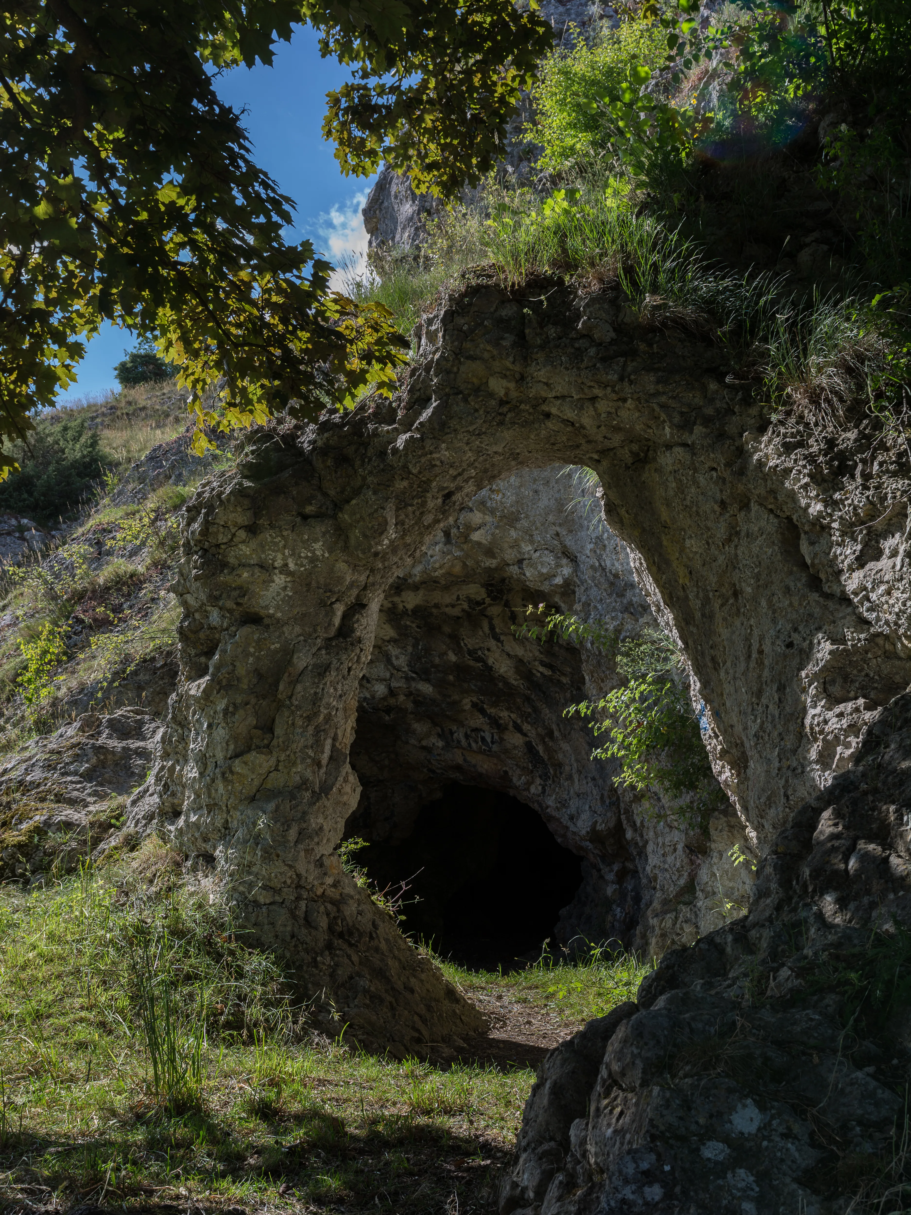
The Irpfelhöhle is a 54-metre-long karst cave on the southern slope of the Irpfelberg, whose entrance is formed by a free-standing rock arch.
EspeleoWorld
Irpfelhöhle
The Irpfelhöhle is a 54-metre-long karst cave on the southern slope of the Irpfelberg, whose entrance is formed by a free-standing rock arch.
Giengen an der Brenz
Fiche actualisée
https://espeleoworld.com/fr/c/irpfelhoehle-giengen-an-der-brenz
Les informations peuvent changer. Vérifiez toujours les coordonnées, l'accès, la météo et l'état de la cavité avant de partir.
The Irpfelhöhle is a 54-metre-long karst cave on the southern slope of the Irpfelberg, whose entrance is formed by a free-standing rock arch.
Photos

© Thilo Parg · CC BY-SA 4.0, https://creativecommons.org/licenses/by-sa/4.0/ · Wikimedia Commons · https://commons.wikimedia.org/wiki/File:Irpfelhoehle_2017-06-17_2.jpg
Description
Morphologie
The Irpfelhöhle has a length of 54 metres. A special feature of this cave is a free-standing rock arch at the entrance. This arch is the last remnant of a cave chamber that fell victim to natural slope erosion.
Autres détails
The Irpfelhöhle is a natural monument and a protected geotope.
Commentaires des utilisateurs (0)
Aucun commentaire pour le moment.
Soyez le premier à partager votre expérience !
Explorations enregistrées (0)
Aucune exploration enregistrée pour le moment.
Enregistrez votre visite dans cette cavité !
Grottes à proximité
Source : Geotopkataster Baden-Württemberg (Regierungspräsidium Freiburg – LGRB) (services.lgrb-bw.de), avec modifications. Data licence Germany – attribution – version 2.0 (dl-de/by-2-0), https://www.govdata.de/dl-de/by-2-0 Datenquelle: Regierungspräsidium Freiburg - LGRB, www.lgrb-bw.de · données de 2026 · Source : Wikidata – cave items (Germany) (www.wikidata.org), avec modifications. CC0 1.0, https://creativecommons.org/publicdomain/zero/1.0/ Wikidata (CC0 1.0) · données de 2026 · Source : German Wikipedia – article leads (cave descriptions) (de.wikipedia.org), avec modifications. CC BY-SA 4.0, https://creativecommons.org/licenses/by-sa/4.0/ Wikipedia contributors (de.wikipedia.org), CC BY-SA 4.0 · Texte de Wikipedia contributors (Irpfelhöhle) · adapté par Espeleoworld (normalisé, traduit) ; l'adaptation est sous licence CC BY-SA 4.0, https://creativecommons.org/licenses/by-sa/4.0/ · description · obtenu le 2026-11-13 · https://de.wikipedia.org/wiki/Irpfelh%C3%B6hle · données de 2026