
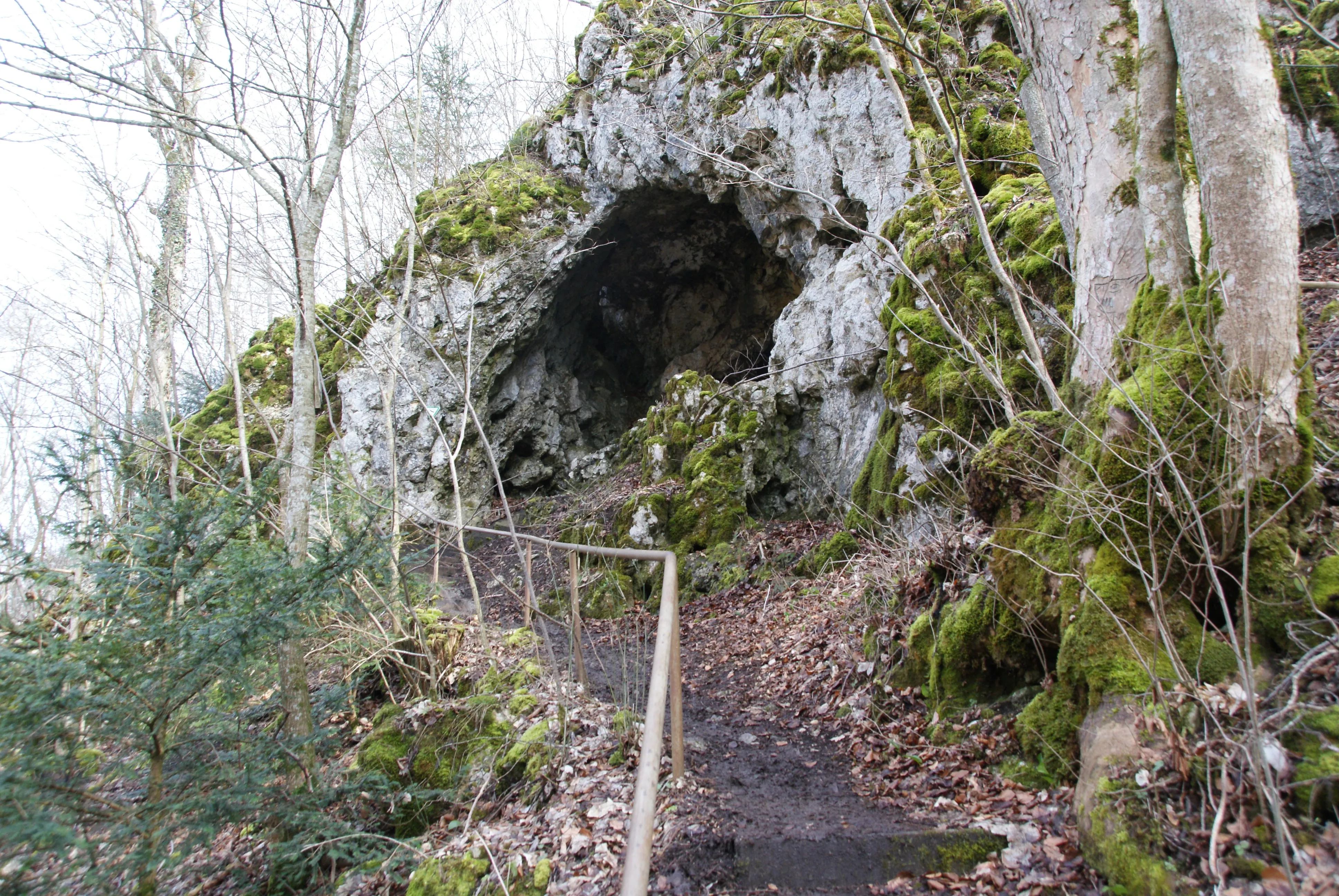
Höhle Kätherenküche
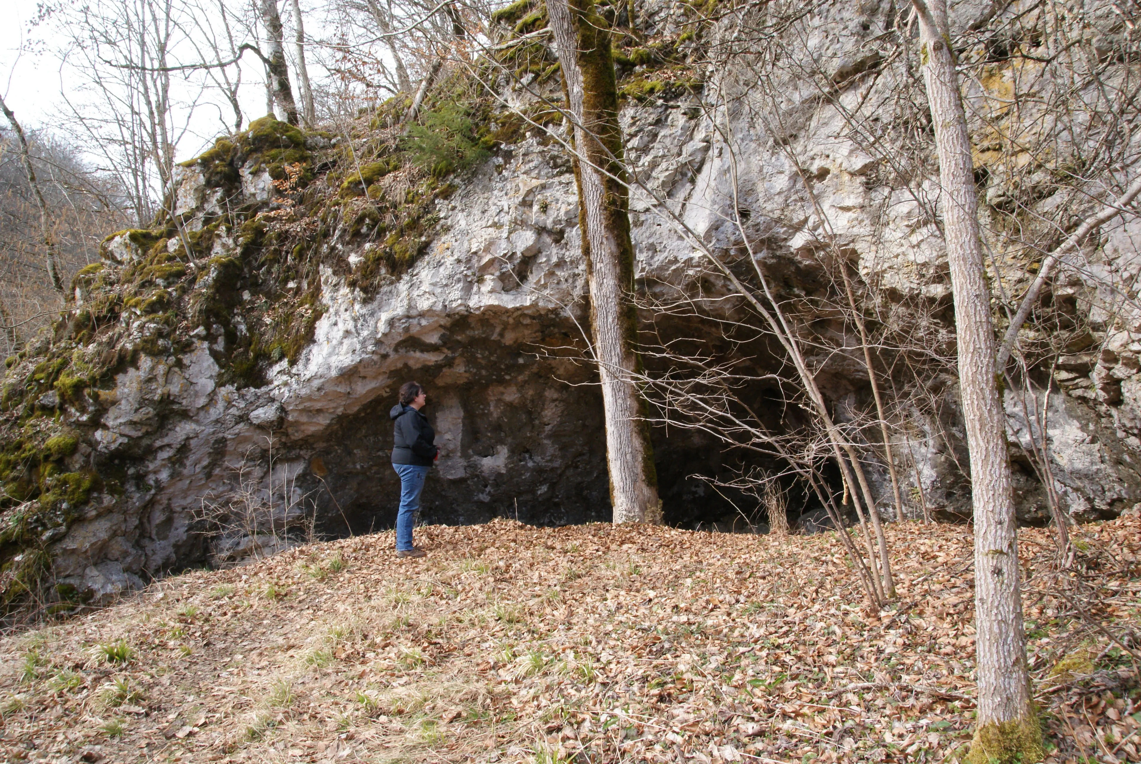
The Käthra Kuche is a half-cave (abri) east of Briel on the southern edge of the Swabian Alb.
EspeleoWorld
Höhle Kätherenküche
The Käthra Kuche is a half-cave (abri) east of Briel on the southern edge of the Swabian Alb.
Ehingen (Donau)
Fiche actualisée
https://espeleoworld.com/fr/c/hoehle-kaetherenkueche-ehingen-donau
Les informations peuvent changer. Vérifiez toujours les coordonnées, l'accès, la météo et l'état de la cavité avant de partir.
The Käthra Kuche is a half-cave (abri) east of Briel on the southern edge of the Swabian Alb.
Photos
© Karle3 · CC BY-SA 4.0, https://creativecommons.org/licenses/by-sa/4.0/ · Wikimedia Commons · https://commons.wikimedia.org/wiki/File:Kd3_20200308_04664_kaethra_kuche.jpg
Description
Morphologie
The Käthra Kuche (also Kätheren Küche, the „Küche der Katharina“) is a half-cave (abri). The rock and the cave are protected under the name Fels mit Höhle „Kätheren Küche“ as natural monument no. 84250330172.
Histoire
The cave is said to have served a Katharina Schunter as a Wohnhöhle (dwelling cave) around 1800. She came from the Schunter family, which inhabited the nearby Schunterhöhle. During her stay in the cave she is said to have made fires for cooking. The rising smoke led the inhabitants of the nearby village of Briel to exclaim „D’ Käther kocht“ – Katharina is cooking. Hence the naming Kätheren Küche (= Käthra Kuche).
Commentaires des utilisateurs (0)
Aucun commentaire pour le moment.
Soyez le premier à partager votre expérience !
Explorations enregistrées (0)
Aucune exploration enregistrée pour le moment.
Enregistrez votre visite dans cette cavité !
Grottes à proximité

Source : Geotopkataster Baden-Württemberg (Regierungspräsidium Freiburg – LGRB) (services.lgrb-bw.de), avec modifications. Data licence Germany – attribution – version 2.0 (dl-de/by-2-0), https://www.govdata.de/dl-de/by-2-0 Datenquelle: Regierungspräsidium Freiburg - LGRB, www.lgrb-bw.de · données de 2026 · Contient des informations de © OpenStreetMap contributors, www.openstreetmap.org, mises à disposition sous la licence Open Database License (ODbL 1.0, https://opendatacommons.org/licenses/odbl/1-0/), avec modifications. · noms · obtenu le 2026-11-13 · https://www.openstreetmap.org/node/1788403407 · données de 2026 · Source : Wikidata – cave items (Germany) (www.wikidata.org), avec modifications. CC0 1.0, https://creativecommons.org/publicdomain/zero/1.0/ Wikidata (CC0 1.0) · données de 2026 · Source : German Wikipedia – article leads (cave descriptions) (de.wikipedia.org), avec modifications. CC BY-SA 4.0, https://creativecommons.org/licenses/by-sa/4.0/ Wikipedia contributors (de.wikipedia.org), CC BY-SA 4.0 · Texte de Wikipedia contributors (Käthra Kuche) · adapté par Espeleoworld (normalisé, traduit) ; l'adaptation est sous licence CC BY-SA 4.0, https://creativecommons.org/licenses/by-sa/4.0/ · description · obtenu le 2026-11-13 · https://de.wikipedia.org/wiki/K%C3%A4thra_Kuche · données de 2026 · Les données dérivées sont disponibles sur demande sous l'ODbL : [email protected]