
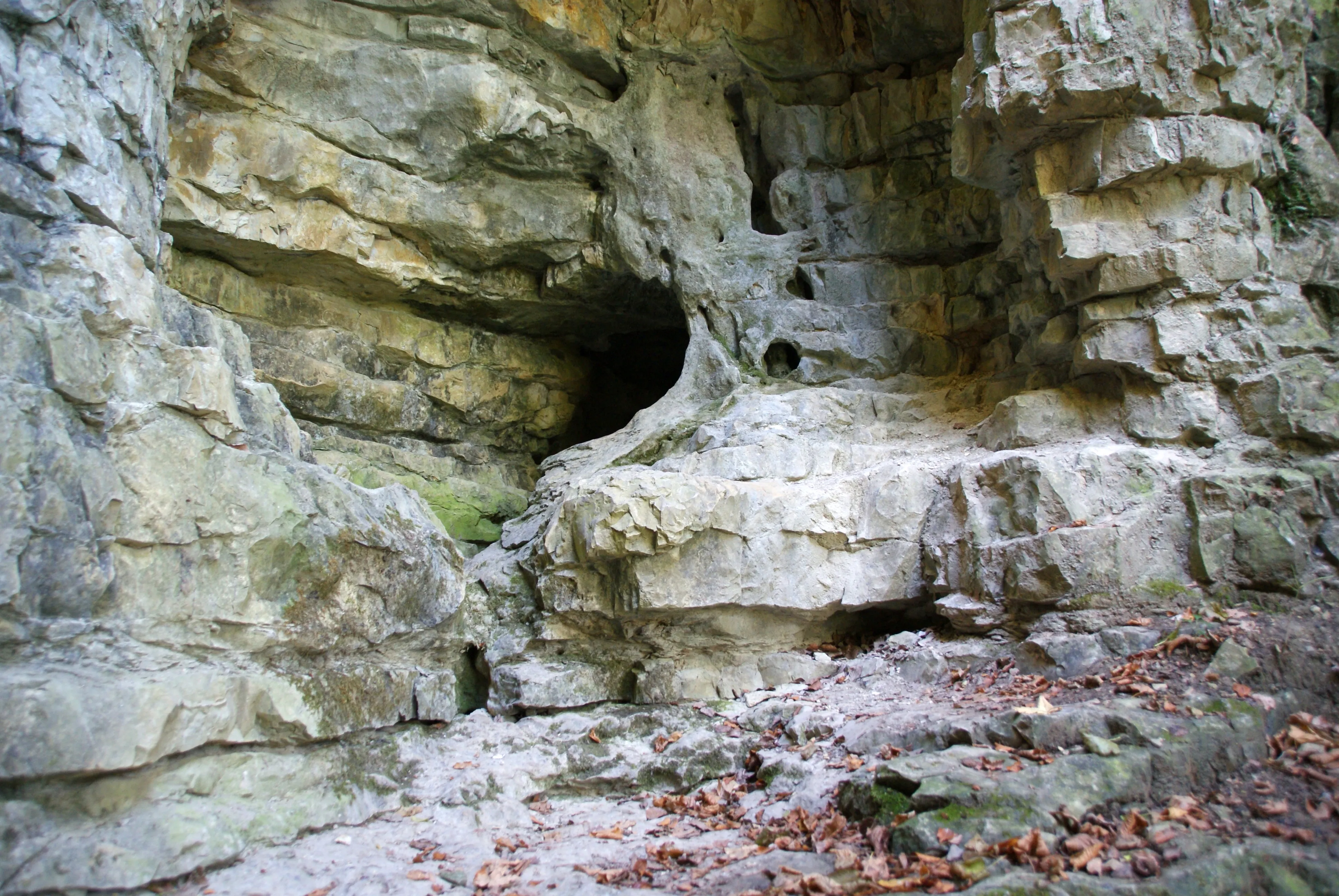
Höhle Bauerloch
The Bauerloch is a karst cave on the northern escarpment of the Swabian Alb.
EspeleoWorld
Höhle Bauerloch
The Bauerloch is a karst cave on the northern escarpment of the Swabian Alb.
Neuffen
Fiche actualisée
https://espeleoworld.com/fr/c/hoehle-bauerloch-neuffen
Les informations peuvent changer. Vérifiez toujours les coordonnées, l'accès, la météo et l'état de la cavité avant de partir.
The Bauerloch is a karst cave on the northern escarpment of the Swabian Alb.
Photos

© Karle3 · CC BY-SA 4.0, https://creativecommons.org/licenses/by-sa/4.0/ · Wikimedia Commons · https://commons.wikimedia.org/wiki/File:Bauerloch-Hoehle-20161016-00527.jpg
Description
Hydrologie
During heavy rain and at snowmelt, the Dürrenbach springs from the entrance of the Bauerloch, and large parts of the cave are then completely under water. In dry periods the stream emerges only at about 520 m above sea level in the lower part of the Tales.
Progression
For this reason, entering the cave is dangerous.
Autres détails
The Bauerloch is protected as a geotope under the number 13634/934 and, under the name Bauerlochhöhle und Magerrasen im Gewann Bauerlochberg with the protected area number 811-60462912, also as a natural monument.
Commentaires des utilisateurs (0)
Aucun commentaire pour le moment.
Soyez le premier à partager votre expérience !
Explorations enregistrées (0)
Aucune exploration enregistrée pour le moment.
Enregistrez votre visite dans cette cavité !
Grottes à proximité
Source : Geotopkataster Baden-Württemberg (Regierungspräsidium Freiburg – LGRB) (services.lgrb-bw.de), avec modifications. Data licence Germany – attribution – version 2.0 (dl-de/by-2-0), https://www.govdata.de/dl-de/by-2-0 Datenquelle: Regierungspräsidium Freiburg - LGRB, www.lgrb-bw.de · données de 2026 · Contient des informations de © OpenStreetMap contributors, www.openstreetmap.org, mises à disposition sous la licence Open Database License (ODbL 1.0, https://opendatacommons.org/licenses/odbl/1-0/), avec modifications. · noms · obtenu le 2026-11-13 · https://www.openstreetmap.org/node/759770645 · données de 2026 · Source : Wikidata – cave items (Germany) (www.wikidata.org), avec modifications. CC0 1.0, https://creativecommons.org/publicdomain/zero/1.0/ Wikidata (CC0 1.0) · données de 2026 · Source : German Wikipedia – article leads (cave descriptions) (de.wikipedia.org), avec modifications. CC BY-SA 4.0, https://creativecommons.org/licenses/by-sa/4.0/ Wikipedia contributors (de.wikipedia.org), CC BY-SA 4.0 · Texte de Wikipedia contributors (Bauerloch) · adapté par Espeleoworld (normalisé, traduit) ; l'adaptation est sous licence CC BY-SA 4.0, https://creativecommons.org/licenses/by-sa/4.0/ · description · obtenu le 2026-11-13 · https://de.wikipedia.org/wiki/Bauerloch · données de 2026 · Les données dérivées sont disponibles sur demande sous l'ODbL : [email protected]