
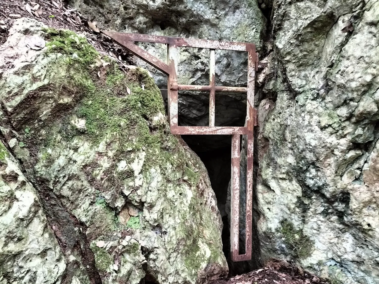
Grotta Poligonale
A cavity formed along a joint, with the floor filled in, ending in a fissure at the bottom that is currently not passable.
EspeleoWorld
Grotta Poligonale
A cavity formed along a joint, with the floor filled in, ending in a fissure at the bottom that is currently not passable.
Amelia
Longueur: 45 m · Profondeur: 30 m
Fiche actualisée
https://espeleoworld.com/fr/c/grotta-poligonale-amelia-terni
Les informations peuvent changer. Vérifiez toujours les coordonnées, l'accès, la météo et l'état de la cavité avant de partir.
A cavity formed along a joint, with the floor filled in, ending in a fissure at the bottom that is currently not passable.
Photos

© Maurizio Todini · LicenseRef-FUGS-media-per-item · Federazione Umbra Gruppi Speleologici (FUGS), Catasto Speleologico dell'Umbria · https://catasto.fugs.it/index.php?mod=caves&op=view&id=1038
Description
Morphologie
This is a cavity formed along a joint with the floor filled in; it ends in a fissure at the bottom that is currently not passable. Descending trend.
Progression
Easy traversability, with the recommended period being all year. Progression difficulty: climbs and narrow squeezes. Temporary rigging: a thirty-meter rope to be anchored to a tree at the entrance.
Autres détails
Geology: Montenero is a Mesozoic carbonate block; its "island" shape is due to its emergence in the Pleistocene sea, confirmed by the presence of borings made by lithophagous organisms at an elevation of 300 m above sea level. From: E. Squazzini in the Proceedings of the 2005 Amelia Conference.
Histoire
Paleoethnological finds. Archaeology and paleoethnology: of interest due to the presence of bones, it was the subject of excavation campaigns by the Soprintendenza around 1998-99 and most recently in 2004-2005. In November 2005, at the conference held in Amelia "Uomini, terre e materiali: aspetti dell'antica Ameria tra paleontologia e tardoantico", a paper was presented by M.C. De Angelis-R. Sardella-E. Squazzini-G. Manzi entitled "Il sito di Montenero di Amelia, fauna e resti antropici". Protection of historical-archaeological sites: yes. Studies: paleoethnological. Cadastral chronology: it has never been registered even though its discovery dates back to the '90s. Notes on the name: so called by its discoverer Stefano Baroncini but also referred to in some scientific publications as Grotta delle Ossa.
Commentaires des utilisateurs (0)
Aucun commentaire pour le moment.
Soyez le premier à partager votre expérience !
Explorations enregistrées (0)
Aucune exploration enregistrée pour le moment.
Enregistrez votre visite dans cette cavité !
Grottes à proximité
Source : Catasto Cavità Umbria (Federazione Umbra Gruppi Speleologici, FUGS) (catasto.fugs.it), avec modifications. LicenseRef-FUGS-no-licence-stated Federazione Umbra Gruppi Speleologici (FUGS), Catasto Speleologico dell'Umbria · https://catasto.fugs.it/index.php?mod=caves&op=view&id=1038 · données de 2025 · Source : Catasto Cavità Umbria (Federazione Umbra Gruppi Speleologici, FUGS) (catasto.fugs.it), avec modifications. LicenseRef-FUGS-media-per-item Federazione Umbra Gruppi Speleologici (FUGS), Catasto Speleologico dell'Umbria · données de 2025