
Grotta GIS
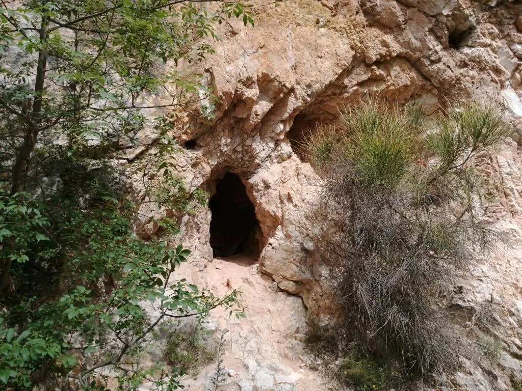
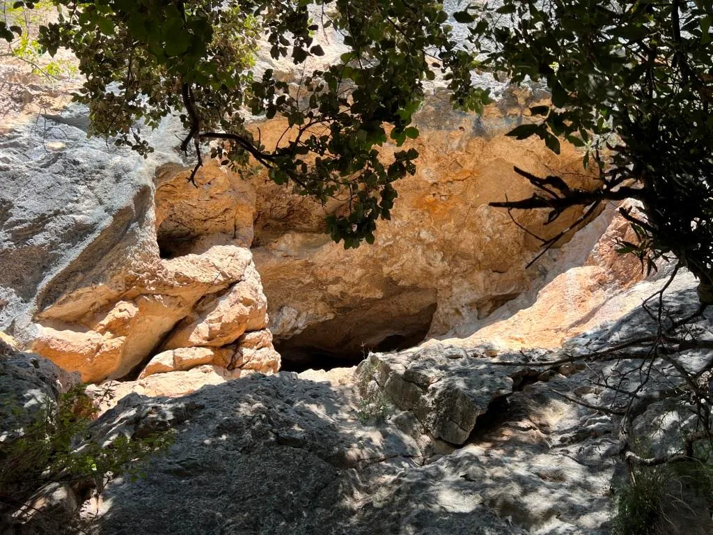
Cave at the base of the wall of a disused quarry at Cesi, Colle Zannuto, with an entrance 1.5x1 m and a brick wall just inside.
EspeleoWorld
Grotta GIS
Cave at the base of the wall of a disused quarry at Cesi, Colle Zannuto, with an entrance 1.5x1 m and a brick wall just inside.
Terni
Longueur: 800 m · Profondeur: 70 m
Fiche actualisée
https://espeleoworld.com/fr/c/grotta-gis-terni-terni
Les informations peuvent changer. Vérifiez toujours les coordonnées, l'accès, la météo et l'état de la cavité avant de partir.
Cave at the base of the wall of a disused quarry at Cesi, Colle Zannuto, with an entrance 1.5x1 m and a brick wall just inside.
Photos
© Luca Bussolati · LicenseRef-FUGS-media-per-item · Federazione Umbra Gruppi Speleologici (FUGS), Catasto Speleologico dell'Umbria · https://catasto.fugs.it/index.php?mod=caves&op=view&id=860
Description
Morphologie
Trend: Ascending/Descending.
Geology: MAS Limestone Massiccio - Lower-Upper Jurassic (Sinemurian-Pliensbachian); massive limestones; massive.
Hydrologie
Blows when hot; internal temperature 13 °C; humidity 98 %; air flows 6 m/s, flow rate 0.5 mc/sec. Measurements on 29/06/2024 at about 10.00, outside clear, temperature 28 °C, humidity 61%, strong cold blowing current.
Progression
Traversability: Demanding; recommended period all year round.
Progression difficulty: pits, slides, narrow passages.
Autres détails
Owner of the land: Calce San Pellegrino Spa Str. Amerina Loc. San Pellegrino 05035 Narni.
Bio
Other hypogean fauna: troglobitic beetle Carabidae: Duvalius virginiae Magrini-Vanni & Cirocchi, 1996; troglobitic beetle Curculionidae: Otiorrhynchus (Lixorrhynchus) virginiae Magrini-Abbazzi & Cirocchi, 2001; troglophilic beetle Carabidae: Laemostenus latialis Leoni, 1907; troglophilic orthopteran Rhaphidophoridae: Dolichopoda laetitiae Menozzi, 1920.
Bait trapping reveals the presence of two endemic and specialized species and one troglophilic species.
Studies and monitoring: entomological.
Commentaires des utilisateurs (0)
Aucun commentaire pour le moment.
Soyez le premier à partager votre expérience !
Explorations enregistrées (0)
Aucune exploration enregistrée pour le moment.
Enregistrez votre visite dans cette cavité !
Grottes à proximité

Source : Catasto Cavità Umbria (Federazione Umbra Gruppi Speleologici, FUGS) (catasto.fugs.it), avec modifications. LicenseRef-FUGS-no-licence-stated Federazione Umbra Gruppi Speleologici (FUGS), Catasto Speleologico dell'Umbria · https://catasto.fugs.it/index.php?mod=caves&op=view&id=860 · données de 2025 · Source : Catasto Cavità Umbria (Federazione Umbra Gruppi Speleologici, FUGS) (catasto.fugs.it), avec modifications. LicenseRef-FUGS-media-per-item Federazione Umbra Gruppi Speleologici (FUGS), Catasto Speleologico dell'Umbria · données de 2025